Castle Peak is a 14,265 foot mountain in the Elk Range of Colorado. It features stunning views, a gorgeous lake, and is often combined with Conundrum Peak (route explained below). Here’s everything you need to know to hike this 14er.
Distance – 11.8 miles round trip (18.99 km)
Height – 14,265 feet (4347.97 m)
Elevation gain – 4,811 feet (1,466.39 m)
Duration – 7 to 9 hours (book time)
Difficulty – Strenuous
Class: Class 2 Hike
Seasons – This hike can be completed in all seasons, but winter is especially difficult, and dangerous.
Trailhead Location – Castle Creek Trailhead (2WD) – 9,800 feet or 11,150 feet with 4WD (directions below)
Trails
Castle Creek Trail (2WD Trailhead) – 11.8 Miles Round Trip – 4,811 Feet Elevation Gain
If you have a 4WD vehicle with high clearance, you will be able to make it passed this trailhead. 4WD vehicles can make it passed this first point during good conditions, but may have to stop at one of the early on tent sites. Regardless of the vehicle, be prepared to make this hike from the 2WD trailhead in case of conditions that make the road impassible.
From this trailhead, hikers simply hike along the road. Eventually, hikers will reach the 4WD trailhead at 11,150 feet. Continue reading the rest of the route from the 4WD trailhead.
Castle Creek Trail (4WD Trailhead) – 6.2 Miles Round Trip- 3,200 Feet Elevation Gain
Once reaching the 4WD trailhead, hikers can continue along the road, bearing right at the first junction. The road is easy hiking, and the trail continues to switchback and follow the road all the way to Montezuma Mine and the parking area at 12,650 feet.
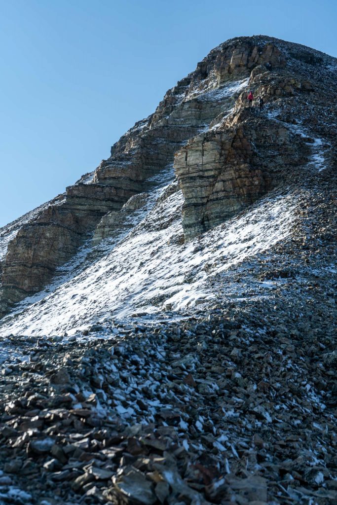
Hikers begin ascending boulders and loose rock. .3 miles from the mine parking area the trail breaks off to the right towards Conundrum peak, but hikers should stay left towards Castle Peak. .3 miles after this, hikers will see cairns heading up to the left via switchbacks to the ridge.
Hikers take these switchbacks and follow the ridge to the summit of Castle Peak. This remains class 2, however the ridge does have some exposure points with steep drop offs. The views are simply incredible.
Castle Peak And Conundrum Peak Loop – 12.3 Mile Loop – 5,357 Feet Elevation Gain
We recommend summiting Castle Peak first, then descending the ridge to the saddle between both peaks, and then summiting Conundrum before returning. This hike still remains class 2, but the trail from the saddle back down can be tricky during snowy times or muddy times. During those times, it may make sense to head back up to the summit of Castle and descending the same route.
Castle Peak Parking At Montezuma Mine – 2.2 Miles Round Trip
This is a common road for high clearance 4WD vehicles capable of handling some pretty tough roads. If you have a vehicle that can handle this, you can cut off a large portion of this hike.
Trail Map
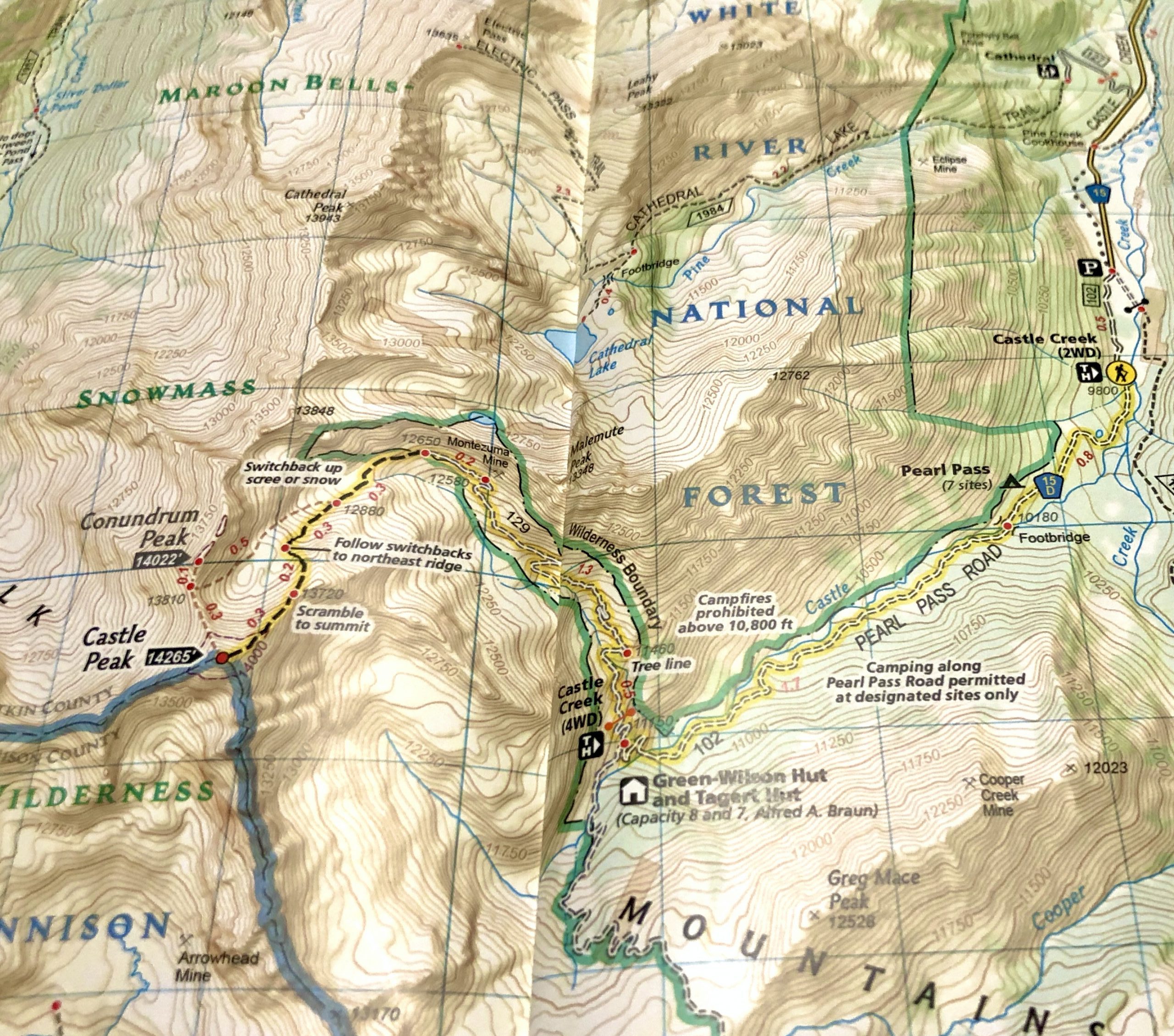
You can also view the map we created here.
Hiking Castle Peak In Winter
As with any 14er, this hike is significantly more dangerous in winter. These summits are doable in winter months via the same route, but added caution is needed. Hikers will very likely have to begin at the 2WD trailhead for winter summits.
Camping For Castle Peak
There are 7 first come first serve campsites with parking spots along Pearl Pass Road shortly after the 2WD trailhead. The only camping permitted is in the designated sites only.
You can read about these sites here.
There is also nearby camping at Castle Peak Campground which you can read about here.
Current Weather Conditions:
Here is the detailed weather forecast for the next few days. We highly recommend you check out the mountain forecast for this peak the morning of your hike.
Mount Crested Butte, CO
This Afternoon
A chance of snow showers and a slight chance of thunderstorms after 1pm. Partly sunny, with a high near 33. West southwest wind 15 to 20 mph. Chance of precipitation is 50%. New snow accumulation of 1 to 2 inches possible.
Tonight
Snow showers likely and a slight chance of thunderstorms. Cloudy, with a low around 16. West northwest wind 20 to 25 mph. Chance of precipitation is 60%. New snow accumulation of 1 to 3 inches possible.
Friday
Snow showers likely before noon, then snow showers and a chance of thunderstorms. Cloudy, with a high near 28. West wind 20 to 25 mph. Chance of precipitation is 90%. New snow accumulation of 1 to 3 inches possible.
Friday Night
Snow showers and a chance of thunderstorms. Cloudy, with a low around 16. Southwest wind 10 to 25 mph. Chance of precipitation is 90%. New snow accumulation of 2 to 4 inches possible.
Saturday
Snow showers and a chance of thunderstorms. Cloudy, with a high near 24. West southwest wind 10 to 15 mph. Chance of precipitation is 100%. New snow accumulation of 5 to 9 inches possible.
Saturday Night
Snow showers and a chance of thunderstorms. Cloudy, with a low around 17. Chance of precipitation is 90%. New snow accumulation of 2 to 4 inches possible.
Sunday
Snow showers and a chance of thunderstorms. Cloudy, with a high near 26. Chance of precipitation is 90%. New snow accumulation of 1 to 3 inches possible.
Directions & Parking
The 2WD trailhead is accessible to all types of vehicles. Directions to the 2WD Trailhead:
Simply continue along Pear Pass Road road to reach the 4WD trailhead and campsites.
Additional Pictures
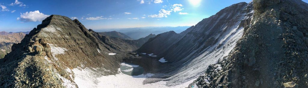
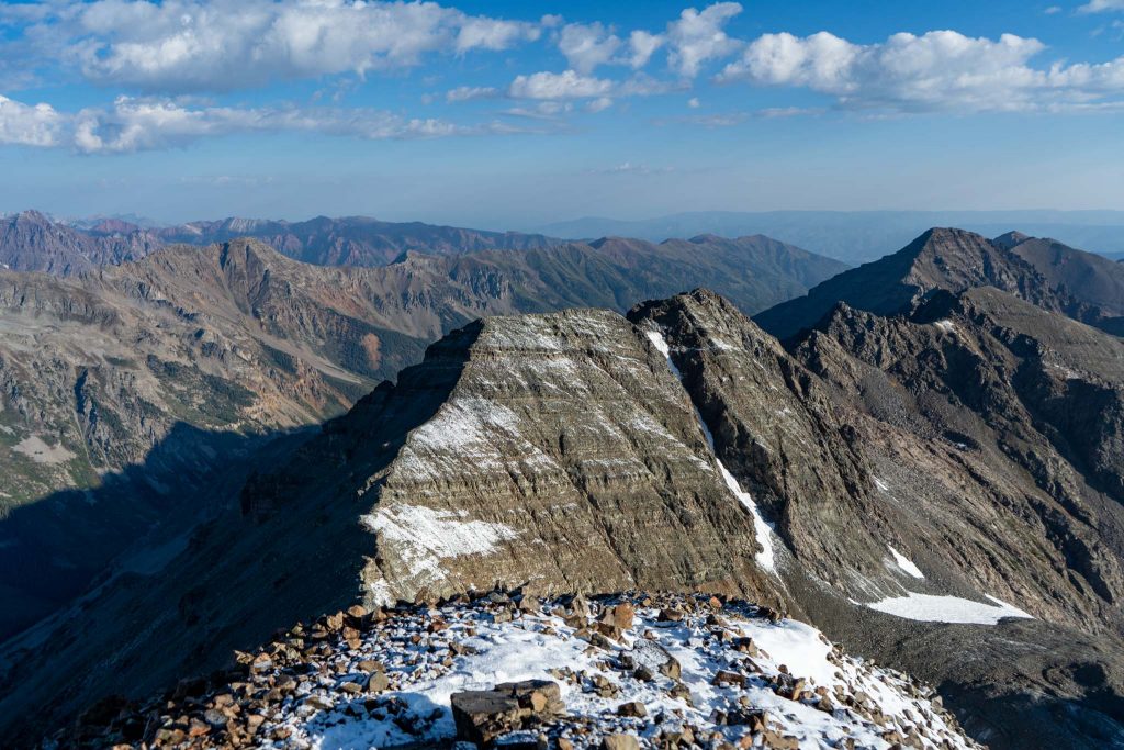
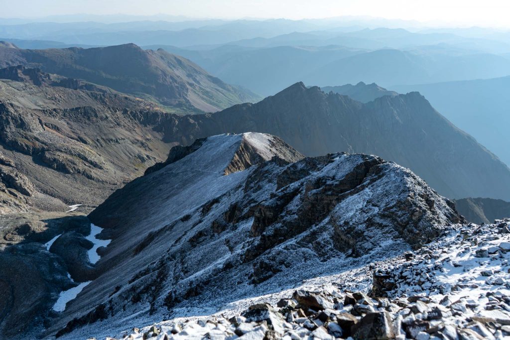
Castle peak from saddle between Castle and Conundrum
Conundrum Peak
Hikers heading down castle peak
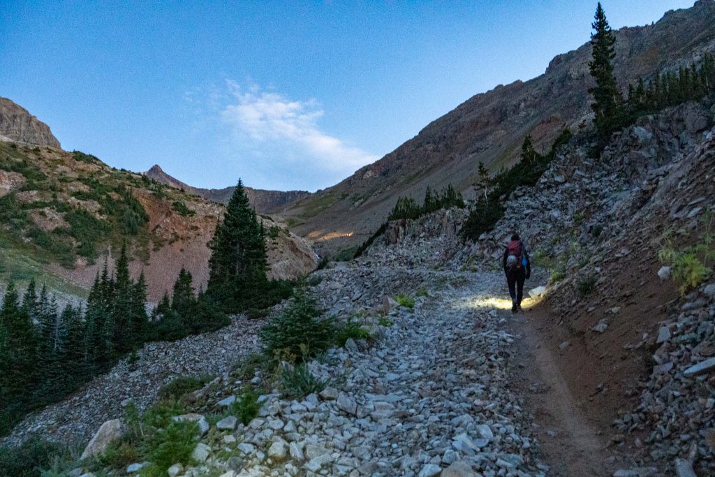
Pearl Pass Road with truck ahead
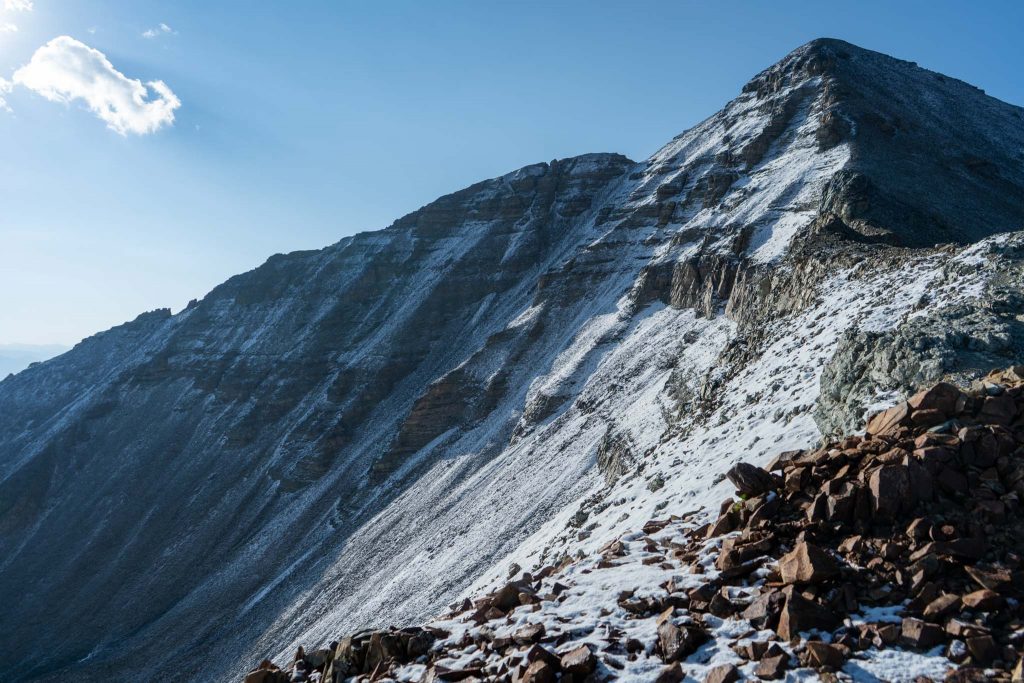
Views along ridge heading up Castle Peak

Max DesMarais is the founder of hikingandfishing.com. He has a passion for the outdoors and making outdoor education and adventure more accessible. Max is a published author for various outdoor adventure, travel, and marketing websites. He is an experienced hiker, backpacker, fly fisherman, backcountry skier, trail runner, and spends his free time in the outdoors. These adventures allow him to test gear, learn new skills, and experience new places so that he can educate others. Max grew up hiking all around New Hampshire and New England. He became obsessed with the New Hampshire mountains, and the NH 48, where he guided hikes and trail runs in the White Mountains. Since moving out west, Max has continued climbed all of the Colorado 14ers, is always testing gear, learning skills, gaining experience, and building his endurance for outdoor sports. You can read more about his experience here: hikingandfishing/about