In this article, we are going to give you everything you need to know to hike the Chicago Basin 14ers. These 4 peaks (arguably 5) are located in the San Juan Mountains of Colorado, have what may be one of the most difficult approaches to any Colorado 14er, but feature some of the most incredible views in all of the U.S. Here, you’ll learn about the train system to the trailhead, hiking all the way in, camping information, peak information, and more.
Quick Navigation:
Trail Map | Trails | Hiking In Winter | Camping | Directions | Pictures
There are two main routes (one shortened by train), and the statistics or each are listed here:
Difficulty – Extremely Strenuous
Distance – 21 – 38 miles round trip (33.80 – 61.26 km)
Elevation gain – 8,913 – 12,329 feet (2,716.68 – 3,757.88 m)
Duration – 15 to 25 hours (book time)
Hike Class: Class 3
Trailhead Location – Needleton Trailhead (Train Stop) or Purgatory Trailhead
Dogs – Allowed
Need To Know Information
- There are two main options for hiking all 4 fourteeners, taking the Durango & Silverton Narrow Gauge Railroad train to the Needleton Trailhead, or hiking a long distance in from the Purgatory Trailhead.
- Both options require significant planning as the train requires reservations, and the hike in without the train is substantial, so it requires proper gear and preparation.
- This hike allows for travelers to summit 3 of the official fourteeners, and 1 sub peak: Mount Eolus, North Eolus (sub peak), Sunlight Peak, and Windom Peak.
- The entire approach in is simple class 1-2 hiking, but the Eolus mountains and Sunlight peak require class 3 hiking. Windom would be considered difficult class 2 or even class 3.
- There is free parking at both Purgatory Trailhead, and at the Train Station in Durango.
Train Information
- Up to date train information, and ticket purchase information can be found here: https://www.durangotrain.com/wilderness-access/
- There is not 100% guarantee of getting a train ride back to your starting point.
Important Camping Information
- Chicago basin sits in the Weminuche Wilderness and therefore is subject to those wilderness regulations. The regulations for the Weminuche Wilderness should be read thoroughly here.
- Proper Leave No Trace Principles are required in this area.
- Camping is not allowed at Twin Lakes, camping is only allowed in the area below the Twin Lakes basin, and this the end of this zone is denoted with a trail sign.
Trail Map
We have created a trail map image, as well as several map links to download GPX files and such for your trip.

Click map to open in a new tab for a full size image.
GPX Files & Detailed Trail Maps
Purgatory Creek Approach Map & GPX
Needleton Trailhead Approach Map & GPX
Twin Lakes to All 4 Fourteeners Map & GPX
Routes
Purgatory Creek Approach – 38 Miles (61.26 km) – 12,329 Feet (3,757.88 m) Elevation Gain
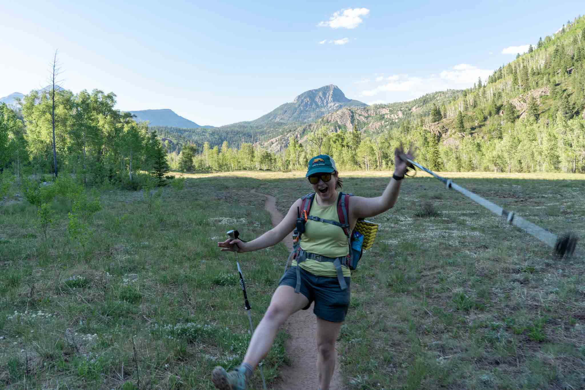
Purgatory Flats near the Purgatory Trailhead
This approach is stunningly beautiful. It takes hikers down an incredible canyon along Cascade Creek before crossing a gorgeous bridge over the Animas River, and then following the Animas for several miles before reaching the junction where the Needleton approach starts.
There is ample camping at tons of points along this approach, making it easy to do this approach in segments or camping along the approach on the way in or out. Hikers descend about 1,000 feet before reaching the Animas river and slowly making there way upwards along the river.
The trail is very well traveled, well maintained, and easy to talk on, making it relatively simple to travel quick.
Parking for this trailhead is free.
Needleton Trailhead (Train) Approach – 21 Miles (33.80 km) – 8,913 Feet (2,716.68 m) Elevation Gain
The Needleton Trailhead starts right along the Animas where hikers begin heading south on flat terrain before reaching the junction to turn left heading up alongside Needle Creek. It is here that the trail really starts to gain more elevation quickly. Camping spots are still quite frequent only a short distance off the trail. The trails are all well traveled, well maintained, and easy to follow.
Summiting The 14ers
Hikers have the option to go whatever path, or summit these 14ers in any order. Our recommended path is: North Eolus, Eolus, Sunlight, and Windom. We believe this is the most efficient way and rewarding way to summit pending good conditions. Hikers can choose to tag all 4 in one day (only for the hardy!) or head back down to the campsites, and make the trek back up a separate day or two do finish the 14ers.
Some important notes:
- Eolus and North Eolus are class 3 with solid exposure, but pretty good rock.
- Sunlight is class 4 and includes a loose rock field heading up to the saddle.
- Windom is rated class 2, but given the boulder fields, we would give it a class 3 grade as well.
- None of them are easy summits and should only be done by people with the experience and gear to make it happen safely.
- There is A LOT of vertical gain and loss doing all 4 in a day. Keep that in mind. Don’t let the short mileage fool you, as it is steep.
- There is a pretty scary summit block on Sunlight Peak that most people should avoid climbing on. It is the very highest point, so you’ll see it when you get there. Just stay off of it unless you have the experience.
- The views are some of the best in the world.
Hiking in Winter
The train does not run in winter months. This is not a frequently done in the winter due to the difficult access.
Camping Information
There is tons of backcountry sites along the animas, along Needle Creek, and in Chicago Basin. All of it is first come first serve camping. In addition to camping, Durango has plenty of hotels that hikers and backpackers will likely want to stay at before or after your trip.
Weather
We highly recommend you watch the Mountain Forecast for these peaks leading up to your hike. In addition, here is a detailed weather forecast for the area:
Silverton, CO
Tonight
Snow showers and a chance of thunderstorms. Cloudy, with a low around 19. South southwest wind 10 to 15 mph, with gusts as high as 25 mph. Chance of precipitation is 90%. New snow accumulation of 6 to 10 inches possible.
Saturday
Snow showers and a chance of thunderstorms. Cloudy, with a high near 27. Southwest wind 10 to 15 mph. Chance of precipitation is 90%. New snow accumulation of 3 to 5 inches possible.
Saturday Night
A chance of snow showers and a chance of thunderstorms. Mostly cloudy, with a low around 19. West northwest wind 10 to 15 mph. Chance of precipitation is 50%. New snow accumulation of 1 to 3 inches possible.
Sunday
A chance of snow showers before noon, then snow showers and a chance of thunderstorms. Partly sunny, with a high near 33. West northwest wind 10 to 15 mph. Chance of precipitation is 80%. New snow accumulation of less than one inch possible.
Sunday Night
Partly cloudy, with a low around 16. Northwest wind 10 to 15 mph.
Monday
Sunny, with a high near 38.
Monday Night
Mostly clear, with a low around 22.
Directions
Each of the below are to the 4wd trailhead, which will take hikers directly past the 2wd trailhead.
Directions to Purgatory Trailhead:
The parking lot is located on Tacoma Drive with is a residential road.
Durango & Silverton Narrow Gauge Railroad Parking Lot:
There are no day hike parking fees here at either trailhead.
Additional Pictures
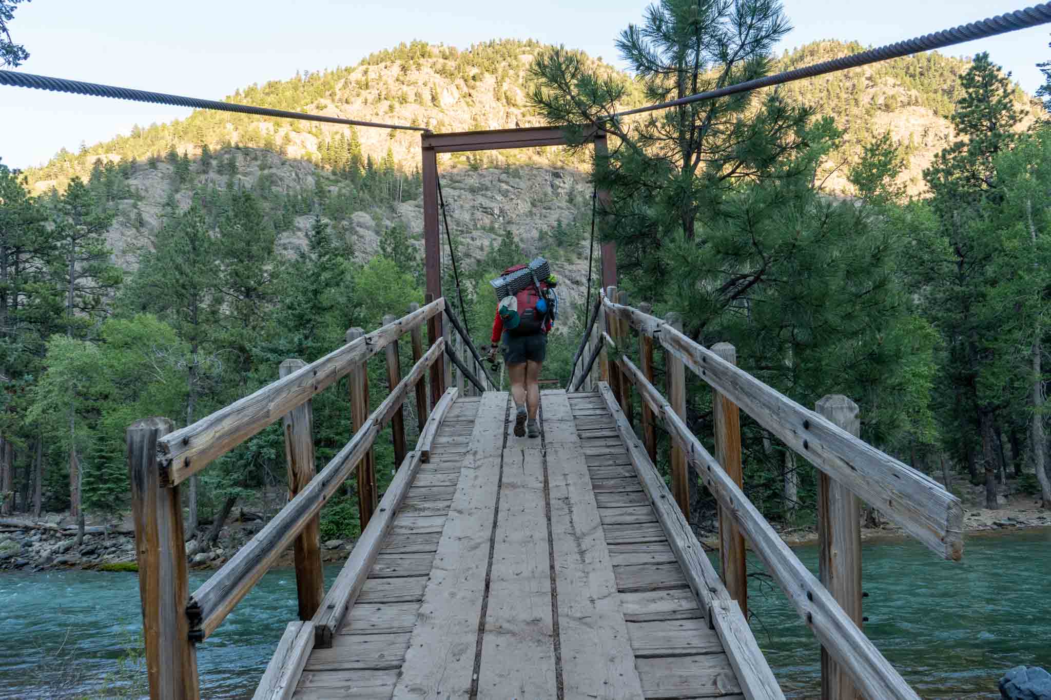
The hiking bridge across the Animas River
Summit views from Sunlight Peak
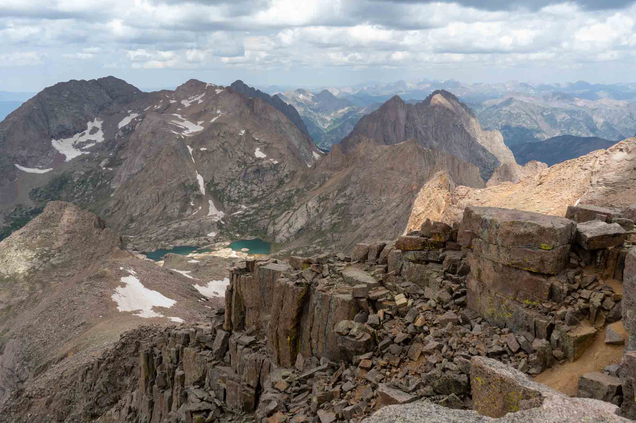
Photo from the summit of Windom Peak looking at Twin Lakes
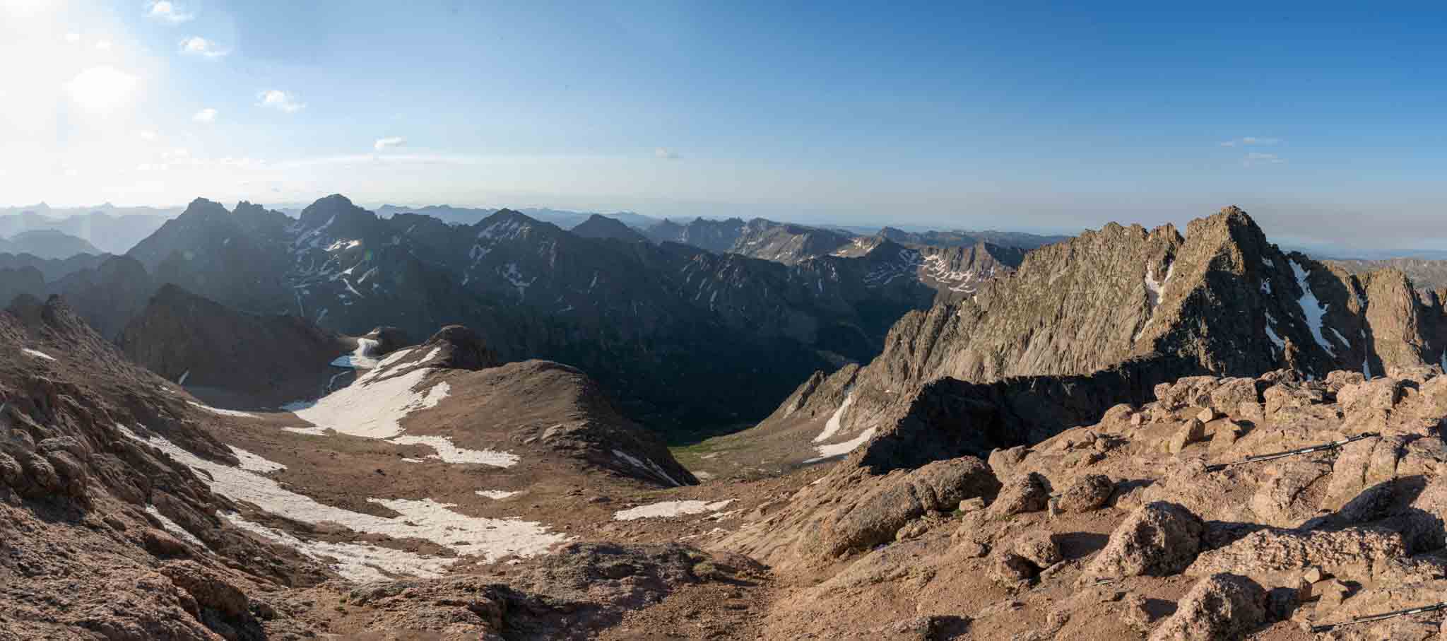
Taken from the summit of North Eolus
Taken from the summit of North Eolus
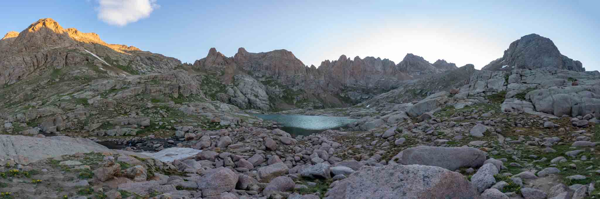
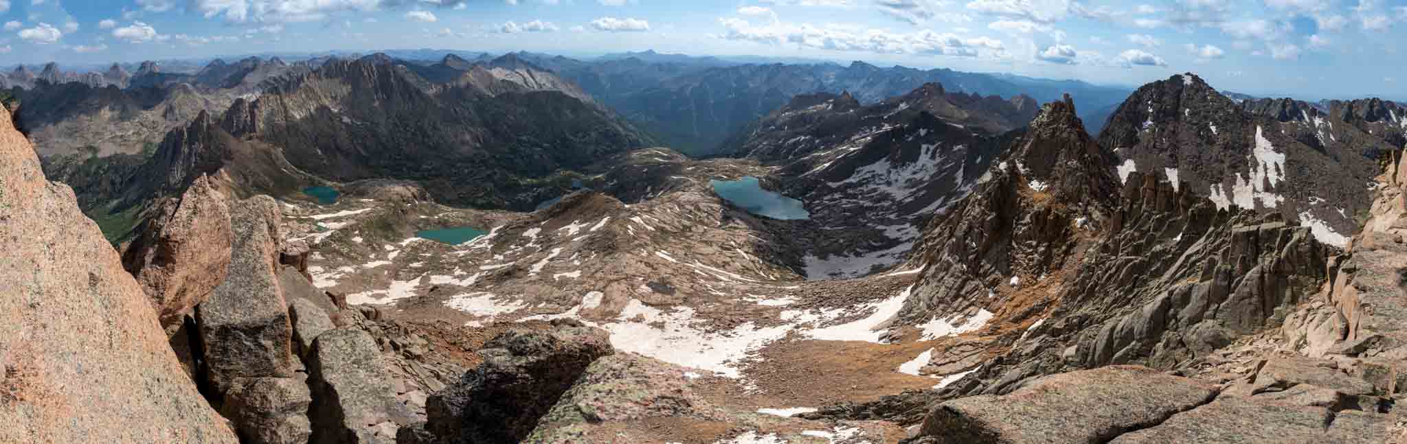
Twin Lakes with the surrounding peaks
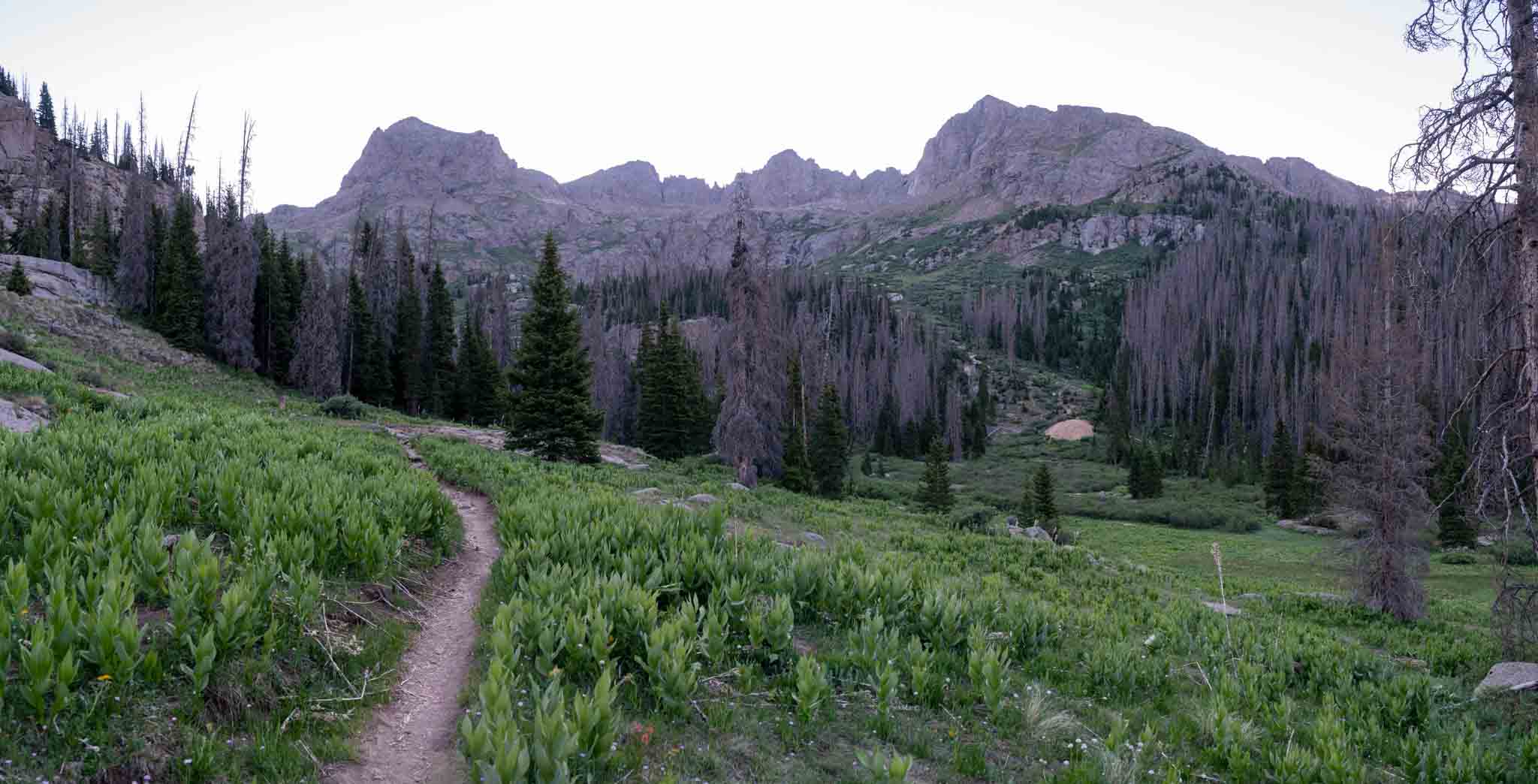
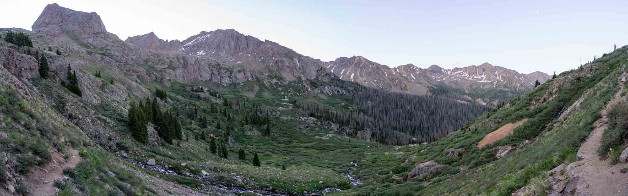
Photo from the Chicago Basin looking towards the ascent to Twin Lakes

Max DesMarais is the founder of hikingandfishing.com. He has a passion for the outdoors and making outdoor education and adventure more accessible. Max is a published author for various outdoor adventure, travel, and marketing websites. He is an experienced hiker, backpacker, fly fisherman, backcountry skier, trail runner, and spends his free time in the outdoors. These adventures allow him to test gear, learn new skills, and experience new places so that he can educate others. Max grew up hiking all around New Hampshire and New England. He became obsessed with the New Hampshire mountains, and the NH 48, where he guided hikes and trail runs in the White Mountains. Since moving out west, Max has continued climbed all of the Colorado 14ers, is always testing gear, learning skills, gaining experience, and building his endurance for outdoor sports. You can read more about his experience here: hikingandfishing/about