Crestone Needle is one of the most beautiful Colorado 14er in the Sangre De Cristo Mountains. It is frequently summited with Crestone Peak, and done as an overnight hike. Here we will give you everything you need to know to hike Crestone Needle as a day hike, overnight, or combined with nearby Humboldt Peak and/or Crestone Peak.
Distance – 11 miles round trip (17.70 km)
Height – 14,197 feet (4327.25 m)
Elevation gain – 4,198 feet (1279.55 meters)
Duration – 10 – 12 hours (book time dependant upon trailhead start)
Difficulty – Strenuous
Class: Class 3 Hike (Could be Considered Class 4)
Trailhead Location – South Colony Trailhead (both 2WD and 4WD vehicle options)
Quick Navigation:
Routes | Trail Map | Camping Info | Weather | Directions | Pictures
Need To Know Information
-
- The road to the 4wd trailhead is rough, and requires a good clearance vehicle. Recent improvements to the road mean that Subaru Forester like vehicles can also make it to the trailhead with careful driving.
- Dispersed camping is allowed in Sangre De Cristo Wilderness. There are many campsites utilized near at South Colony Lakes, but be sure to read on the rules and regulations here: https://www.fs.usda.gov/recarea/psicc/recarea/?recid=80754
- This is a class 3 hike with solid exposure, so it should only be completed by those that have experience dealing with other class 3 mountains. When combining this with Crestone Peak via the traverse, this becomes a class 5 route.
Hiking Route Options
There is really only one common route to the summit that we will cover in this article.
South Colony Trailhead (4WD) | 11 Miles Round Trip (17.7 km) – 4,198 Feet Elevation Gain (1279.55 meters) | Class 3
Hikers begin at the South Colony Trailhead and follow the very well marked path that leads them directly to a forest service access road. Hikers hike on this road for 2.5 miles before reaching the next junction. Here hikers can bear right towards South Colony Lake, which is the shortest option to head towards Crestone Needle, but most will choose to bear left because of the gradual gain and quality trail. Either option is great, but if you plan on camping at the lake, we suggest bearing right to head directly towards the lake.
After bearing left and staying along the road, hikers continue for another .9 miles before reaching Crestone Mine and ascending through the woods towards South Colony lake. Hikers stay to the left at South Colony lake and begin ascending through a large boulder field towards Broken Hand pass. The trail here can be difficult to follow at night, but it is well cairned and features several switchbacks on the way up.
.7 miles from the lake, hikers will reach the base of the scree field. Here the hike enters class 3 territory as the terrain is filled with loose rock, sand, and features some class 3 scrambling near the top of Broken Hand Pass. There are several well traveled routes all very close together up this field, simply take the approach that appears safest to you. Rock fall danger is high here, especially with hikers above you. Once hitting broken hand pass, hikers will find a path to the right, which heads towards Crestone Needle.
Hikers follow this path which diverges into a couple paths, both of which end up meeting up again. Any option is fine. The trail is relatively easy to follow until hikers need to begin ascending into the notch. From here, close attention needs to be paid to the route. There are cairns, and the route is for the most part relatively easy to follow, but there are several sections where you should save pictures of the route, so you can know the path.
We also created a GPX file of the route that you can download here so that you can make sure the route is in your GPS device or phone.
South Colony Trailhead (2WD) | 16.2 Miles Round Trip (26.07 km) – 5,472 Feet Elevation Gain (1667.87 meters) | Class 3
This is the same route as above, but add 2.7 miles each way and 880 feet of elevation gain
Crestone Peak And Crestone Needle Combined
Hikers combine these two peaks in two common ways:
Crestone Traverse –
This option requires class 5 climbing and is one of Colorado’s Grand Traverses. This should only be attempted by people with substantial route climbing and class 4 and 5 experience. You can read about this route here: https://www.14ers.com/route.php?route=cnee3
Elevation Gain:
5,300 feet starting at upper 4wd trailhead
6,450 feet starting at lower 2wd trailhead
Distance:
14 miles starting at upper 4wd trailhead
20 miles starting at lower 2wd trailhead
Crestone Peak to Broken Hand Pass, Crestone Needle, & Back Down (Not Traverse)
This route is route to avoid the class 4 and 5 traverse, and involves an extremely long day of hiking Crestone Peak via the standard route, hiking back up Broken Hand Pass, then ascending Crestone Needle, and heading back down to South Colony Lakes.
This is the about an 7,200 vertical feet day from the 4wd trailhead with about 14.2 miles round trip if done this way.
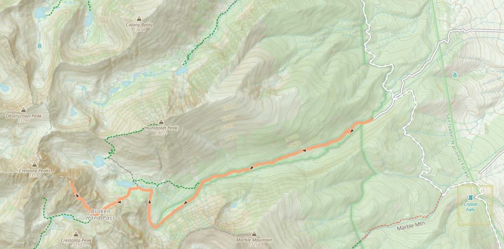
Trail Map
Camping For Crestone Needle
There are various camping options available. It is worth noting that camping options for this hike are in the Sangre De Cristo Wilderness, so those regulations need to be followed.
The most common camping areas are by South Colony Lake. This is a busy area with dozens of tent sites with incredible views. Hikers must stay at least 300 feet away from the lake when camping. There are also campsites on South Colony Lakes road.
Fishing South Colony Lakes
There are lots of fish both of the South Colony Lakes. The river flowing out of the lakes also is very productive.
Current Weather Conditions:
Here is the detailed weather forecast for the next few days. We highly recommend you check out the mountain forecast for this peak the morning of your hike.
Crestone, CO
Directions & Parking
Directions To South Colony Lakes 4WD Trailhead:
Directions to 2wd Trailhead:
Additional Pictures
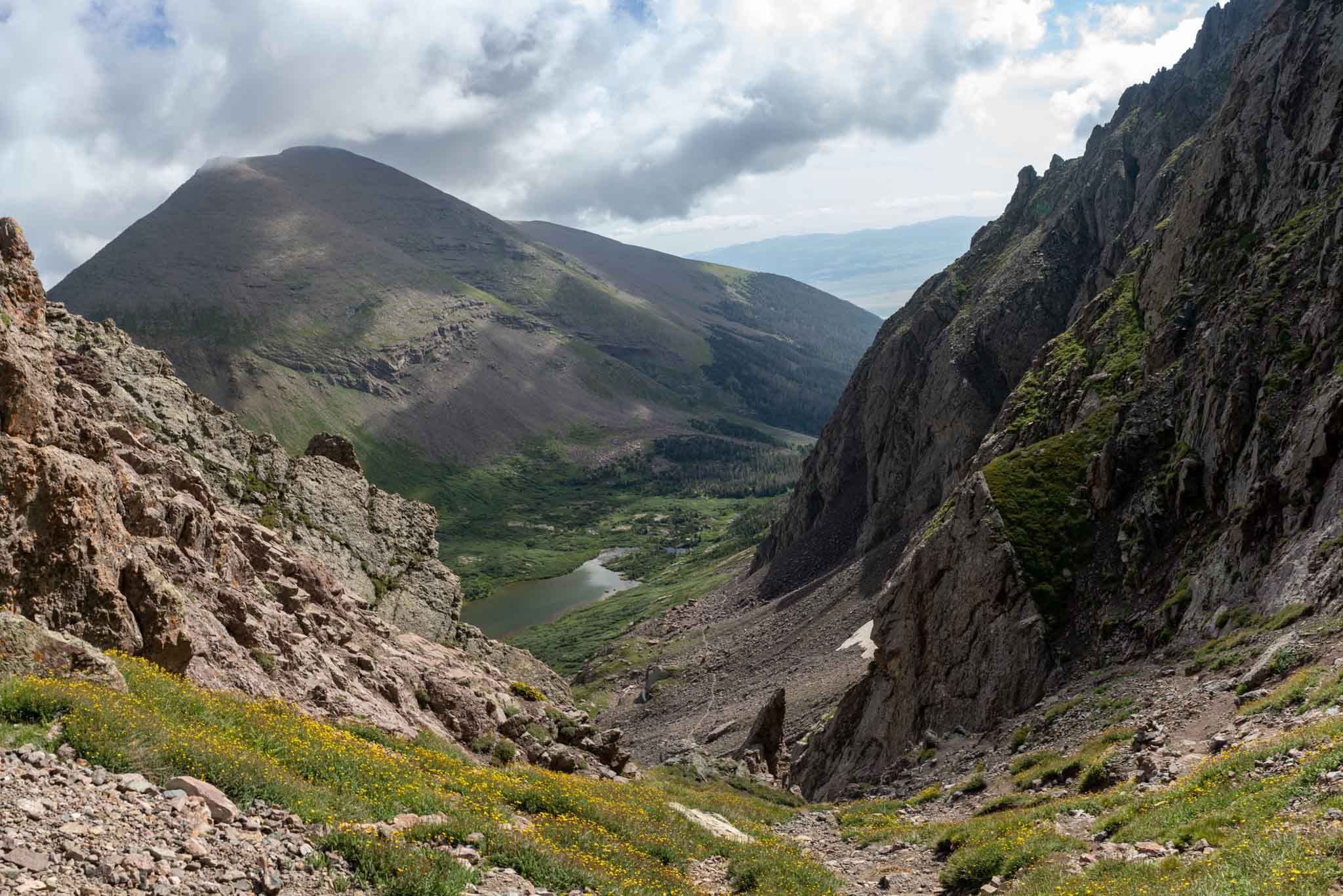
Looking down at the trail from Broken Hand Pass
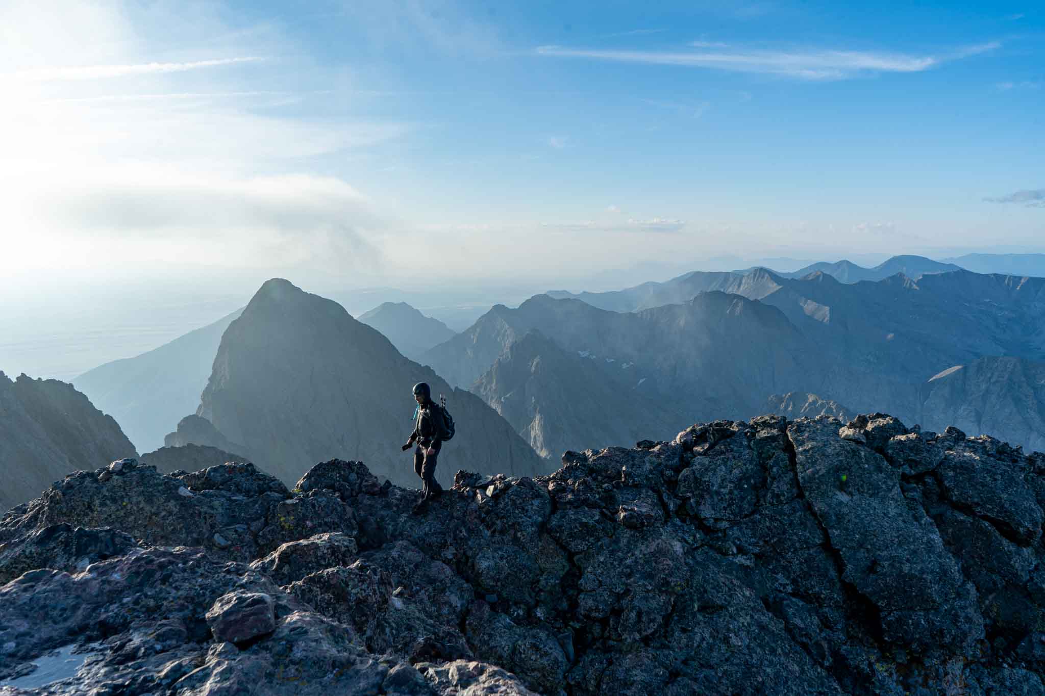
Hiker next to the summit of Crestone Peak looking at Crestone Needle

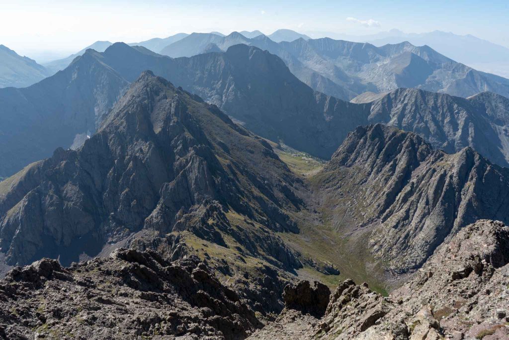
Views looking down towards Broken Hand Pass from Crestone Needle
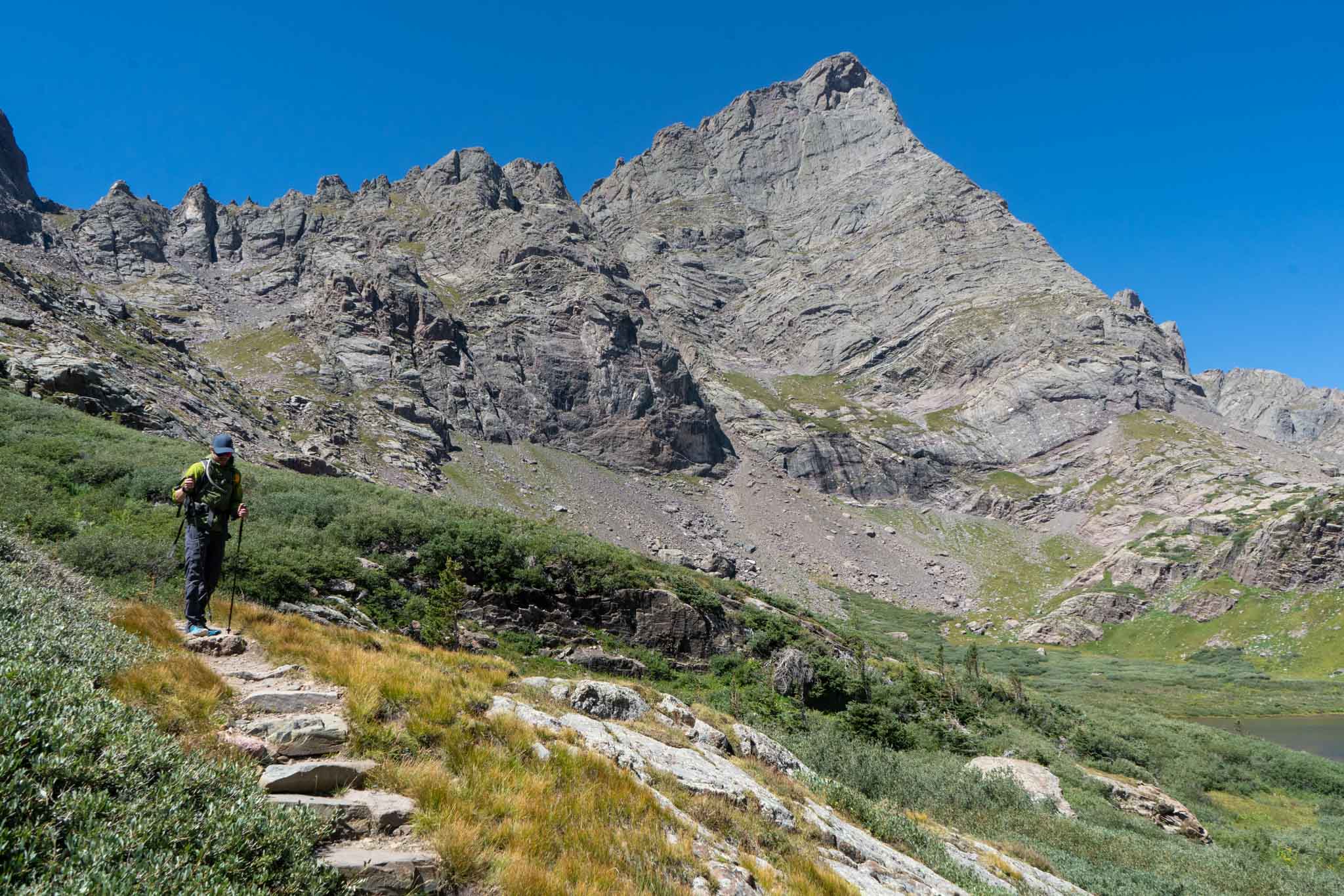
Crestone Needle from South Colony Lake
Crestone Needle summit views

Max DesMarais is the founder of hikingandfishing.com. He has a passion for the outdoors and making outdoor education and adventure more accessible. Max is a published author for various outdoor adventure, travel, and marketing websites. He is an experienced hiker, backpacker, fly fisherman, backcountry skier, trail runner, and spends his free time in the outdoors. These adventures allow him to test gear, learn new skills, and experience new places so that he can educate others. Max grew up hiking all around New Hampshire and New England. He became obsessed with the New Hampshire mountains, and the NH 48, where he guided hikes and trail runs in the White Mountains. Since moving out west, Max has continued climbed all of the Colorado 14ers, is always testing gear, learning skills, gaining experience, and building his endurance for outdoor sports. You can read more about his experience here: hikingandfishing/about