Culebra Peak is a 14,047 foot (4281.53 m) mountain located on private property on the Cielo Vista Ranch. As the southernmost Colorado 14er, this peak has some stunning terrain, but cannot be hiked without purchasing a permit form the Cielo Vista Ranch (see information below for details).
Distance – 14 miles round trip (22.53 km)
Height – 14,047 feet (4281.53 m)
Elevation gain –5,240 feet (1597.15 meters)
Duration – 8 -14 hours (book time dependant upon trailhead start)
Difficulty – Strenuous
Class: Class 2 Hike
Seasons – This hike can be completed in all seasons, but winter is especially difficult, and dangerous.
Trailhead Location – Cielo Vista Ranch Headquarters
Quick Navigation:
Routes | Trail Map | Camping Info | Weather | Directions | Pictures
Need To Know Information
- You need to purchase a permit first from here: https://cielovistaranch.com/culebra-booking/
- Directions to the gate of the ranch can be messed up by Google Maps and Apple Maps (so see written directions below as well)
- No dogs are allowed.
- Bookings are not available year round, and fill up fast, so you should plan this one ahead as much as possible.
- Winter / spring / fall conditions make this hike significantly more difficult, especially when having to start at the ranch headquarters due to road conditions.
- Ranch employees let hikers through the gate at 6 am, and hikers must be back at the gate by 6pm or they will receive a fine. If climbers are not at the headquarters gate by 6:15 AM the gate will be locked, and that person forfeits his/her spot for the climb.
Booking & Reservation Information For Culebra Peak
Booking is done through an outdated credit card form system on the website for $150 per person. This is expensive for sure, but the people are extremely kind, and all property should be respected to keep this accessible for years to come. The ranch was responsive in our experience dealing with them, and they allow you to camp out at the gate of the headquarters. (See camping information below).
Booking site: https://cielovistaranch.com/culebra-booking/
Culebra Peak Routes
Below we show the difference in mileage and elevation gain dependant upon how close to the trailhead you start. Once reaching the 4WD trailhead, there is no true trail, just common routes up to the ridge and to the summit.
From Ranch Headquarters (2WD accessible and winter accessible) – 14 Miles Round Trip (22.53 km) – 5,240 Feet (1597.15 meters) Elevation Gain – Class 2
Starting from the Ranch Headquarters is generally the worst case scenario, but happens frequently if you only have a 2WD vehicle, or if the road conditions are covered in snow. From here, the hike is pretty simple road walking, but still gains elevation relatively quickly. This route, you will simply walk past the other trailhead potentials described below.
From “Four Way” Trail Sign (4WD Vehicle) – 7 Miles Round Trip (11.27 km) – 3,150 Feet (960.12 m) Total Elevation Gain – Class 2
There is a sign along the road that says “Four Way” about 3.4 miles after the ranch headquarters. There is a parking available here, but hikers and cars continue straight to the 4WD trailhead if possible.
From 4WD Trailhead – 5 Miles (8.05 km) Round Trip – 2,700 Feet (822.96 meters) Elevation Gain
The 4WD trailhead is located at 11,650 feet (3550.92) of elevation. From this trailhead, there is no trail to the summit of Culebra, so there are a few options for hikers to choose from. Directly in front of them, hikers will find a bowl heading towards the ridge:
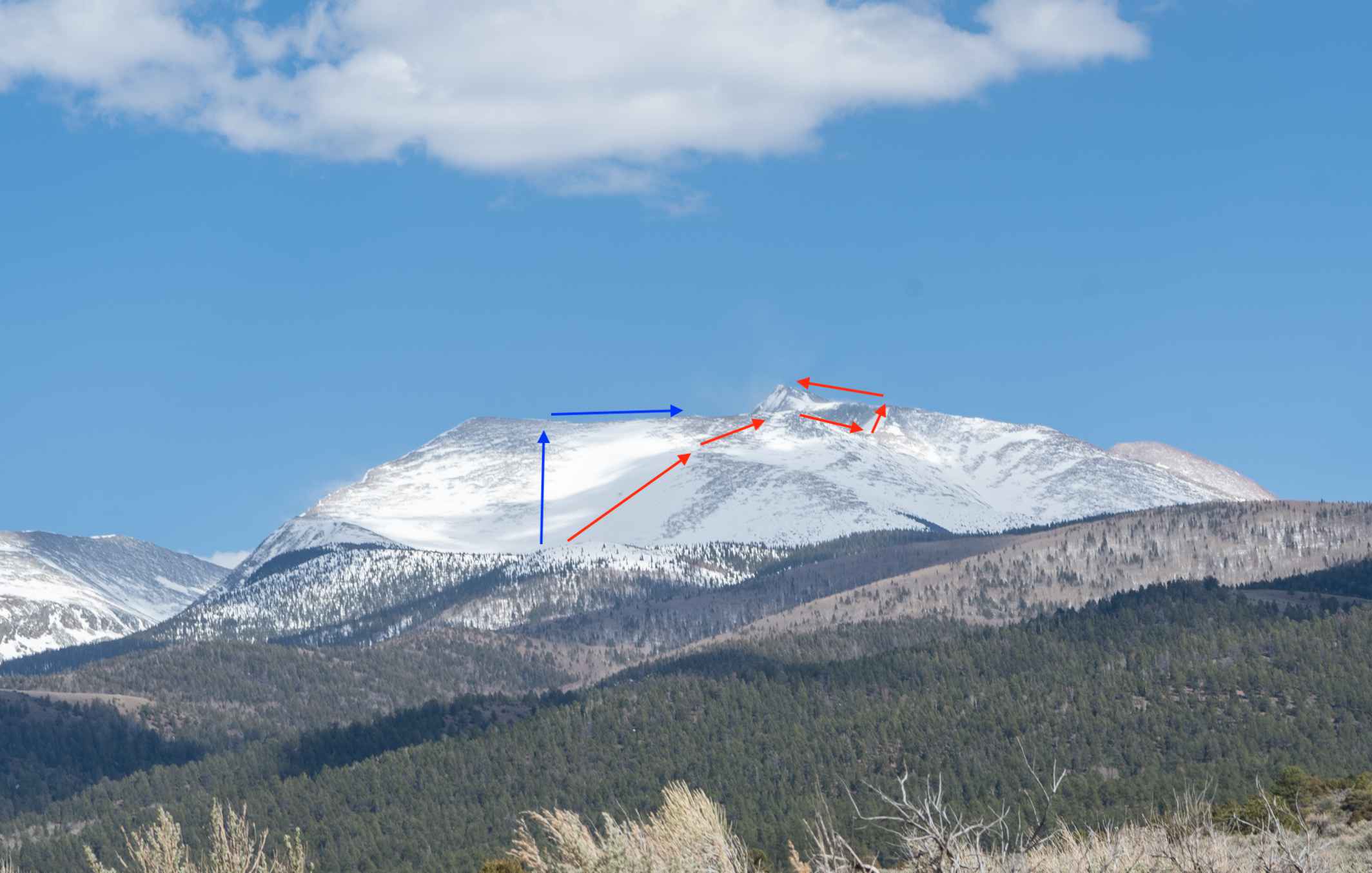
Culebra Peak Route Photo
From the 4WD trailhead, hikers can realistically take any route to the ridge they would like. Most commonly, hikers take the red route to the right of the bowl / gully to shorten the distance to the ridge. There is an old road to the left which is a little longer, but allows hikers to have a bit more time on the ridge walking towards Culebra. Both options are fine.
Once hitting the ridge, hikers walk along the ridge towards Culebra before reaching a spot with about 100-150 feet of drop to the saddle below Culebra. Hikers simply ascend to the first false summit, and traverse the final ridge to the true summit shortly after that.
Adding In Red Mountain
Many hikers will want to add in Red Mountain is one of Colorado’s hundred highest (centennial peaks). Adding in this peak is as simple as traversing the ridge to the summit and heading back to Culebra.
This adds an additional:
1.6 miles (2.57 km) round trip
1,049 feet (319.7 m) of elevation gain and loss
Trail Map
We created a Gaia GPS Map route for you on the route from the ranch headquarters:
https://www.gaiagps.com/public/SMz0awJYWYKIipumRhJNblFu
Here is a trail map as well for you (click to enlarge):
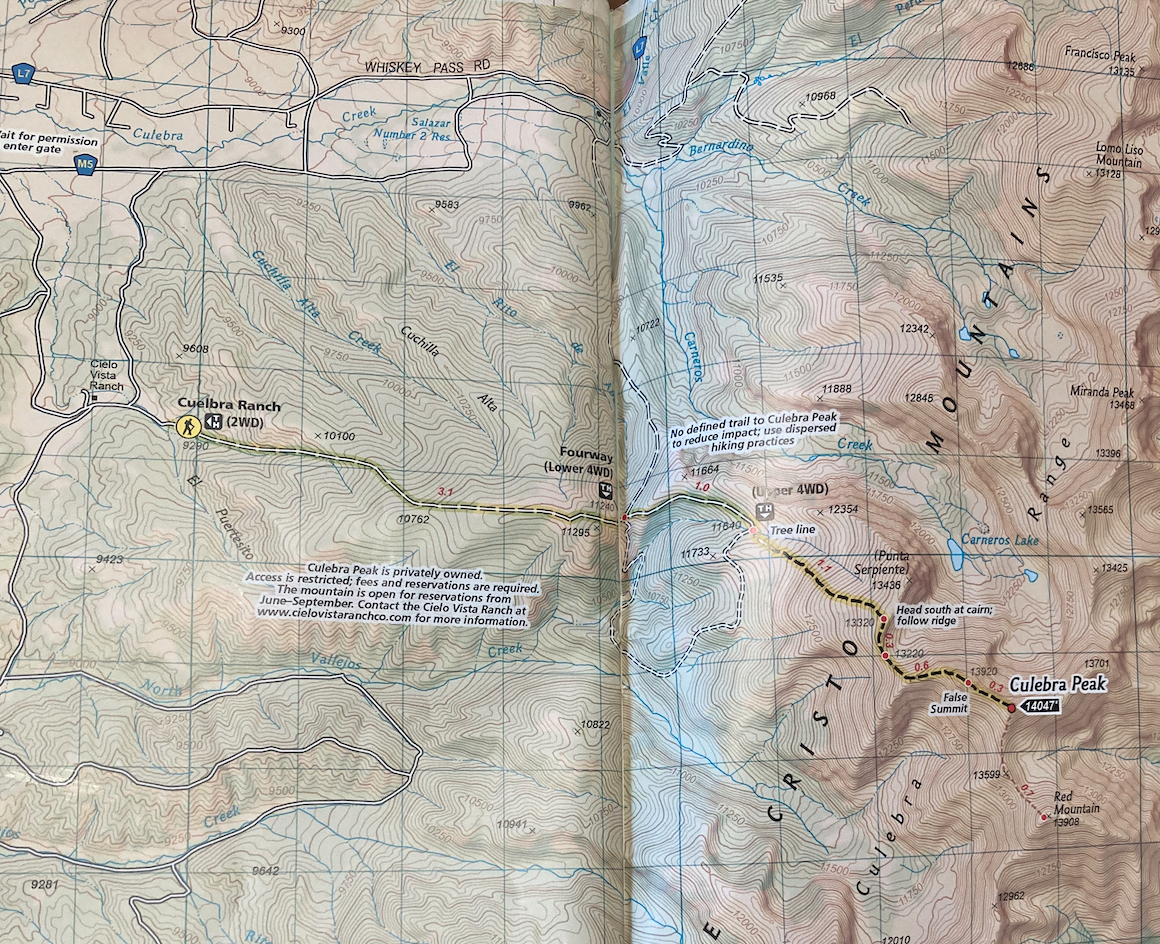
Culebra Peak Trail Map
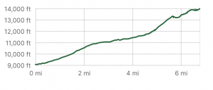
Culebra Peak Elevation Profile
Hiking Culebra Peak In Winter
This is a great winter hike as long as the ranch is accepting visitors. Generally, they accept hikers from January – July, but this can change on a yearly basis. In winter, hikers often have to start at the ranch, making this a long day hike.
Many will choose to ski down as well given you can cover lots of ground quickly on the way down, and skinning up is feasible for all of this hike pending conditions.
Camping For Culebra Peak
The ranch allows hikers to camp at the closed gate the night before. They have a porta potty (sometimes) at the gate and flat ground for tents. If traveling far, this is a great option. The ranch allows hikers to climb over the fence and camp just on the other side in the labeled camping area.
Current Weather Conditions:
Here is the detailed weather forecast for the next few days. We highly recommend you check out the mountain forecast for this peak the morning of your hike.
Stonewall Gap, CO
This Afternoon
Snow showers likely and a chance of thunderstorms. Mostly cloudy, with a high near 30. West wind around 15 mph. Chance of precipitation is 60%. New snow accumulation of 1 to 3 inches possible.
Tonight
Snow showers likely and a chance of thunderstorms. Mostly cloudy, with a low around 18. West wind 5 to 10 mph. Chance of precipitation is 70%. New snow accumulation of 1 to 2 inches possible.
Sunday
A chance of snow showers before noon, then snow showers likely and a chance of thunderstorms. Mostly cloudy, with a high near 36. West northwest wind 5 to 10 mph. Chance of precipitation is 70%. New snow accumulation of 1 to 2 inches possible.
Sunday Night
Snow showers likely and a chance of thunderstorms before midnight. Mostly cloudy, with a low around 18. West wind 5 to 10 mph. Chance of precipitation is 70%. New snow accumulation of less than one inch possible.
Monday
Sunny, with a high near 42. West wind 5 to 20 mph.
Monday Night
Mostly clear, with a low around 25. West southwest wind 20 to 25 mph, with gusts as high as 40 mph.
Tuesday
Sunny, with a high near 47. West wind 20 to 30 mph, with gusts as high as 45 mph.
Directions & Parking
2WD vehicles can make it to the ranch headquarters any time of the year and to the parking lot for 2WD vehicles near the ranch. 4WD vehicles are needed to make it passed the ranch headquarters.
Note Of Caution: The GPS routes have been known to take you on closed private roads to the ranch headquarters, so read the written description to ensure your GPS is taking you the proper way.
Directions to Cielo Vista Ranch Gate:
Additional Pictures
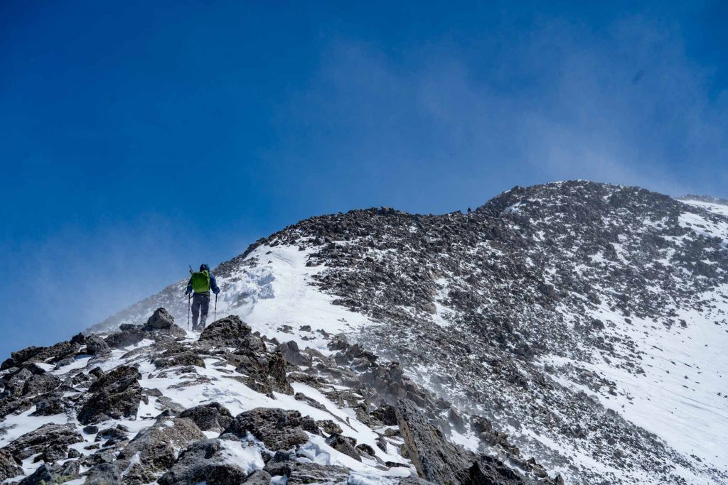
Heading To The False Peak On Culebra Peak
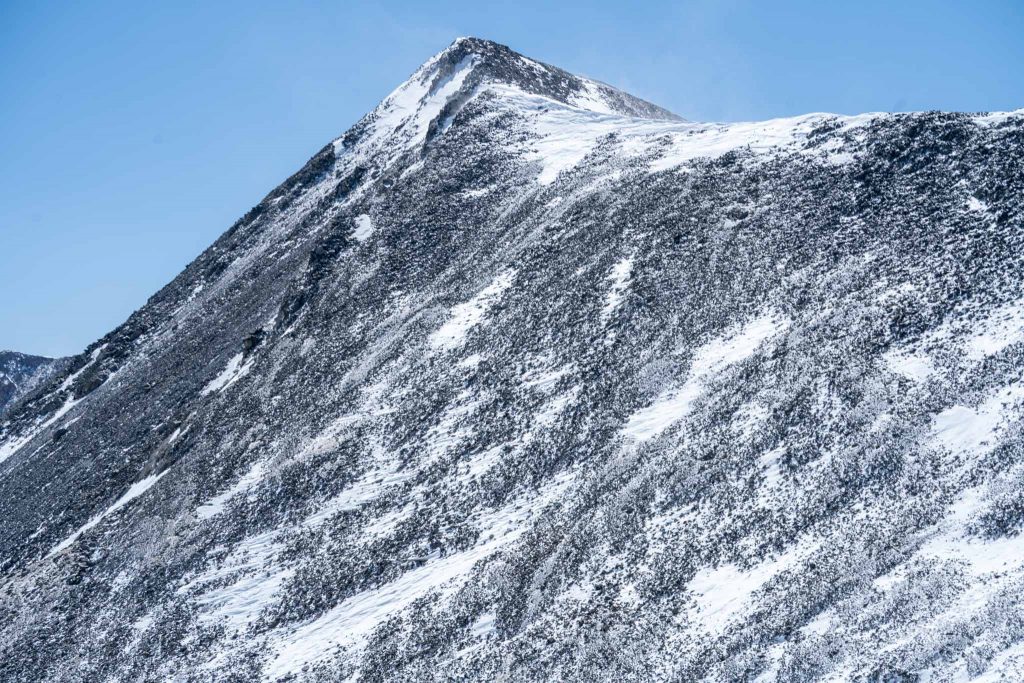
Culebra Peak
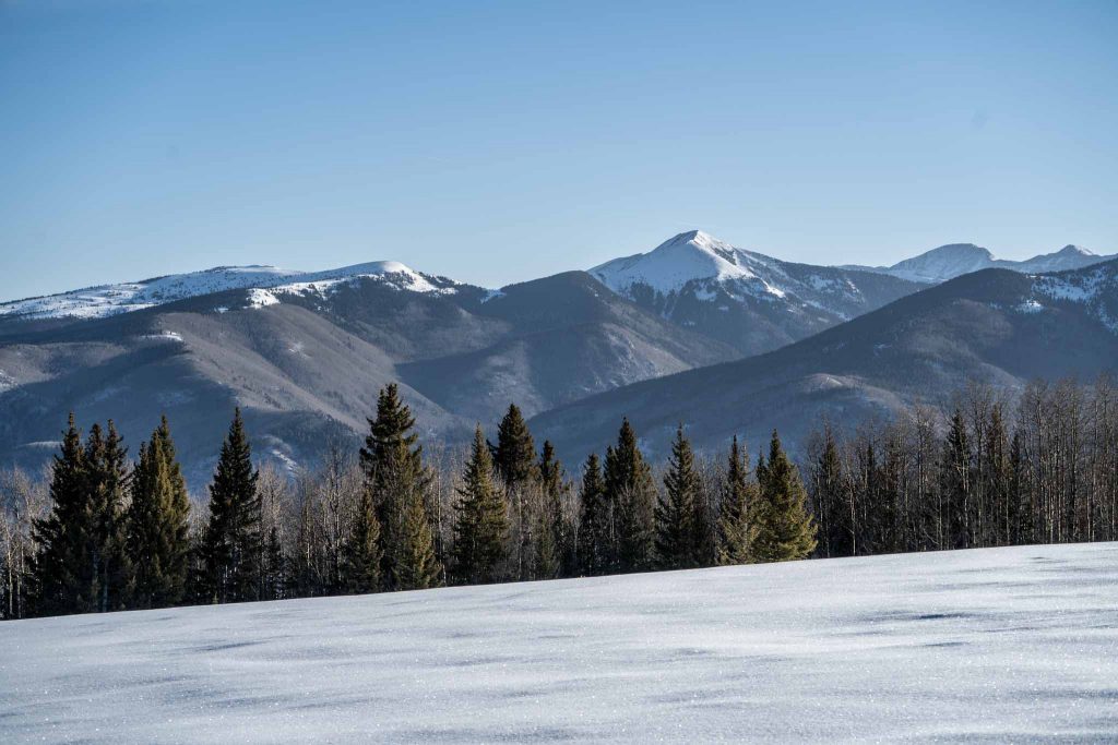
Views Early On
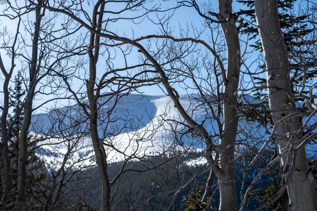
Views of the ridge and the bowl through aspens
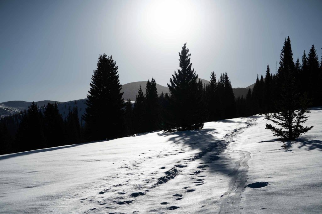
Views early on while skinning up
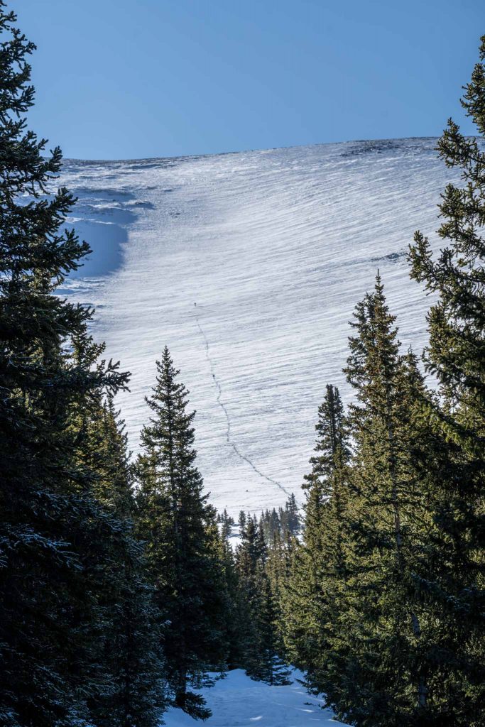
Looking at the bowl near the 4WD trailhead

Max DesMarais is the founder of hikingandfishing.com. He has a passion for the outdoors and making outdoor education and adventure more accessible. Max is a published author for various outdoor adventure, travel, and marketing websites. He is an experienced hiker, backpacker, fly fisherman, backcountry skier, trail runner, and spends his free time in the outdoors. These adventures allow him to test gear, learn new skills, and experience new places so that he can educate others. Max grew up hiking all around New Hampshire and New England. He became obsessed with the New Hampshire mountains, and the NH 48, where he guided hikes and trail runs in the White Mountains. Since moving out west, Max has continued climbed all of the Colorado 14ers, is always testing gear, learning skills, gaining experience, and building his endurance for outdoor sports. You can read more about his experience here: hikingandfishing/about