Nestled amidst the serene waters of the Great Salt Lake, this iconic peak offers an exhilarating hiking experience that promises breathtaking vistas and even a chance to see bison. This article is your guide to successfully navigating the trails, embracing the challenges, and savoring the rewards that await atop Frary Peak, the highest point on Antelope Island.
Distance – 6.62 miles round trip (10.65 km)
Height – 6,581 feet (2005.9 m)
Elevation gain – 2,450 feet (746.8 meters)
Duration – 5-6 hours
Difficulty – Intermediate to difficult
Hike Class: Class 2 hiking
Trailhead Location – Frary Peak Trailhead, Antelope Island (Directions Below)
Quick Navigation:
Routes | Trail Map | Lodging Info | Weather | Directions | Pictures
Need To Know Information
-
-
- Antelope Island has a daily fee. You can read about fees, hours, and campgrounds for Antelope Island here.
- Dogs are allowed but must be on leash.
- Bugs can be bad on this trail. During the spring and summer months, bring layers for protection.
- This hike can be extremely hot in the summer, be prepared, or avoid the hottest hours of the day.
- Parts of the trail closer to the summit have steep drop offs next to the trail. This trail is safe, but caution is needed, and those with fears of heights may dislike portions of this trail.
-
Hiking Route Options
There really is only one route up Frary Peak from a good sized parking lot. There is an overflow parking lot located down further that can be used if hikers want to add to the hike, or on a rare occasion, the parking lot was full.
Frary Peak Trailhead | 6.62 Miles Round Trip (10.65 km) – 2,450 Feet Elevation Gain (746.8 meters)
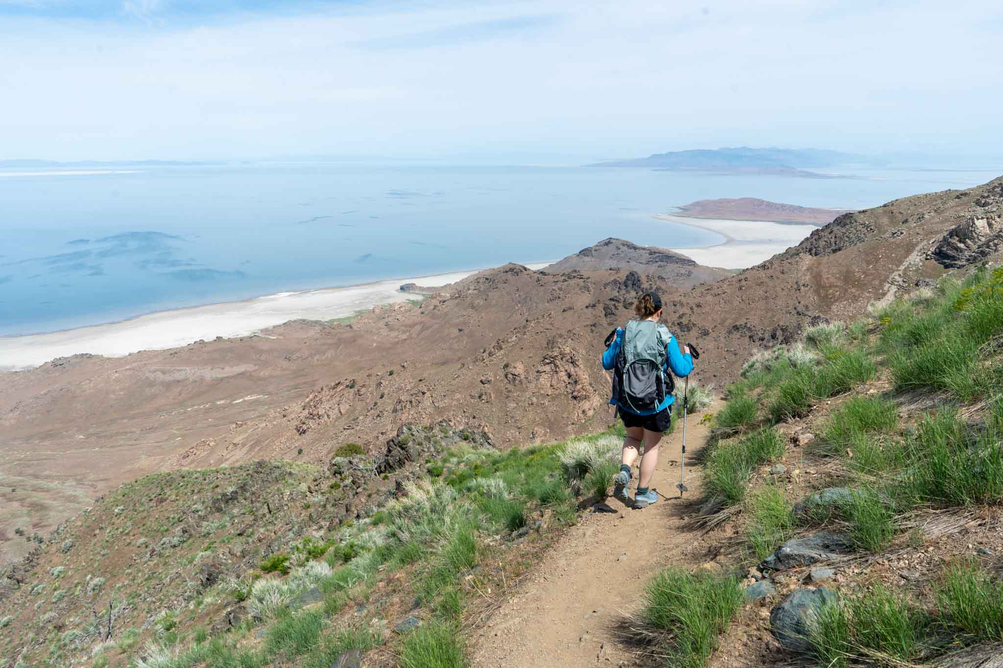
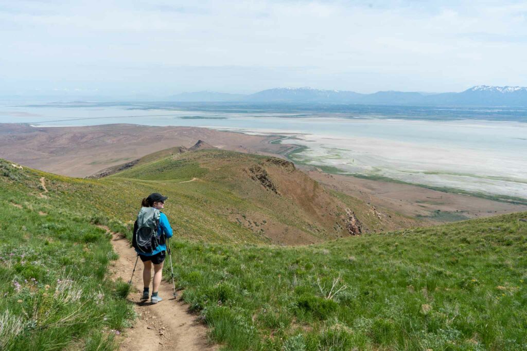
Hikers begin at the parking lot which features a full trail map. There is only one trail leading out of the parking lot which has a few spur trails leading to very cool viewpoints. The most popular named point is Dooly Knob, which is a great alternative to Frary Peak if hikers are looking only for a short hike with great views. Simply put, hikers follow the Frary Peak Trail and the markings towards Frary Peak. The trail is well maintained, easy to follow, and gains elevation pretty steadily across the whole hike with exception to a few flatter portions, and a small descent between Stringham Peak and Frary Peak about 3.3 miles into the hike.
The trail between Stringham Peak and Frary peak is thin, and features a steep hillside just off of the trail. This is where caution should be taken, especially if the trail is wet or muddy.
Once passing this section of trail, the last portion to the summit is a bit steeper, but easy to follow.
Hiking Frary Peak In Winter
This hike is accessible in winter, but traction in the form of microspikes should be brought due to icy conditions if ice is snow is present.
Trail Map

We have created an online map and GPX file you can download and see: View Frary Peak Hike Map and GPX File
Lodging Info
This hike is located on Antelope Island, within the State Park. There are a few campgrounds you can take a look at here. The town of Syracuse sits just outside the island if you are looking for other types of lodging.
Current Weather Conditions:
Here is the detailed weather forecast for the next few days. We highly recommend you check out local weather the morning of your hike.
Syracuse, UT
This Afternoon
Mostly sunny, with a high near 70. South wind around 24 mph.
Tonight
A slight chance of rain showers between midnight and 3am, then patchy blowing dust and a slight chance of rain showers. Mostly cloudy. Low around 41, with temperatures rising to around 56 overnight. South wind 30 to 37 mph. Chance of precipitation is 20%.
Sunday
Rain showers before noon, then a slight chance of thunderstorms and rain and snow showers. Cloudy. High near 57, with temperatures falling to around 38 in the afternoon. West southwest wind 22 to 38 mph, with gusts as high as 51 mph. Chance of precipitation is 90%.
Sunday Night
A chance of thunderstorms and rain and snow showers. Cloudy, with a low around 37. Southwest wind 21 to 26 mph. Chance of precipitation is 90%.
Monday
Rain and snow showers likely before noon, then a chance of showers and thunderstorms. Mostly cloudy, with a high near 51. West southwest wind 23 to 28 mph. Chance of precipitation is 60%.
Monday Night
Showers and thunderstorms. Mostly cloudy, with a low around 39. Chance of precipitation is 80%.
Tuesday
A chance of thunderstorms and rain and snow showers. Mostly cloudy, with a high near 47. Chance of precipitation is 80%.
Directions & Parking
Directions to Frary Peak Trailhead:
Additional Pictures
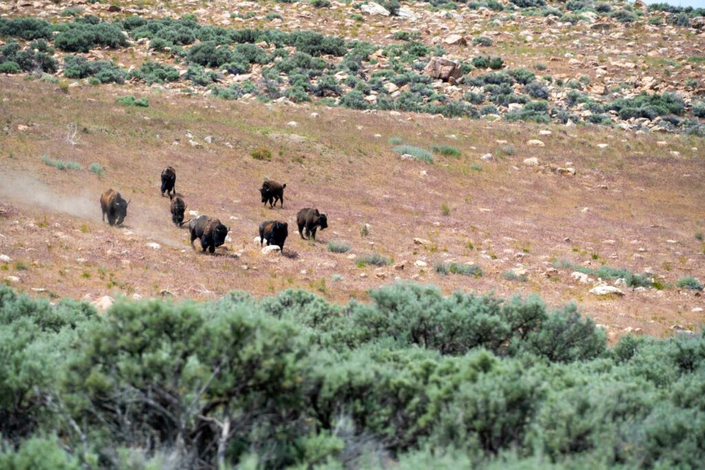
Bison on Antelope Island
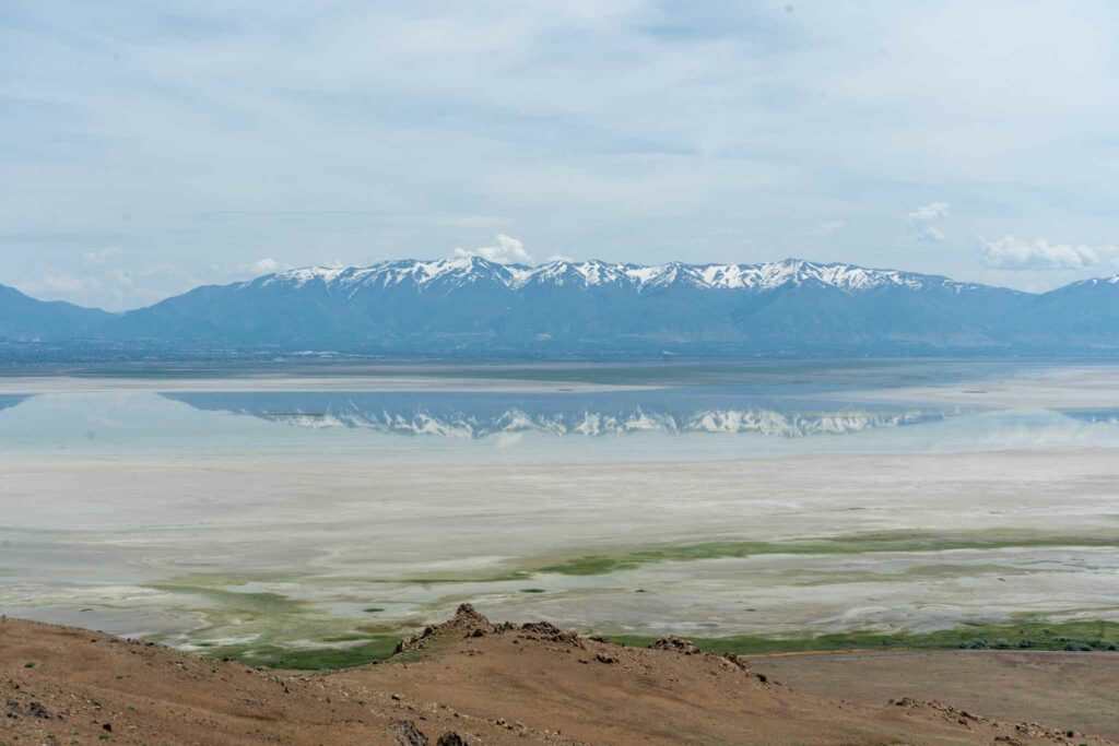
Reflection on the Great Salt Lake
Trail looking at Dooly Knob in the distance
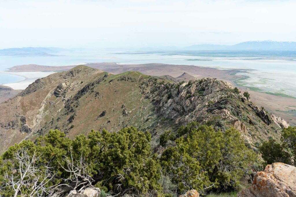
Views looking back at the trail from Frary Peak
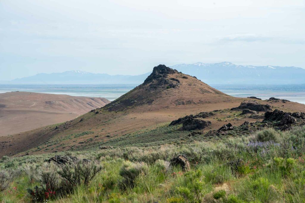
Dooly Knob
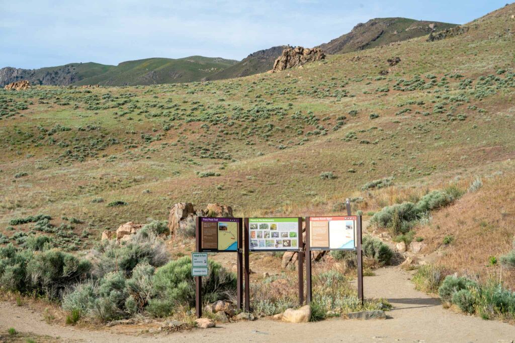
Frary Peak Trailhead

Max DesMarais is the founder of hikingandfishing.com. He has a passion for the outdoors and making outdoor education and adventure more accessible. Max is a published author for various outdoor adventure, travel, and marketing websites. He is an experienced hiker, backpacker, fly fisherman, backcountry skier, trail runner, and spends his free time in the outdoors. These adventures allow him to test gear, learn new skills, and experience new places so that he can educate others. Max grew up hiking all around New Hampshire and New England. He became obsessed with the New Hampshire mountains, and the NH 48, where he guided hikes and trail runs in the White Mountains. Since moving out west, Max has continued climbed all of the Colorado 14ers, is always testing gear, learning skills, gaining experience, and building his endurance for outdoor sports. You can read more about his experience here: hikingandfishing/about
Incredible Views
Not only did we have great trail conditions, there weren’t many bugs, the weather was perfect, and the lake left us with some pretty incredible reflections and colors!
Stopped on our way back from Jackson WY, and the hike didn’t disappoint. It is a definite must do if you live in the area as it is extremely unique.