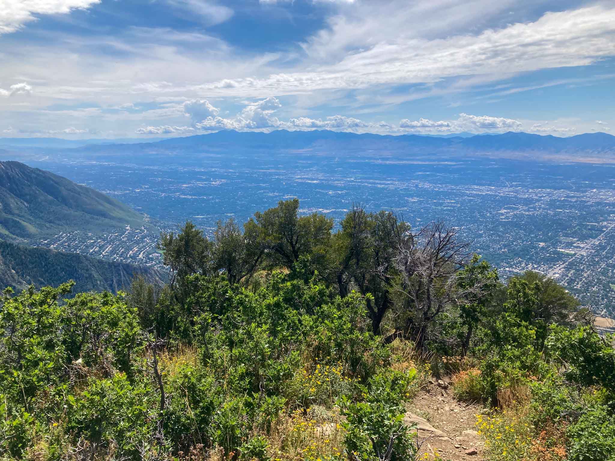
Grandeur Peak is a gorgeous and easy to access hike that looms over Salt Lake City. There are a couple common hiking routes to the summit, and in this article, we will cover everything you need to know.
Difficulty – Intermediate
Distance – 5.52 miles round trip (8.88 km)
Height – 8,299 feet (2529.54 m)
Elevation gain – 2,403 feet (732.43 m)
Duration – 3-4 hours (book time)
Trailhead Location – Church Fork Picnic Area Trailhead (5,926 Feet) or Grandeur Peak Trailhead (AKA West Ridge Trailhead) (4,933 Feet)
Dogs – Allowed on this trail.
Grandeur Peak Hike Video
Here is some of our drone footage highlighting the incredible views from this awesome hike:
Need To Know Information
- Dogs are allowed. In Millcreek Canyon, dogs are allowed off leash on odd days of the month. On even days, dogs must be leashed.
- There are two common routes – one route requires paying to enter Millcreek Canyon, but has less elevation gain. The other has free parking, but has more elevation gain. Both routes are described below.
Trail Map
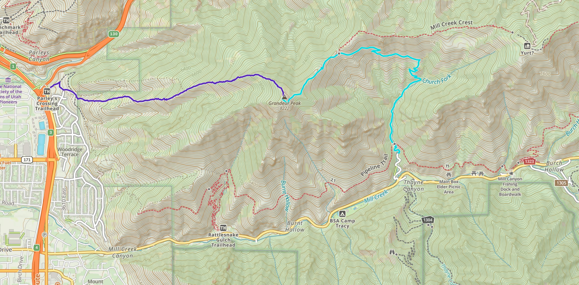
Click to enlarge
Download GPX For Church Fork Trailhead Here
Download GPX For Grandeur Peak Trailhead Here
Routes
Grandeur Peak Via Church Fork – 6.14 miles round trip (9.88 km) – 2,616 feet (797.36 m) Elevation Gain
This is the most common route to the summit of Grandeur due to the higher elevation starting point, and the fact that the trailhead is located at a very popular picnic area in Millcreek Canyon. This route does require paying an entrance fee for the Canyon. You can read about this below.
This trail is very well traveled, very well maintained, and very well marked, making it easy or anyone to follow. Hikers follow the signs and trail that follows a small creek and climbs gradually, and eventually relatively steeply through switchbacks.
This trail is slightly longer than via the West Ridge Trailhead, but has about 600 less feet of elevation gain, and a better trail, making it a much easier approach.
Grandeur Peak Via West Ridge Trailhead (Grandeur Peak Trailhead) – 4.42 miles round trip (7.11 km) – 3,247 feet (989.69 m) Elevation Gain
While this trail is shorter in distance, it is much steeper, and the trail is not as well maintained, making it a more difficult ascent than via Millcreek Canyon. There are actually several unmarked trails via ridges that head to the summit. All of about equal difficulty. Hikers simply take what appears to be the most traveled route, straight up the ridge all the way, and they will arrive at the summit.
This route is unforgiving and very steep, but is a blast as you have awesome views of Salt Lake City 100% of the trail. There is zero tree coverage, meaning hikers are exposed to sun, wind, and rain the entirety of the hike. On a hot day, this route is brutal.
The Grandeur Peak Loop | 9.74 miles round trip (15.67 km) – 4,378 feet (1334.41 m) Elevation Gain
If hikers want to do a loop, and experience both trails at once, there is a very feasible route with incredible views. By starting at the West Ridge Trailhead, hikers can ascend Grandeur Peak, drop down back into Millcreek Canyon, and turn onto the Pipeline Trail all the way to the stunning viewpoint at the mouth of Millcreek Canyon. At this point, the trail gets far less maintained, but is still easy to follow as it meanders along the west side of the mountains back to the starting point at the West Ridge Trailhead.
If you are interested in this route, we have created a GPX route of it here.
Hiking in Winter
This is prone to avalanche conditions in winter and should only be done by those who are aware of current avalanche conditions, and are prepared for winter hiking. You can read the current avalanche forecasts on the Utah Avalanche Center website.
Camping Information
Only backcountry camping is allowed in the canyon. Camping must be at least 1/2 mile off the road, and 200 feet from any trails, water, or developed areas. More information can be found here.
Weather
Here is a detailed weather forecast for the area:
Millcreek, UT
This Afternoon
A chance of thunderstorms and rain and snow showers. Cloudy. High near 49, with temperatures falling to around 36 in the afternoon. West northwest wind around 7 mph. Chance of precipitation is 90%. Little or no snow accumulation expected.
Tonight
A chance of thunderstorms and rain and snow showers. Cloudy, with a low around 36. Northeast wind around 7 mph. Chance of precipitation is 90%.
Saturday
Rain and snow showers before noon, then snow showers and a slight chance of thunderstorms. Cloudy. High near 44, with temperatures falling to around 36 in the afternoon. West northwest wind 6 to 10 mph. Chance of precipitation is 100%. New snow accumulation of less than half an inch possible.
Saturday Night
A slight chance of thunderstorms and rain and snow showers likely. Mostly cloudy, with a low around 36. Northwest wind 5 to 10 mph. Chance of precipitation is 70%.
Sunday
A chance of snow showers before 9am, then a chance of rain showers. Partly sunny, with a high near 50. West northwest wind 5 to 10 mph. Chance of precipitation is 30%.
Sunday Night
Partly cloudy, with a low around 37.
Monday
A slight chance of showers and thunderstorms after noon. Mostly sunny, with a high near 55. Chance of precipitation is 20%.
Directions
To Millcreek Canyon Trailhead at Church Fork:
To West Ridge Trailhead (Grandeur Peak Trailhead)
Additional Pictures
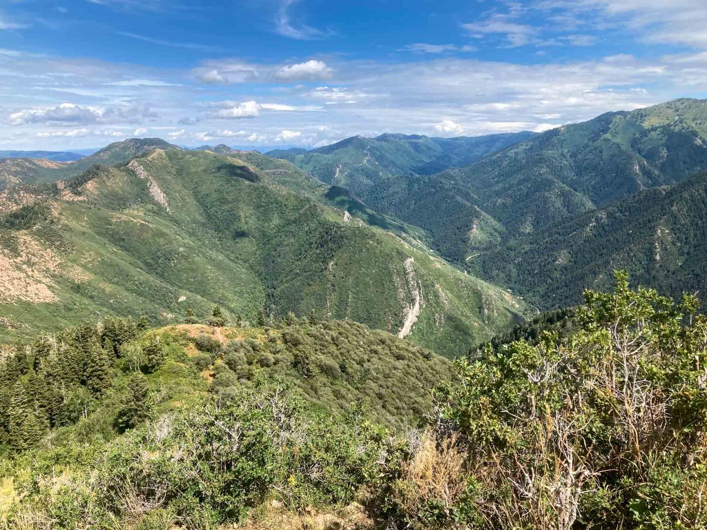
Grandeur Peak looking into Millcreek Canyon
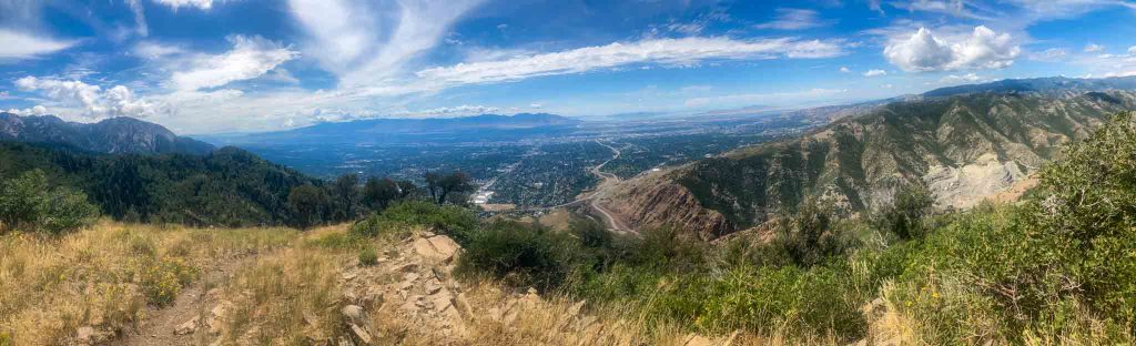
Pano from Grandeur Peak

Max DesMarais is the founder of hikingandfishing.com. He has a passion for the outdoors and making outdoor education and adventure more accessible. Max is a published author for various outdoor adventure, travel, and marketing websites. He is an experienced hiker, backpacker, fly fisherman, backcountry skier, trail runner, and spends his free time in the outdoors. These adventures allow him to test gear, learn new skills, and experience new places so that he can educate others. Max grew up hiking all around New Hampshire and New England. He became obsessed with the New Hampshire mountains, and the NH 48, where he guided hikes and trail runs in the White Mountains. Since moving out west, Max has continued climbed all of the Colorado 14ers, is always testing gear, learning skills, gaining experience, and building his endurance for outdoor sports. You can read more about his experience here: hikingandfishing/about
PR On West Face
Great conditions, got PR on west face and back down.