Jacks Mountain is a gorgeous peak that overlooks Salt Lake City. It features a great trail, stunning views, and a mailbox at the top in memory of Jack Edwards. Jack Edwards was a child who died in 1995 of leukemia. His ashes were spread in the foothills of Salt Lake City, and this peak has mailboxes set up near the top containing a journal.
The instructions for these journals are as follows: “Please take a moment to say hello to Jackie Jack and write a little (or long) note.” This represents a great opportunity to sit at the summit and read some entries!
Distance – 2.4 miles round trip (3.9 km)
Height – 6,455 feet (1967.5 m)
Elevation gain – 1,400 feet (427 meters)
Duration – 3.5 – 4 hours
Difficulty – Easy to Intermediate
Trailhead Locations – Jacks Mountain Trailhead
Dogs: Allowed
Jacks Mountain Loop
Many people choose to do a little loop up the steeper trail, and down the ridge which is slightly less steep to add to the experience. This doesn’t add much mileage and is worth it to change it up a bit from and turn your hike into a small loop.
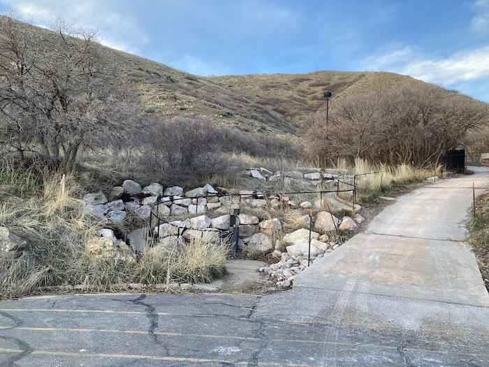
Hikers start at the trailhead with the walking path along the railing as seen below.
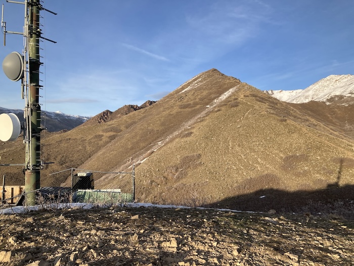
From here, you can see your halfway point, the tower at the peak on the photo. Hikers simply head up the trail and take the path that they want to. The right path is the steepest and most direct. Staylng left and flat for a bit, hikers walk around to the ridge will increase the mileage, but make the hike up slightly less steep.
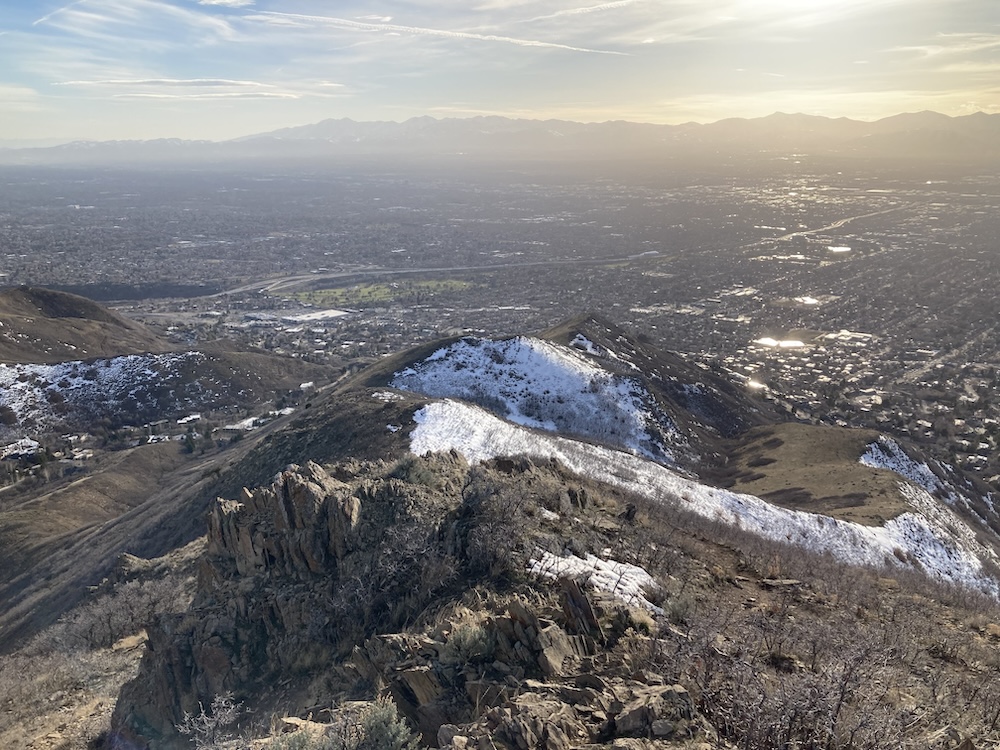
Once reaching the tower as seen in the photo, you’ll see the true Jacks summit and the trail to the top pretty clearly. There is a less traveled path that avoids the extra gain and loss of elevation to the tower, but we recommend just hiking to the tower.
From here, hike down about 100 vertical feet to the saddle, and then begin hiking the well traveled path to the summit of Jacks Mountain. Return back to the tower, and then decide to hike along the ridge to do the loop, or to hike straight back down to the trailhead.
Hiking Jacks Mountain In Winter
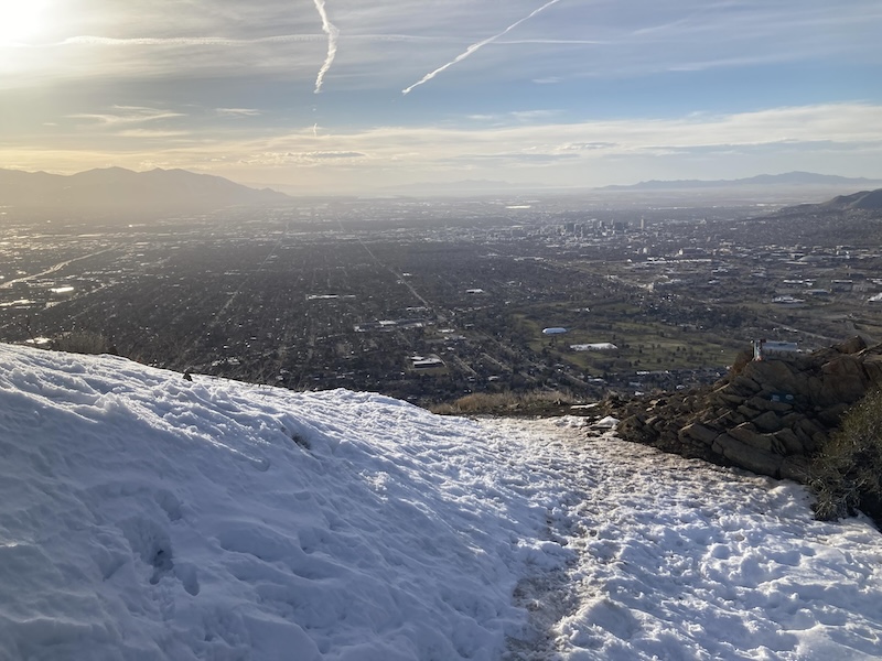
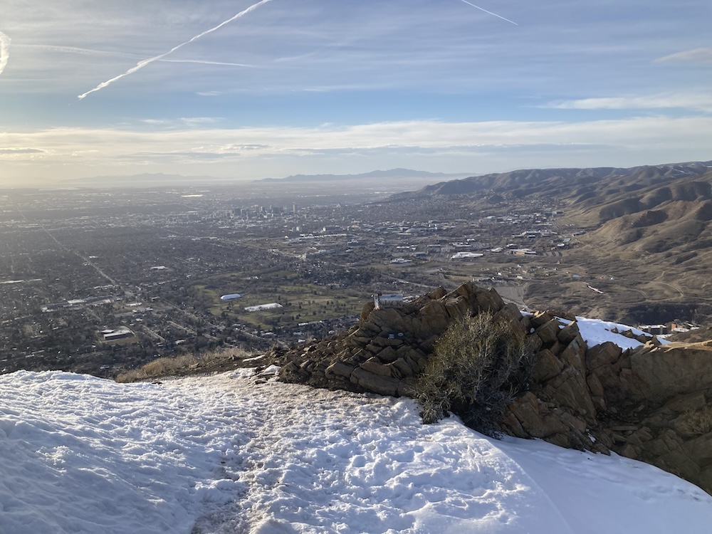
Jacks is at relatively low elevation, and most of the trail faces between South and West, meaning for most of the year the trail remains dry, and snow and ice free. After snowfall, it may have snow, but it does generally disappear quickly. The top portion at the summit by the mailbox does generally hold snow for a good portion of winter, but this stretch is generally quite small.
Tips For Jacks Mountain
- This hike is steep, so poles can help you a bit on the hike up be more efficient, as well as feel more stable on the way down.
- Expect to spend a little extra time reading some journal entries at the top if weather allows.
- This hike is exposed to wind and sun. So make sure you bring sunscreen, water, and wind protection if windy.
Trail Map
Current Weather Conditions:
Here is the detailed weather forecast for the next few days. We highly recommend you check out local weather the morning of your hike.
Millcreek, UT
Today
A slight chance of rain showers. Partly sunny. High near 59, with temperatures falling to around 57 in the afternoon. West northwest wind 2 to 6 mph. Chance of precipitation is 20%.
Tonight
Mostly clear, with a low around 44. East southeast wind 2 to 6 mph.
Monday
A chance of rain showers after noon. Mostly sunny. High near 67, with temperatures falling to around 65 in the afternoon. South wind 6 to 12 mph. Chance of precipitation is 30%.
Monday Night
A chance of rain showers before midnight. Partly cloudy, with a low around 37. Northwest wind 5 to 13 mph. Chance of precipitation is 50%.
Tuesday
Sunny, with a high near 62. West southwest wind 3 to 10 mph.
Tuesday Night
Partly cloudy, with a low around 43.
Wednesday
A slight chance of rain showers. Partly sunny, with a high near 56. Chance of precipitation is 20%.
Directions & Parking
Parking for this trailhead is quite simple. It is roadside parking in a neighborhood. You can park as close to the trailhead as you can, and there is the Arcadia Heights trailhead a couple hundred feed down the road, where you can also easily park along the road here.
Additional Pictures

Max DesMarais is the founder of hikingandfishing.com. He has a passion for the outdoors and making outdoor education and adventure more accessible. Max is a published author for various outdoor adventure, travel, and marketing websites. He is an experienced hiker, backpacker, fly fisherman, backcountry skier, trail runner, and spends his free time in the outdoors. These adventures allow him to test gear, learn new skills, and experience new places so that he can educate others. Max grew up hiking all around New Hampshire and New England. He became obsessed with the New Hampshire mountains, and the NH 48, where he guided hikes and trail runs in the White Mountains. Since moving out west, Max has continued climbed all of the Colorado 14ers, is always testing gear, learning skills, gaining experience, and building his endurance for outdoor sports. You can read more about his experience here: hikingandfishing/about
A little muddy
A little muddy today with some snow on the north side and at the summit. Mud right at the tower, mud at the saddle, and small amounts of mud in scattered spots. Overall, still great running, no need for spikes, just might need to step around a little mud.
Great Day For Jacks!
Trail is in perfect condition all the way to the saddle between the towers and the true summit. Tiny bit of mud in that saddle and easy to walk around. Conditions to summit fantastic. Little bit of snow by mailbox at the summit, but overall trail is in great shape! No spikes needed.
Great Conditions - Very Small Amount of Mud At Saddle
Only a tiny bit of avoidable mud at saddle. Summit has some snow, but only the very top. Overall great conditions.