La Plata Peak is a beautiful peak located in the Sawatch Range of Colorado. This 14,361 foot summit has hikers gain over 4,500 feet of elevation to reach the summit. This is a common year round hike.
Distance –9.6 miles round trip (15.45 km)
Height – 14,336 feet (4,369.6 m)
Elevation gain – 4,560 feet (1,389.9 m)
Duration – 6 to 9 hours (book time)
Difficulty – Strenuous
Class: Class 2 Hike
Seasons – Year-round (caution and experience needed in winter – see below)
Trailhead Location – La Plata Peak Trailhead – 10,160 feet (directions below)
Trail Map
Below is the main trail map. If you scroll down to the bottom of this article in the images section, there is a trail map highlighting all of the different route options.
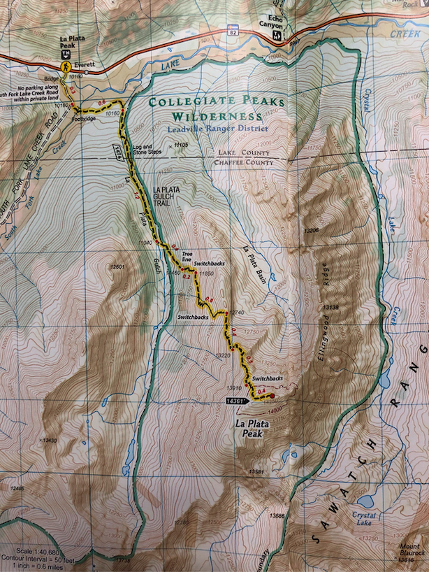
La Plata Peak Trail Map
Trails
La Plata Gulch Trail: 9.6 Miles Round Trip | 4,560 Feet Elevation Gain | Class 2
This is the most common route up La Plata Peak and begins at the La Plata Peak Trailhead Parking. This is a relatively small lot that is open year round.
The trail is well marked, easy to follow and is quite flat for the first mile. Hikers bear left .3 miles into the hike to stay off South Fork Lake Creek Road. (This is often cross country skied in winter).
Hikers will continue ascending and break treeline 2.5 miles into the hike. The views are stunning from this point on. In summer, hikers will hike along the La Plata Basin ascending, before heavy switchbacks have hikers rise to the ridge. The last mile push to the summit covers over 1,000 feet of elevation gain, making it relatively steep. The section below the ridge should be avoided during avalanche season. See winter hiking information below.
Ellingwood Ridge: 9.5 Miles Round Trip | 5,900 Feet Elevation Gain | Class 3
This is a much more difficult and less traveled route up La Plata. If you are in for some more difficult trails, and unreal ridgeline views, this may be a great option. This route is not recommended in Winter.
This hike begins the same as the La Plata Gulch trail, but hikers will bear left immediately after the second bridge crossing. Helmets are recommended on this route due to loose rocks.
North Face Route: 8.75 Miles Round Trip | 4,900 Feet Elevation Gain | Class 2-3
This route is not recommended for most. It begins the same as the recommended winter route (below) but hikers will bear left at “The Crux” and hikers will need to bushwack and do some route finding. This route goes right up the north face of La Plata via the main couloir. Hikers can choose to take a couple other couloir options as well.
Hiking in Winter
La Plata Peak is a great winter ascent. The trailhead remains open year round, so mileage is not added. Due to avalanche risk, an altered path is recommended during winter months. This path deviates from the normal summer route before treeline, and heads directly to a section known as the Cruz. This section, is the most difficult section of the entire hike. Ice axes are a nicely added tool here given the steepness and rocks. (You can see an image of the recommended path up the Crux below.
Hikers will deviate from the normal path at around 10,800 feet and head towards the ridge.
See image below to follow the correct path.
Another winter route is known as the North Face route, which takes hikers up the steep couloir on the North Face of La Plata.
All routes are highlighted in a map below.
As with all CO 14ers, experience and extreme caution is necessary in the winter.
Camping Information
The closest campground is the Twin Peaks Campground. Parry Peak Campground is also nearby. We recommend grabbing tent sites there for a short drive to the trailhead.
Current weather conditions:
Here is the detailed weather forecast for the next few days. We highly recommend you check out the mountain forecast for this region the morning of your hike.
Twin Lakes, CO
Today
Partly sunny, with a high near 23. Wind chill values as low as -11. West northwest wind 15 to 25 mph.
Tonight
Mostly cloudy, with a low around 12. North wind 5 to 15 mph.
Thursday
A slight chance of snow showers before noon, then snow showers likely and a slight chance of thunderstorms. Mostly cloudy, with a high near 27. East southeast wind 5 to 20 mph. Chance of precipitation is 70%. New snow accumulation of around one inch possible.
Thursday Night
A chance of snow showers and a chance of thunderstorms. Cloudy, with a low around 19. Southeast wind 15 to 20 mph. Chance of precipitation is 50%. New snow accumulation of 4 to 6 inches possible.
Friday
A chance of snow showers before 9am, then snow showers likely and a chance of thunderstorms. Mostly cloudy, with a high near 31. South southeast wind 10 to 15 mph. Chance of precipitation is 60%. New snow accumulation of 1 to 2 inches possible.
Friday Night
A chance of snow showers and a chance of thunderstorms before midnight. Mostly cloudy, with a low around 20. South southeast wind 5 to 10 mph. Chance of precipitation is 40%. New snow accumulation of 1 to 2 inches possible.
Saturday
A slight chance of snow showers before noon, then snow showers likely and a chance of thunderstorms. Partly sunny, with a high near 35. West wind 5 to 15 mph. Chance of precipitation is 60%. New snow accumulation of less than one inch possible.
Directions & Parking
This trailhead is accessible year round. The road leading up to the trailhead, CO 82 closes in winter times just beyond the trailhead.
Directions to La Plata Peak Trailhead (La Plata Gulch Trailhead):
Additional Pictures

The Crux – La Plata Peak Winter Route

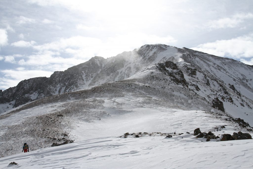
La Plata Peak From Ridge
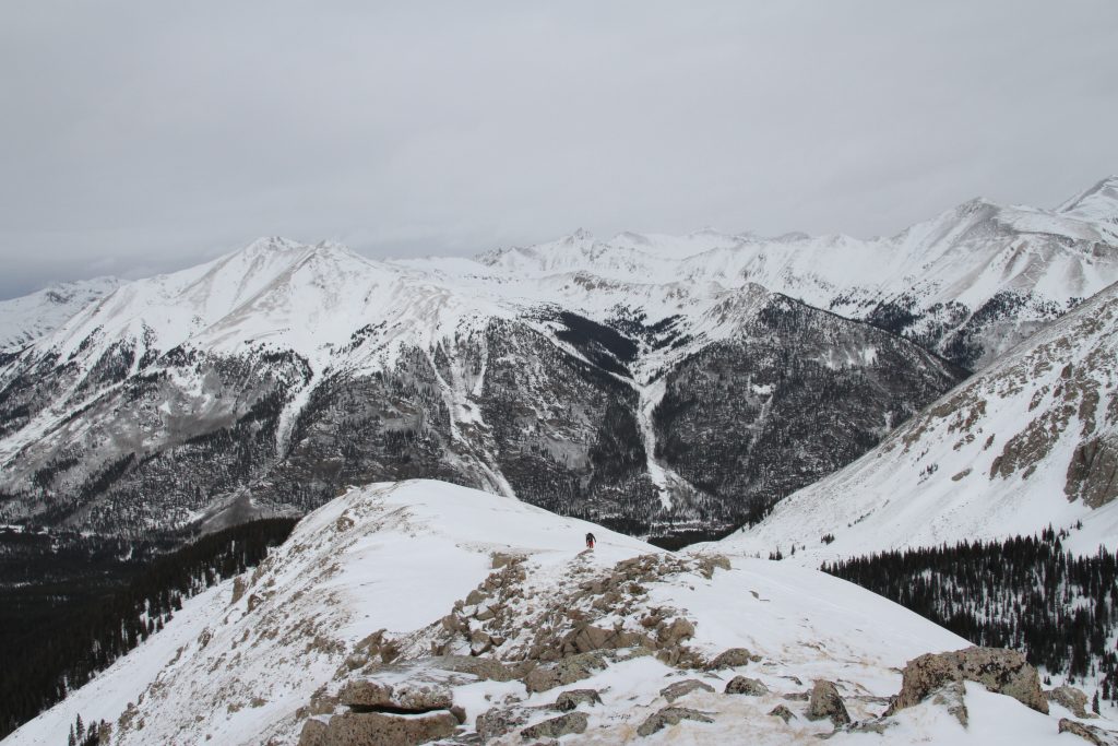
La Plata Peak Views
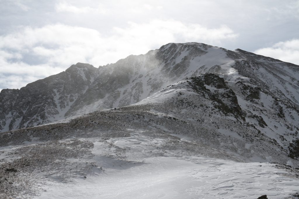
La Plata Peak, Colorado

La Plata Peak Winter Route Trail Map
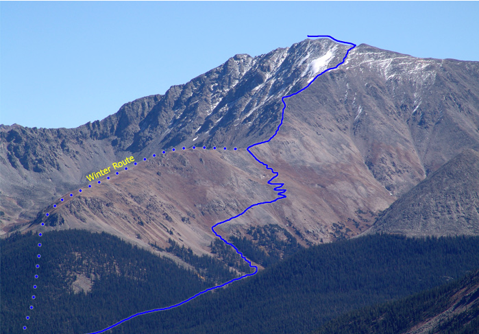
Image courtesy of 14ers.com

Max DesMarais is the founder of hikingandfishing.com. He has a passion for the outdoors and making outdoor education and adventure more accessible. Max is a published author for various outdoor adventure, travel, and marketing websites. He is an experienced hiker, backpacker, fly fisherman, backcountry skier, trail runner, and spends his free time in the outdoors. These adventures allow him to test gear, learn new skills, and experience new places so that he can educate others. Max grew up hiking all around New Hampshire and New England. He became obsessed with the New Hampshire mountains, and the NH 48, where he guided hikes and trail runs in the White Mountains. Since moving out west, Max has continued climbed all of the Colorado 14ers, is always testing gear, learning skills, gaining experience, and building his endurance for outdoor sports. You can read more about his experience here: hikingandfishing/about