Missouri Mountain is a 14,067 foot peak in the Sawatch Range of Colorado. Missouri is frequently summited alone, or combined with Mount Belford, or Mount Belford and Mount Oxford for a stunning but long day hike. This article will tell you everything you need to know to summit this mountain, as well as do an awesome loop of one, or both of the other nearby 14ers.
Distance – 10.8 miles round trip (17.38 km)
Height – 14,067 feet (4,287.6 m)
Elevation gain – 4,770 feet (1,453.9 m)
Duration – 6 to 8 hours (book time)
Difficulty – Strenuous
Class: Class 2 Hike
Seasons – This hike can be completed in all seasons, but winter is especially difficult, and dangerous.
Trailhead Location – Missouri Gulch Trailhead – 9,650 feet (directions below)
Trails
Missouri Gulch Trail – 5.4 Miles One Way – 4,770 Feet Elevation Gain
This is the most common route taken to the summit of Missouri. The trail begins by crossing over clear creek with a well maintained foot bridge. The trail remains relatively level for about .5 miles before hikers begin the first set of switchbacks.
1.2 miles in, hikers will reach a log bridge crossing the creek. The trail continues to ascend along the creek before reaching the junction towards either Mount Belford, or Missouri Mountain. Hikers bear right at this junction towards Missouri Mountain & Elkhead Pass.
At night, the section of trail can be difficult to follow here because of various paths leading to tent sites. Hikers cross the river via a log bridge about .15 miles after the junction. Once crossing the water, the trail is very easy to follow.
For 1.2 miles, hikers ascend slowly before reaching the junction to Elkhead pass, or to Missouri Mountain. Hikers turn right and begin steeply climbing switchbacks towards the saddle of Missouri Mountain. In .9 miles, hikers will climb 1,080 feet to the ridge.
Hikers then begin hiking along the ridge and climbing towards the summit. The summit is .7 miles from when hikers hit the top of the ridge.
The trail is easy to follow, but does have moments of exposure (long drops) on both the left and right side at points. This is still listed as class 2 hiking, but certainly some larger drops can be found.
Hikers reach the summit with stunning views and can retrace their way backwards.
Mount Belford & Missouri Mountain Loop – 12.1 Mile Loop – 6,214 Feet Elevation Gain
This is an extremely fun route. We recommend summiting Mount Belford first, then heading down Elkhead Pass and taking the spur trail to the summit of Missouri Mountain You can read about the trails from Mount Belford towards Missouri here.
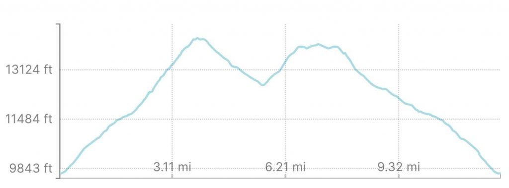
Missouri Mountain & Mount Belford Elevation Profile
Mount Belford, Mount Oxford, & Missouri Mountain Loop – 14.7 Miles – 7,538 Feet Elevation Gain
This route is even more fun (and painful) than the above. A long day with a ton of elevation gain and loss, this loop is only for the hearty, but highly recommended if you want to do a full day with 3 fourteeners combined into one.
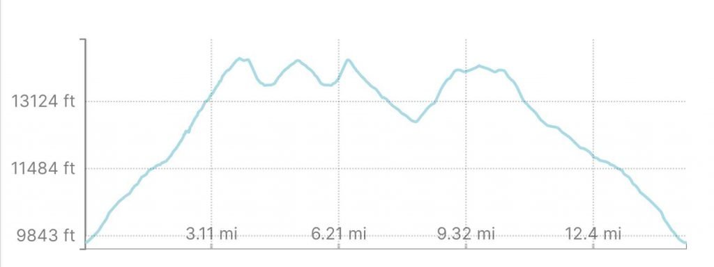
Mount Belford, Oxford & Missouri Mountain Elevation Profile
Trail Map
We have a few trail map variations for you here.
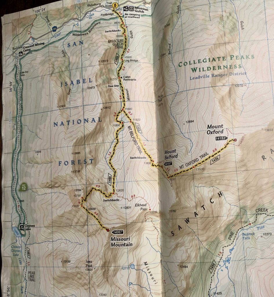
Mount Belford, Oxford & Missouri Mountain Trail Map
Want to combine all 3 fourteeners? Check out this map:
Hiking Missouri Mountain In Winter
As with any 14er, this hike is significantly more dangerous in winter. These summits are doable in winter months via the same route.
Camping For Missouri Mountain
There is no camping allowed at the trailhead for Mount Belford, Oxford & Missouri, however all along the road leading to the trailhead, there are various dispersed campsites that are first come first serve, free, and require no reservations.
The dispersed backcountry sites are also available at various points along the hike, most of which at the junction between the three summits. More information can be found here: https://www.fs.usda.gov/wps/portal/fsinternet/cs/generalinfo
Current Weather Conditions:
Here is the detailed weather forecast for the next few days. We highly recommend you check out the mountain forecast for this peak the morning of your hike.
Twin Lakes, CO
Overnight
Mostly cloudy, with a low around 20. West wind 20 to 30 mph. New snow accumulation of less than one inch possible.
Friday
A slight chance of snow showers between 11am and noon, then snow showers likely and a slight chance of thunderstorms. Mostly cloudy, with a high near 30. West wind 20 to 30 mph. Chance of precipitation is 70%. New snow accumulation of 1 to 2 inches possible.
Friday Night
Snow showers and a chance of thunderstorms. Mostly cloudy, with a low around 18. Southwest wind 10 to 20 mph. Chance of precipitation is 80%. New snow accumulation of 2 to 4 inches possible.
Saturday
Snow showers and a chance of thunderstorms. Cloudy, with a high near 24. Southwest wind 10 to 15 mph. Chance of precipitation is 100%. New snow accumulation of 7 to 11 inches possible.
Saturday Night
Snow showers and a chance of thunderstorms. Cloudy, with a low around 16. West northwest wind 10 to 15 mph. Chance of precipitation is 80%. New snow accumulation of 2 to 4 inches possible.
Sunday
Snow showers likely before noon, then snow showers likely and a chance of thunderstorms. Mostly cloudy, with a high near 26. West northwest wind around 15 mph. Chance of precipitation is 70%. New snow accumulation of less than half an inch possible.
Sunday Night
A slight chance of snow showers before midnight. Mostly cloudy, with a low around 16. West wind around 15 mph. Chance of precipitation is 20%.
Directions & Parking
The trailhead is accessible to all types of vehicles. The road leading to Missouri Gulch Trailhead is dirt, but two wheel drive vehicles won’t have issues.
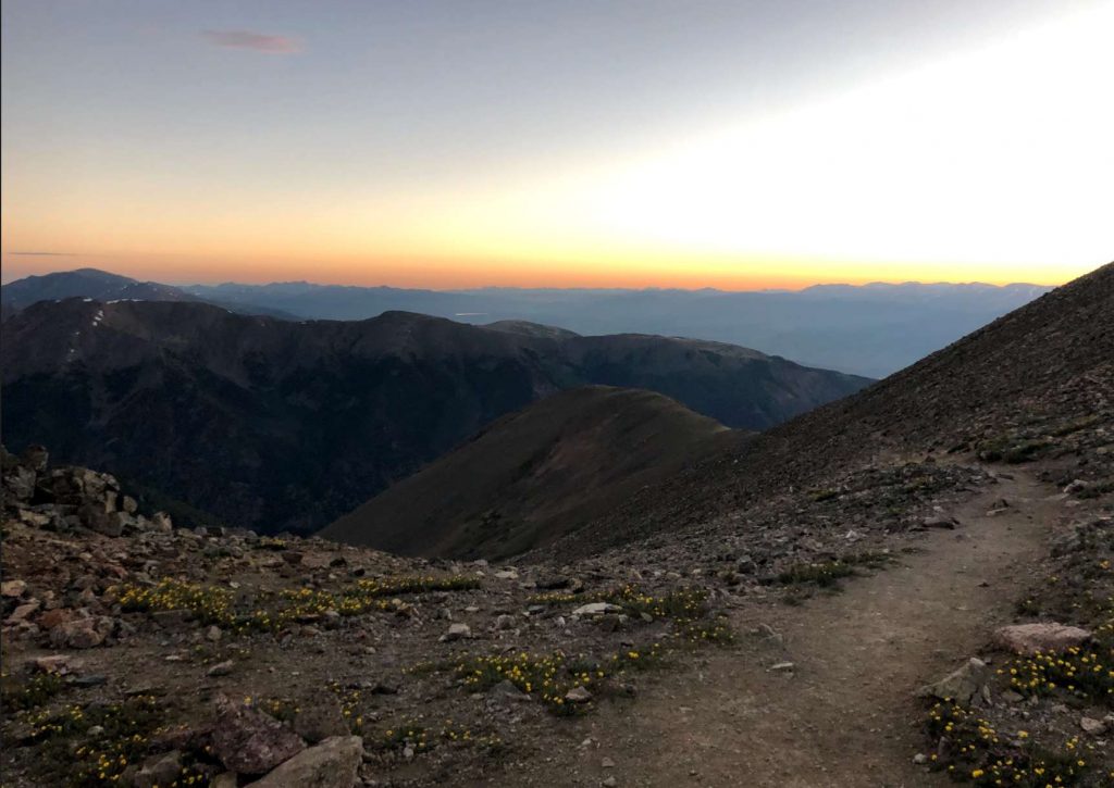
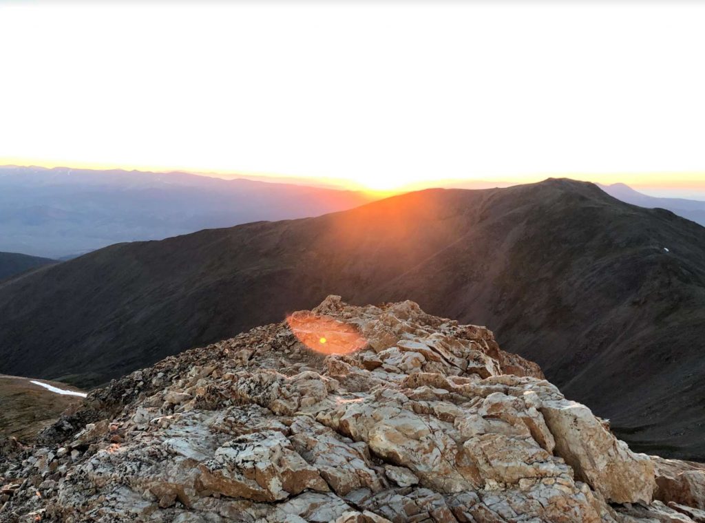
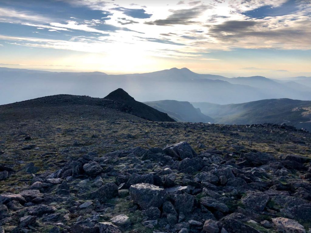
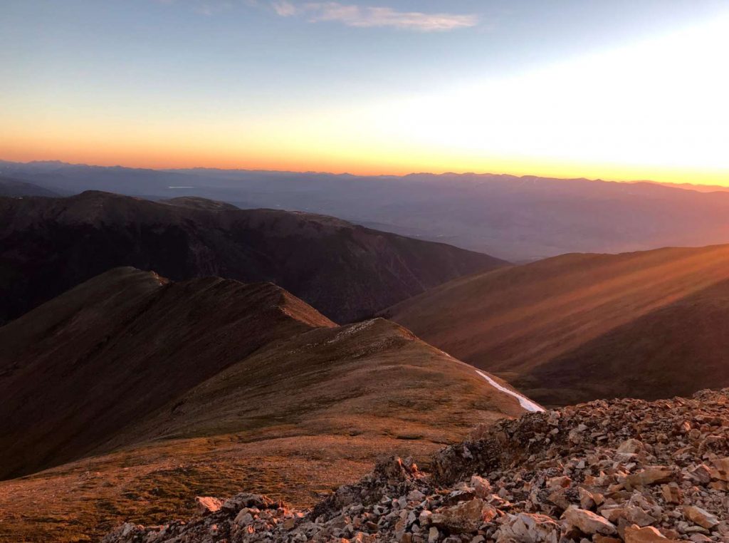
Additional Pictures
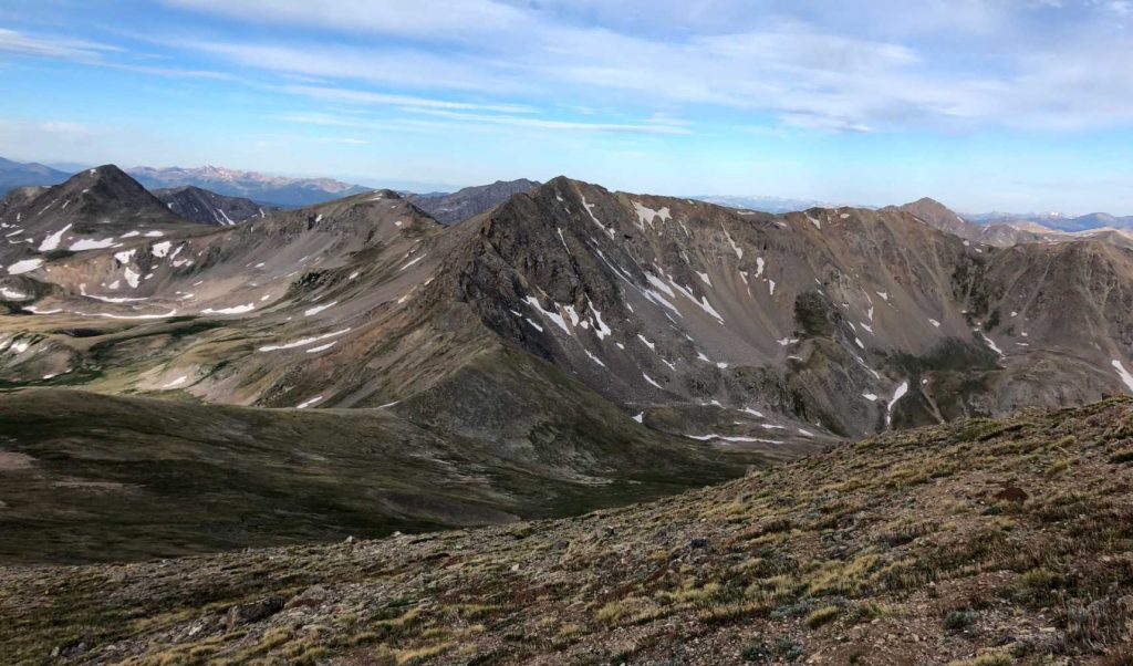
Missouri Mountain & Elkhead Pass From Mount Belford
Views From Mount Belford Trail
Mount Oxford from Mount Belford summit
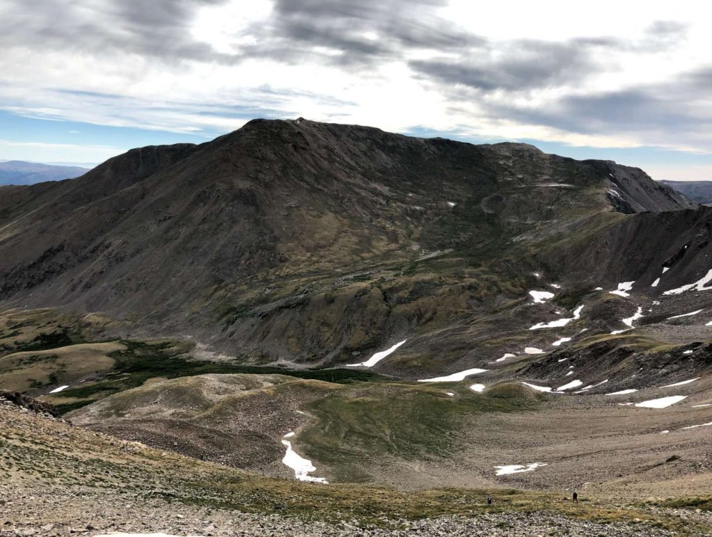
Mount Belford as seen from Missouri Mountain
Mount Oxford summit views
Views heading up Mount Belford, Colorado

Max DesMarais is the founder of hikingandfishing.com. He has a passion for the outdoors and making outdoor education and adventure more accessible. Max is a published author for various outdoor adventure, travel, and marketing websites. He is an experienced hiker, backpacker, fly fisherman, backcountry skier, trail runner, and spends his free time in the outdoors. These adventures allow him to test gear, learn new skills, and experience new places so that he can educate others. Max grew up hiking all around New Hampshire and New England. He became obsessed with the New Hampshire mountains, and the NH 48, where he guided hikes and trail runs in the White Mountains. Since moving out west, Max has continued climbed all of the Colorado 14ers, is always testing gear, learning skills, gaining experience, and building his endurance for outdoor sports. You can read more about his experience here: hikingandfishing/about