Mount Aire is a common hike for locals due to its close proximity and stunning views. Hikers can access trails off of I-80, or from Millcreek Canyon. In this article, we will discuss everything you need to know to hike this mountain from any trailhead.
Distance – 3.24 miles round trip (5.2 km)
Height – 8,602 feet (2621.9 m)
Elevation gain – 1,869 feet (569.7 meters)
Duration – 3-4 hours
Difficulty – Difficult
Hike Class: Class 2 hiking
Trailhead Locations – Elbow Fork Trailhead | Lambs Canyon Trailhead (Directions Below)
Quick Navigation:
Routes | Trail Map | Lodging Info | Weather | Directions | Pictures
Need To Know Information
-
-
- If hiking from Millcreek Canyon, cars will need to purchase either day pass ($5), or a yearly pass ($50) for the canyon. Payment is taken on the way out of the canyon, rather than heading in!
- This peak has two main options for hiking, and we explain both below.
- Dogs are allowed on this hike.
-
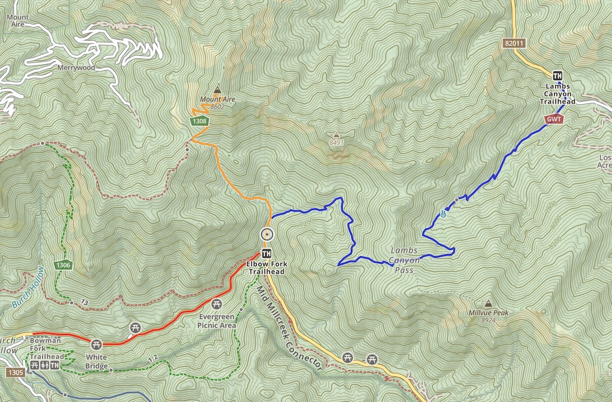
Hiking Route Options
Here is the information associated with the two options for reaching the summit.
Mount Aire Via Elbow Fork Trailhead | 3.24 Miles Round Trip (5.2 km) – 1,869 Feet Elevation Gain (569.7 meters)
This is the most common trailhead to the summit as it is the quickest approach and has the least amount of elevation gain. It is well marked, easy to follow, and accessed from Millcreek Canyon.
We have created a full GPX file and map of this route for you: Elbow Fork Trailhead Map & GPX File
Mount Aire Via Lambs Canyon Trailhead | 9.58 Miles Round Trip (15.4 km) – 4,515 Feet Elevation Gain (1376.2 meters)
This is a longer approach that features elevation gain, then elevation loss, and then a gain once again to summit. It therefore is a lot more difficult than the Millcreek side. For that reason, it isn’t the recommended approach if you are looking for the easiest way to summit. The trail is well marked and easy to follow.
We have created a full GPX file and map of this route for you: Lambs Canyon Trailhead Map & GPX File
Hiking Mount Aire In Winter
There is avalanche danger in winter, so it is important for hikers or skiers to have the proper gear and knowledge before summitting this peak while snow is on the ground.
In addition, the Millcreek Canyon side has a road closure in winter adding to the length. You can see a GPX file we created from the parking lot at the closed gate during winter months: Mount Aire Winter GPX
Trail Map
We have created an online map and GPX file for each of the trail options listed above. You can use those links to view an online map of Mount Aire as well.
Camping Info
There are several campground options in Millcreek canyon.
Current Weather Conditions:
Here is the detailed weather forecast for the next few days. We highly recommend you check out local weather the morning of your hike.
Emigration Canyon, UT
This Afternoon
A chance of thunderstorms and rain and snow showers. Cloudy. High near 46, with temperatures falling to around 37 in the afternoon. West wind around 8 mph. Chance of precipitation is 100%. Little or no snow accumulation expected.
Tonight
A chance of thunderstorms and rain and snow showers. Cloudy, with a low around 35. West wind around 8 mph. Chance of precipitation is 90%.
Saturday
Snow showers likely before noon, then snow showers and a slight chance of thunderstorms. Cloudy. High near 42, with temperatures falling to around 37 in the afternoon. West southwest wind 6 to 12 mph. Chance of precipitation is 100%.
Saturday Night
A slight chance of thunderstorms and rain and snow showers. Mostly cloudy, with a low around 33. West northwest wind 6 to 12 mph. Chance of precipitation is 80%.
Sunday
A chance of snow showers before noon, then a chance of rain showers. Partly sunny, with a high near 47. West northwest wind 6 to 13 mph. Chance of precipitation is 40%.
Sunday Night
Partly cloudy, with a low around 35.
Monday
A chance of showers and thunderstorms after noon. Mostly sunny, with a high near 53. Chance of precipitation is 30%.
Directions & Parking
Directions to Elbow Fork Trailhead:
Directions To Lambs Canyon Trailhead:
Additional Pictures
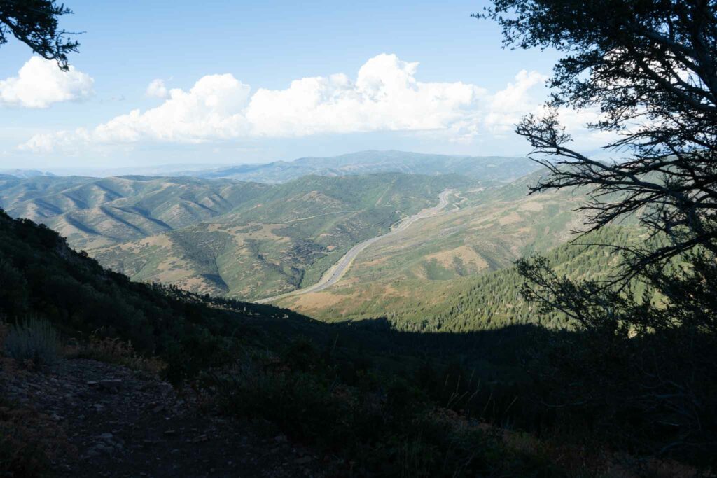
I-80 From near the summit of Mount Aire
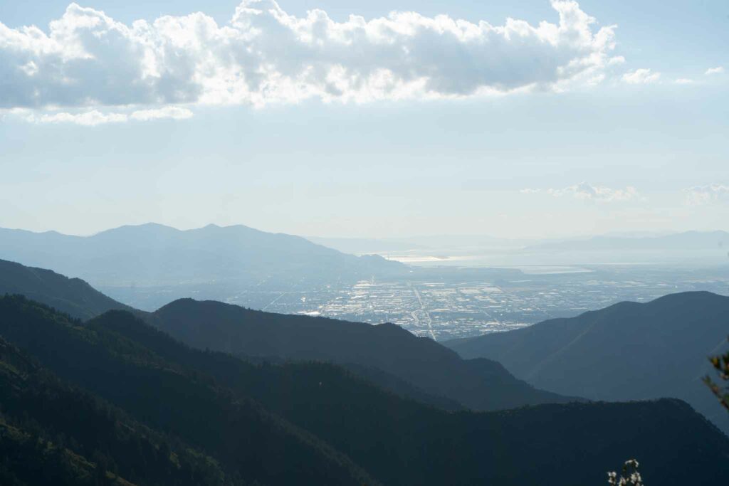
Salt Lake from Mount Aire

Max DesMarais is the founder of hikingandfishing.com. He has a passion for the outdoors and making outdoor education and adventure more accessible. Max is a published author for various outdoor adventure, travel, and marketing websites. He is an experienced hiker, backpacker, fly fisherman, backcountry skier, trail runner, and spends his free time in the outdoors. These adventures allow him to test gear, learn new skills, and experience new places so that he can educate others. Max grew up hiking all around New Hampshire and New England. He became obsessed with the New Hampshire mountains, and the NH 48, where he guided hikes and trail runs in the White Mountains. Since moving out west, Max has continued climbed all of the Colorado 14ers, is always testing gear, learning skills, gaining experience, and building his endurance for outdoor sports. You can read more about his experience here: hikingandfishing/about
Perfect Weather, Only A Couple People
Headed up after work with to quickly summit. We had perfect weather, the summit to ourselves, and only saw a few people. Trail in great shape. We came from Millcreek side!