Mount Harvard is a 14,429 foot peak in the Collegiate Peaks Wilderness of Colorado. This hike features incredible backpacking, stunning views, and a difficult day or overnight track. It is often combined with the neighboring Mount Columbia.
Distance – 12.8 miles round trip (20.60 km)
Height – 14,429 feet (4397.96 m)
Elevation gain – 4,471 feet (1362.76 m)
Duration – 8 to 10 hours (book time)
Difficulty – Strenuous
Class: Class 2 Hike
Seasons – This hike can be completed in all seasons, but winter is especially difficult, and dangerous. Only very experienced hikers should attempt this hike in any season.
Trailhead Location – North Cottonwood Trailhead – 9,870 feet (directions below)
Trails
Horn Fork Basin Trail (SW Ridge): 12.8 Miles Round Trip | 4,471 Feet Elevation Gain | Class 2
This is the most common route to the summit and features class 1 and class 2 hiking. The trail begins at the North Cottonwood trail (the same start for Mount Columbia), and begins a gradual climb for the first several miles. Hikers simply follow the well traveled trail. The first junction is .9 miles in and hikers bear right to stay on the Horn Fork Basin Trail.
3 miles in, hikers reach the junction that takes them left to Harvard, or right towards Mount Columbia. Hikers bear left and begin heading into Horn Fork Basin. Treeline is right here, and the basin in stunningly gorgeous with the surrounding mountains, river, and wildflowers.
4.4 miles in hikers reach a trail that heads to Bear Lake. This can be a cool detour if you’d like to be by the lake. Maintain straight on the trail to head towards the summit. From here hikers experience the steepest inclines, scree, and many switchbacks. But views are stunning.
The last final push to the summit features a little scrambling. When ice is present, be extra cautious here.
Mount Harvard & Mount Columbia Combined – 13.6 Miles Round Trip – 6,016 Feet Elevation Gain
Many choose to summit both peaks in a day hike or overnight hike camping in the basin. This turns this trip into a much more difficult one, but super fun and beautiful.
We recommend summiting Harvard, and then heading on to Columbia afterwards. Follow the normal path to Harvard, and then begin the track between the two. Hikers basically stay along the ridge and follow the path marked with some cairns, and worn by hikers. BIG NOTE: This is not a real trail, meaning route finding is necessary. If you have little experience, we recommend doing these peaks seperately.
Do not descend into Horn Fork Basin. Hikers will need to do some own route finding on this depending upon conditions.
Once summiting Columbia, the route down is pretty easy to follow. This is insanely steep terrain, but the trail has been heavily maintained with some of the nicest switchbacks in any trail system, making it very easy to follow.
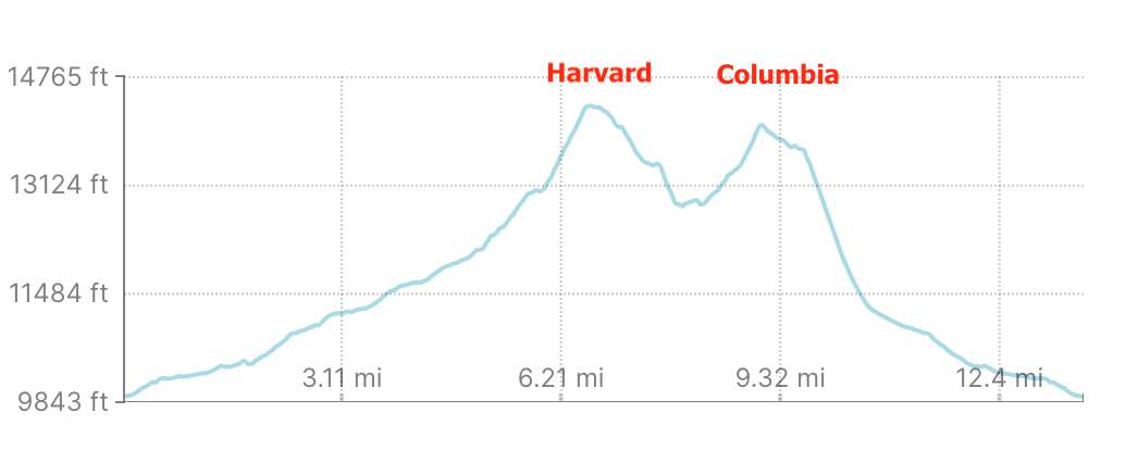
Mount Harvard And Columbia Elevation Profile
Alternate Routes
The other common option for summiting Harvard is via the South Face which diverts from the standard route (above) until about 12,100 feet. This route is only meant for when snow is present to traverse straight up the south side. If you want to see this route better, check out here: https://www.14ers.com/route.php?route=harv3&peak=Mt.+Harvard+and+Mt.+Columbia
Trail Map
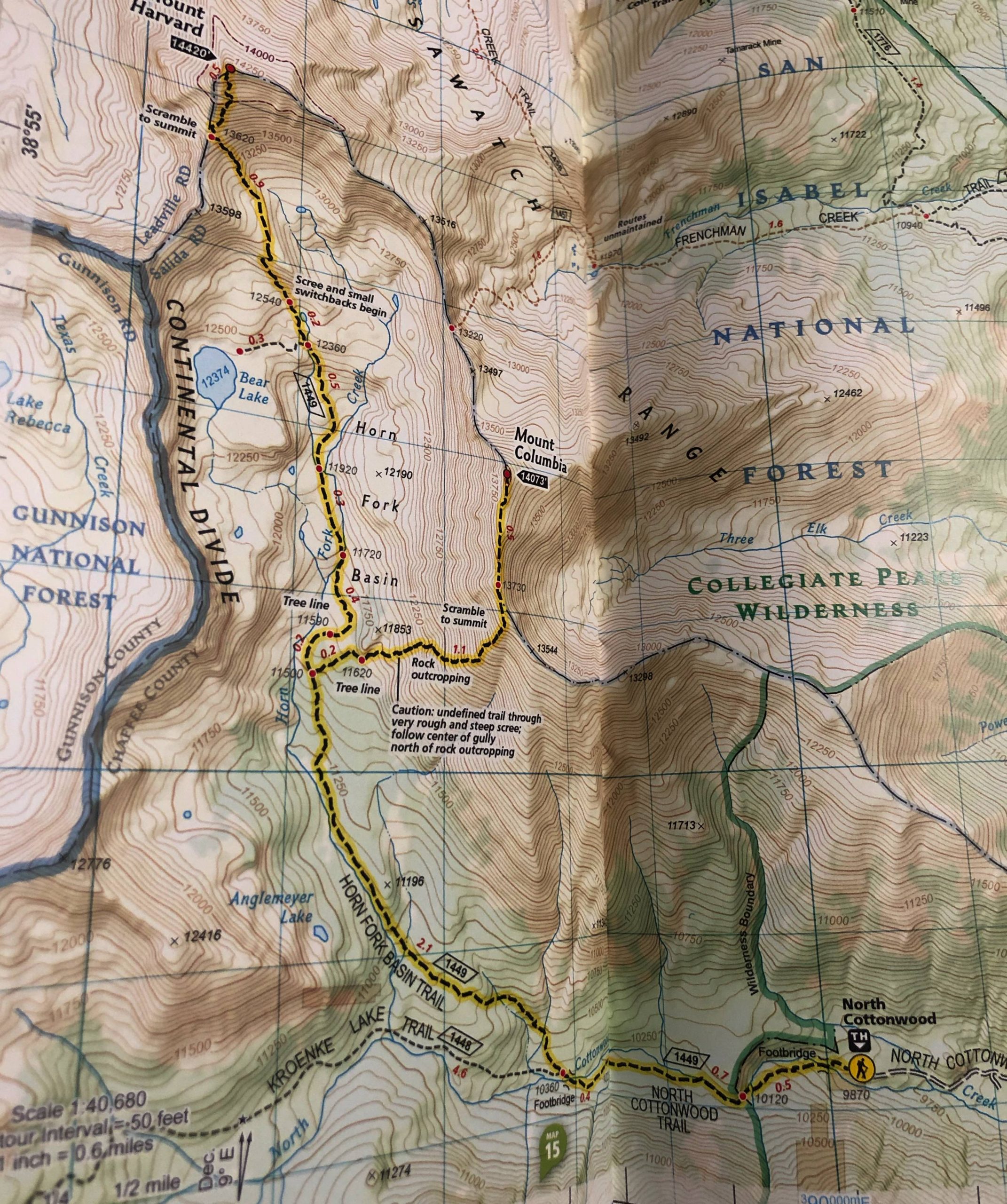
Mount Harvard Trail Map
Hiking Mount Harvard in Winter
As with any 14er, this hike is significantly more dangerous in winter. There is plenty of avalanche danger on this route as well. Be prepared, and don’t take this lightly. The last push to the summit of Mount Harvard can be a bit icy on the rocks as well, making the standard route potentially a little more difficult.
Camping For Mount Harvard & Horn Fork Basin
This hike features various camping options. The trailhead, as well as the road leading to the trailhead features tons of dispersed campsites, though the government site specifically says no camping at the trailhead.
“Dispersed camping is permitted along the road to North Cottonwood. Campers must camp at least 100 feet away from the stream.”
In addition, hikers can camp in Horn Fork Basin if they wish to make this an overnight hike.
Here is the government site on this area to read about self serve free wilderness permits: https://www.fs.usda.gov/recarea/psicc/recreation/recarea/?recid=12684&actid=104
Current Weather Conditions:
Here is the detailed weather forecast for the next few days. We highly recommend you check out the mountain forecast for this peak the morning of your hike.
Buena Vista, CO
Tonight
A slight chance of snow showers before midnight. Mostly cloudy, with a low around 21. West northwest wind 15 to 20 mph, with gusts as high as 40 mph. Chance of precipitation is 20%. New snow accumulation of around one inch possible.
Friday
Snow showers likely and a slight chance of thunderstorms after noon. Partly sunny, with a high near 35. West wind 15 to 25 mph, with gusts as high as 40 mph. Chance of precipitation is 60%. New snow accumulation of 1 to 2 inches possible.
Friday Night
Snow showers likely and a chance of thunderstorms. Mostly cloudy, with a low around 19. Southwest wind 10 to 15 mph. Chance of precipitation is 70%. New snow accumulation of 1 to 3 inches possible.
Saturday
Snow showers and a chance of thunderstorms. Cloudy, with a high near 25. South southwest wind 10 to 15 mph. Chance of precipitation is 90%. New snow accumulation of 6 to 10 inches possible.
Saturday Night
Snow showers and a chance of thunderstorms. Mostly cloudy, with a low around 16. West northwest wind around 15 mph. Chance of precipitation is 80%. New snow accumulation of 2 to 4 inches possible.
Sunday
A chance of snow showers before noon, then snow showers likely and a chance of thunderstorms. Mostly cloudy, with a high near 29. West northwest wind 15 to 20 mph. Chance of precipitation is 70%. New snow accumulation of less than half an inch possible.
Sunday Night
A slight chance of snow showers before midnight. Mostly cloudy, with a low around 16. West wind around 15 mph. Chance of precipitation is 20%.
Directions & Parking
This road is accessible for all vehicles.
Directions to North Cottonwood Trailhead:
Additional Pictures
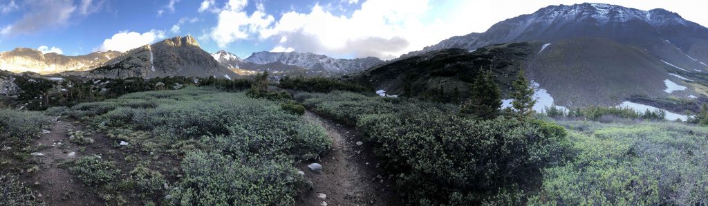
Horn Fork Basin Views
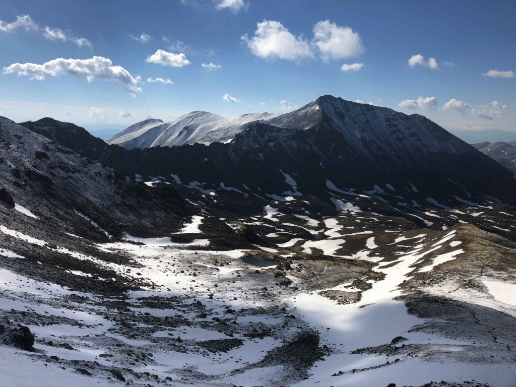
Views Of Mount Columbia
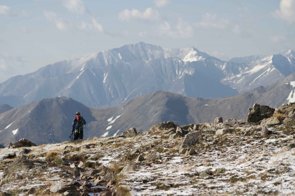
Views Heading Up Mount Harvard
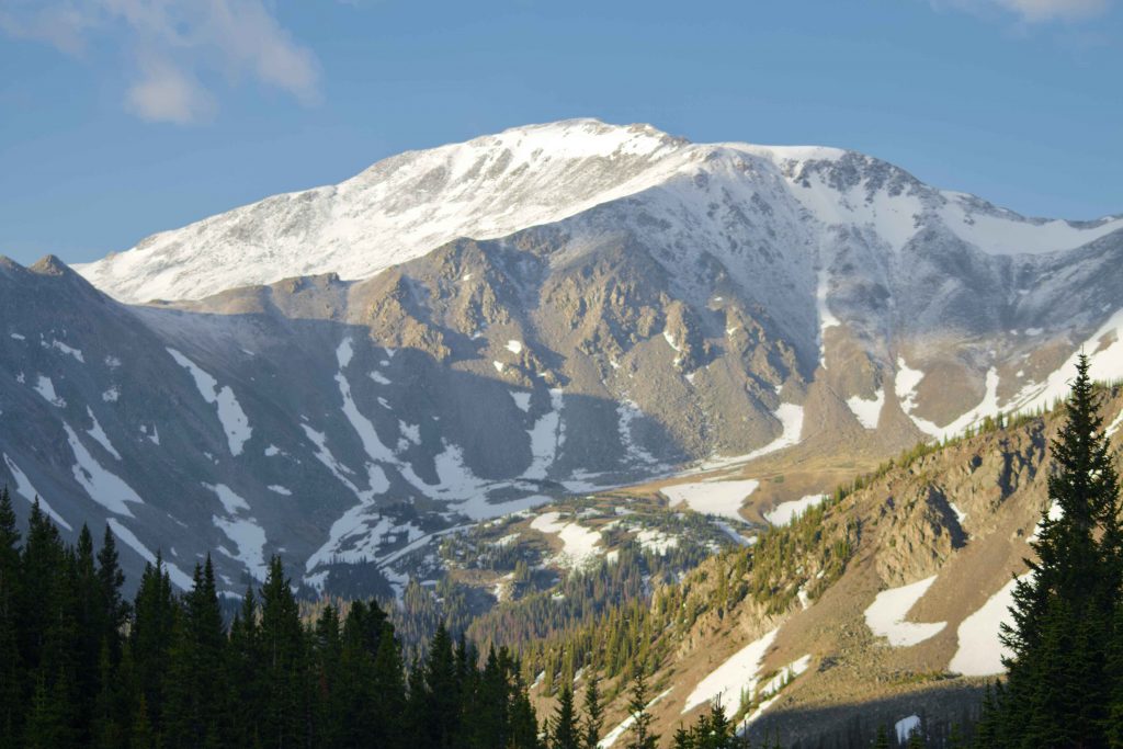
Views From Horn Fork Basin
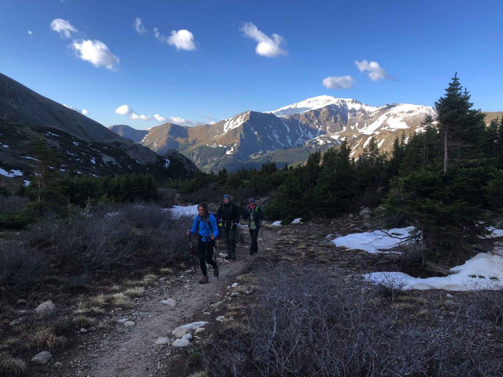
Horn Fork Basin Trail

Max DesMarais is the founder of hikingandfishing.com. He has a passion for the outdoors and making outdoor education and adventure more accessible. Max is a published author for various outdoor adventure, travel, and marketing websites. He is an experienced hiker, backpacker, fly fisherman, backcountry skier, trail runner, and spends his free time in the outdoors. These adventures allow him to test gear, learn new skills, and experience new places so that he can educate others. Max grew up hiking all around New Hampshire and New England. He became obsessed with the New Hampshire mountains, and the NH 48, where he guided hikes and trail runs in the White Mountains. Since moving out west, Max has continued climbed all of the Colorado 14ers, is always testing gear, learning skills, gaining experience, and building his endurance for outdoor sports. You can read more about his experience here: hikingandfishing/about