Mount Abraham is a 4,017′ mountain located in the Green Mountains of Vermont. It is the 5th tallest peak in the state. Mount Abe features pretty stunning views of the surrounding lakes and mountains.
Elevation: 4,017 feet
Elevation gain: 1,735 feet
Distance: 5.1 miles roundtrip
Duration (book time): 4 hours
Difficulty: Moderate
Trails
The Long Trail – 5.1 miles round trip – 1,735 feet elevation gain
Begin your hike at the Lincoln Gap parking lot. Following along the Long Trail for roughly 1.7 miles until you reach a junction with the Battell Trail to your left. Here, continue to follow the Long Trail for another 1.1 miles until you reach the summit of Mount Abraham. To descend, simply retrace your steps the way you came until you reach the trailhead parking lot where you began.
Trail Map

“Peak bagging” options
Many hikers will choose to “peak bag” when tackling Mount Abraham by adding Mount Ellen to their route, making the route 10.8 miles total with 3,290′ of elevation gain.

Camping And Overnight Hiking Options
Camping is available at the Battell Shelter during the summer when there is a caretaker on site. Fees may apply.
Hiking in Winter
*NOTE* Lincoln Gap road is closed during the winter months. If you plan on hiking the Long Trail from Lincoln Gap, be prepared to add a significant amount of mileage roundtrip to your overall hike. Snowshoes, traction, and winter equipment will be necessary. Be sure to do your research and check up on the weather forecast before you go.
Parking
Directions
Via the Long Trail from the East:
From Route 100 in Warren, Vermont, take Lincoln Gap Road. Follow the road for 5 miles to the height of land. There will be a parking lot on both sides of the road.
Via the Long Trail from the West:
From Lincoln, follow long Lincoln Gap Road east to the height of land. The trailhead will be on your left hand side, and a parking lot on both sides of the road.
To Battell Trailhead:
To Lincoln Gap Trailhead:
To Jerusalem Trail Trailhead (For Mount Ellen Peakbagging Route):
Weather Forecast
Below is the next four days of weather for Mount Abraham. Be sure to check conditions the morning of your hike as conditions change rapidly in the mountians.
Bristol, VT
Additional Photos
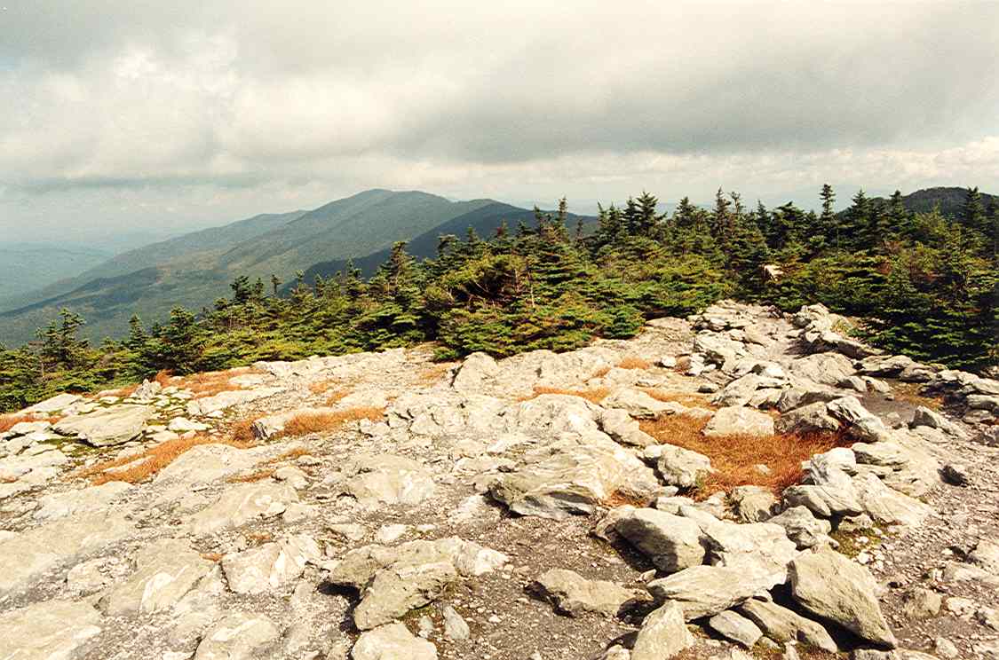
Photo credit – Wikipedia / Views from the summit of Mt. Ellen

Photo credit – Wikipedia / Views from the summit of Mt. Abraham

Andrea is a writer, hiker, and adventurer from New England. She enjoys snowboarding, sunrise hikes, winter, night hiking, traveling, and photography.