Mount Adams is the second highest peak in NH at 5,774 feet. Located in the Presidential Range Between Mount Madison and Mount Jefferson, it has incredible views. It is often hiked as part of the presidential traverse, with Mount Madison, or hiked by itself.
Elevation: 5,774 Feet
Rating: Difficult
Distance: 9.4 miles
Hike Time: 4-7 Hours
Mountain Range: Presidential
Elevation Gain: 4,445 Feet
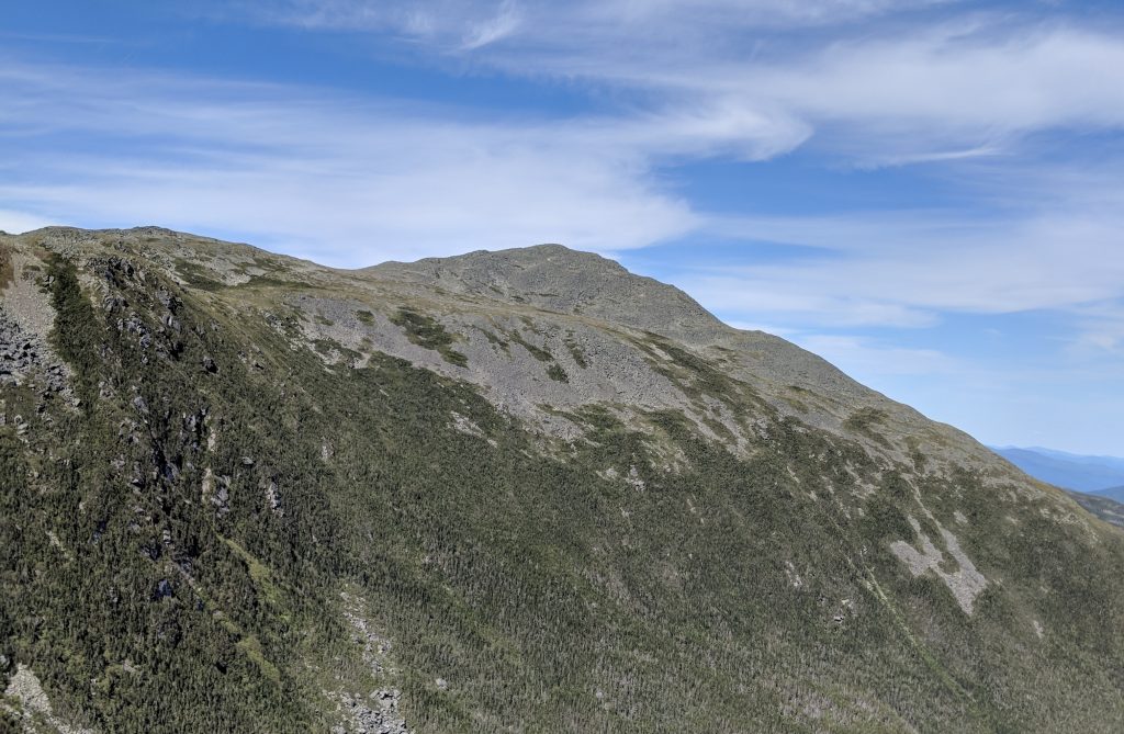
Photo by @laxfreak548
Trail Map
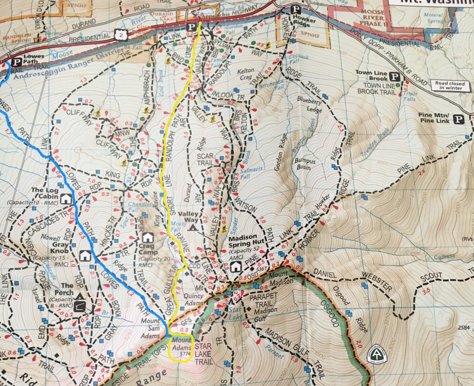
Trails
There are many options to hike up Mount Adams. The below listed are the quickest way to solo hike Mount Adams, however there are other options from the east and south that are great trails for combining other presidential peaks.
Short Line Trail (Yellow)
This trail is 4.8 miles to the summit and begins at the Appalachia Parking Lot.
Air Line Trail
The air line trail parallels the Short Line Trail, and is accessible from the same starting location. This trail is very similar to the short line trail. Mileage: 4.3 miles to summit.
Lowe’s Path (Blue)
This is a 4.7 mile trail to the summit located at the Lowes Path Trailhead (click for directions)
Valley Way Trail
This trail also begins at the Appalachia Parking lot. It is 4.6 miles to the summit of Mount Adams.
Pine Link Trail
This option begins more to the east than the other options. It features around 3,900 feet of elevation gain. This trail is 4.9 miles to the summit of Adams, and 3.7 miles to the summit of Mount Madison. This is a great option for summiting both peaks. This trail begins on Dolly Copp road which is closed in the winter. Directions to Pine Mountain Trailhead
Directions
Weather Forecast
Gorham, NH
This Afternoon
Sunny, with a high near 24. Wind chill values as low as -1. Northwest wind around 30 mph, with gusts as high as 40 mph.
Tonight
Clear, with a low around 12. Wind chill values as low as -5. Northwest wind 20 to 30 mph.
Friday
Sunny, with a high near 37. Wind chill values as low as -3. Northwest wind 15 to 20 mph, with gusts as high as 30 mph.
Friday Night
Mostly clear, with a low around 20. Northwest wind 10 to 15 mph, with gusts as high as 25 mph.
Saturday
Mostly sunny, with a high near 45. Southwest wind 10 to 15 mph, with gusts as high as 25 mph.
Saturday Night
A chance of snow showers between 8pm and 9pm, then rain showers likely. Mostly cloudy, with a low around 31. Chance of precipitation is 60%.
Sunday
Rain showers likely. Mostly cloudy, with a high near 48. Chance of precipitation is 60%.
Pictures
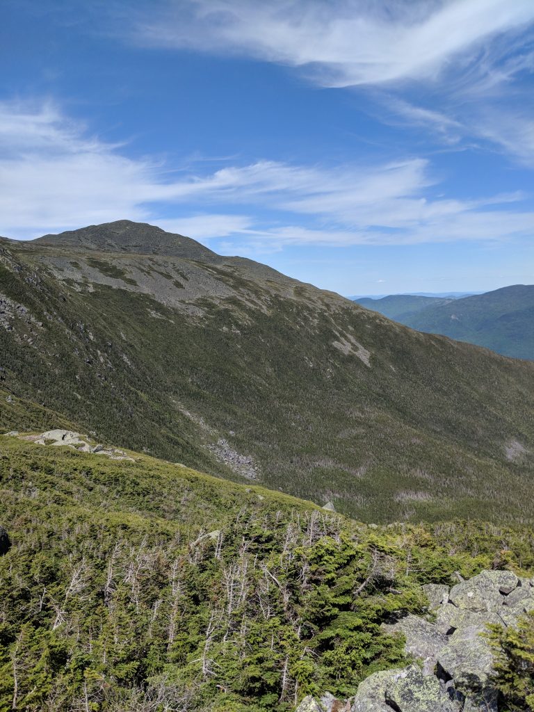
Photo by @laxfreak548
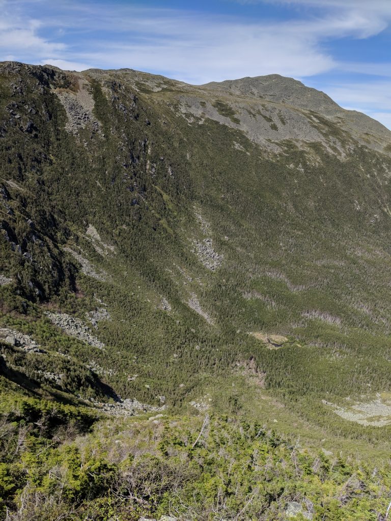
Photo by @laxfreak548

Max DesMarais is the founder of hikingandfishing.com. He has a passion for the outdoors and making outdoor education and adventure more accessible. Max is a published author for various outdoor adventure, travel, and marketing websites. He is an experienced hiker, backpacker, fly fisherman, backcountry skier, trail runner, and spends his free time in the outdoors. These adventures allow him to test gear, learn new skills, and experience new places so that he can educate others. Max grew up hiking all around New Hampshire and New England. He became obsessed with the New Hampshire mountains, and the NH 48, where he guided hikes and trail runs in the White Mountains. Since moving out west, Max has continued climbed all of the Colorado 14ers, is always testing gear, learning skills, gaining experience, and building his endurance for outdoor sports. You can read more about his experience here: hikingandfishing/about