The Pfeifferhorn, formerly known as Little Matterhorn might just be one of the most stunning peaks in all of the Wasatch Mountains. The 360 degree views feature massive peaks, alpine lakes, giant cliffs, and even the Salt Lake valley below. This is a difficult, but non technical hike that is a must do for anyone in the area.
Distance – 9.9 miles round trip (15.9 km)
Height – 11,362 feet (3463.1 m)
Elevation gain – 3,933 feet (1198.8 meters)
Duration – 6-8 hours
Difficulty – Difficult
Hike Class: Class 3 hiking (Mostly class two, but a short class 3 section)
Trailhead Locations – White Pine Lake Trailhead (Directions Below)
Quick Navigation:
Routes | Trail Map | Lodging Info | Weather | Directions | Pictures
Need To Know Information
- Dogs are not allowed on this hike.
- Best hiking season: Late June (after the snow melts) through first snowfalls, usually early to mid October.
- Swimming is not allowed in any of the lakes in this area.
- This is a popular hike, and you will encounter people. Parking fills up quite fast.
- There is overflow parking on the road (explained below).
- Camping is common, and there are no fees or permits required. Camping information and regulations below.
- This summit is high and exposed to the elements, if poor weather is coming in, avoid the summit.
The Pfeifferhorn Via White Pine Lake Trailhead
For this peak, there really is only one hiking route that is commonly taken, and that starts at the White Pine Lake Trailhead.
Round Trip Stats
9.9 miles round trip (15.9 km) – 3,933 feet (1198.8 meters)
Hikers begin on a well marked and well traveled trail just behind the bathrooms at the trailhead. Hikers descend a few feet before crossing Little Cottonwood Creek via a bridge. Hikers follow a very wide trail (more of a road) that gradually inclines for the first mile. At mile 1, there is a junction towards White Pine Lake, or towards Red Pine Lake. Hikers take the route to Red Pine Lake here where they will quickly cross a stream via another bridge.
This trail continues at a gradual incline. At 2.66 miles in, there is another junction where hikers simply stay straight rather than heading towards Maybird Lake. Hikers will be hiking along the Red Pine Fork stream.
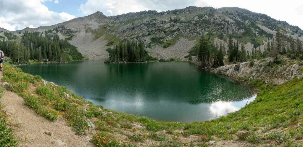
Just about 3.5 miles in, hikers will reach Red Pine Lake where they can walk fully around it. The quickest way upwards is to stay to left of the lake while heading up (east).
Looking at a false summit from Red Pine Lake
After passing the lake, the hike starts to get a bit steeper, and more difficult terrain to walk along. The main trail misses Upper Red Pine Lake, but this can be a great stop on the way back down.
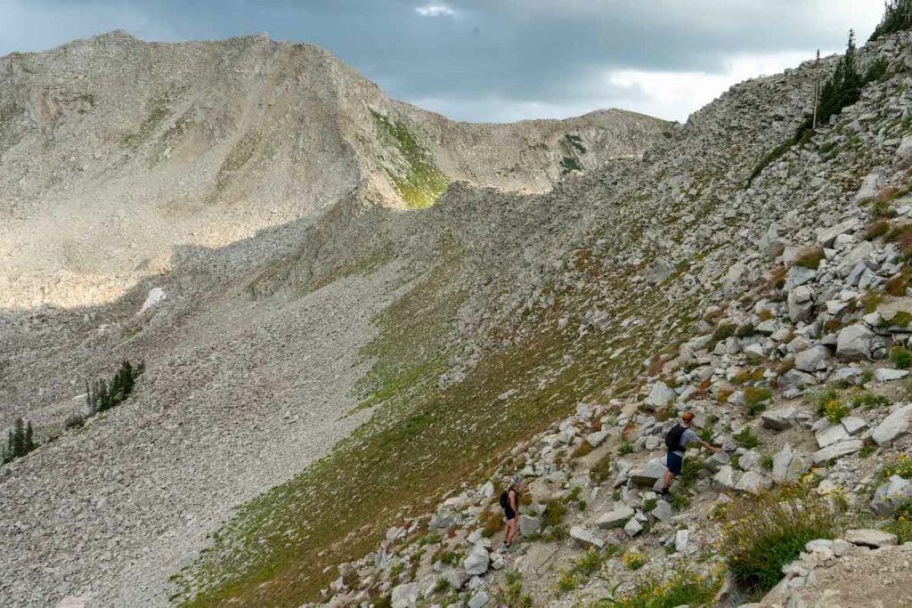
The trail heading up towards the ridge above Red Pine lake
The trail isn’t well maintained heading up to the saddle before the summit, so you’ll likely find various routes that are well traveled. We recommend staying as close the GPX track and map we provide within this article.
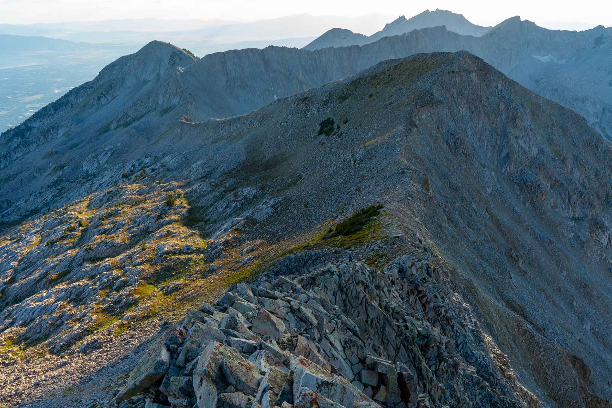
Once reaching the ridge, hikers continue upwards via the obvious path. Shortly before the final steepest portion to the summit, the ridge narrows, and features the “crux” of the hike where there is a short period of rock scrambling, in what we would consider class 3 hiking. Once passing this, the trail is easy to follow, but is steep and has a fair amount of loose dirt to the summit. Hikers head back down the same way they came up.
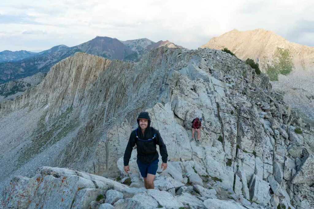
Pfeifferhorn class 3 hiking section
Hiking Pfeifferhorn In Winter
There is avalanche danger in winter, so it is important for hikers or skiers to have the proper gear and knowledge before attempting this peak. In winter, this peak should only be attempted by those with substantial winter experience and knowledge.
Trail Map
We have created an online map: Download The Route Here
Camping Info
This is a common camping area. Due to the wilderness area and watershed regulations, no campfires or dogs are allowed. Any campers must camp at least 200 feet away from trails, lakes, or streams. Campers will find established sites all around both lakes pretty easily.
There are also several campground options in Little Cottonwood Canyon.
Fishing Red Pine Lake
Upper Red Pine Lake has a healthy population of trout. Anglers tend to have better luck at the upper lake, and the main lake, Red Pine Lake, tends to not fish as well. This is a catch and release fishery. Fish will take dry flies on most summer days, but using a dry dropper rig is highly recommended.
Current Weather Conditions:
Here is the detailed weather forecast for the next few days. We highly recommend you check out local weather the morning of your hike.
Granite, UT
Today
Snow showers before noon, then snow showers and a slight chance of thunderstorms. Cloudy. High near 31, with temperatures falling to around 29 in the afternoon. Northwest wind 6 to 10 mph. Chance of precipitation is 100%. New snow accumulation of 4 to 8 inches possible.
Tonight
A chance of snow showers and a slight chance of thunderstorms. Mostly cloudy. Low around 21, with temperatures rising to around 23 overnight. North northwest wind 6 to 9 mph. Chance of precipitation is 50%. New snow accumulation of 1 to 3 inches possible.
Sunday
A chance of snow showers. Partly sunny, with a high near 34. Northwest wind 6 to 10 mph. Chance of precipitation is 40%. New snow accumulation of less than half an inch possible.
Sunday Night
Partly cloudy, with a low around 23. Southwest wind 6 to 10 mph.
Monday
A chance of snow showers and a slight chance of thunderstorms after noon. Mostly sunny, with a high near 42. South southwest wind 13 to 28 mph. Chance of precipitation is 30%.
Monday Night
A chance of snow showers. Partly cloudy, with a low around 18. Chance of precipitation is 40%. New snow accumulation of less than half an inch possible.
Tuesday
Sunny, with a high near 38.
Directions & Parking
The White Pine Trailhead is a medium sized parking lot, but parking is located along the road as long as cars stay off the road, and not over the white lines. This is a very popular destination, so parking is often limited on weekends, holidays, or nice weather days. You’ll frequently see cars lining the road as this trailhead is a popular spot for several hiking destinations.
Additional Pictures
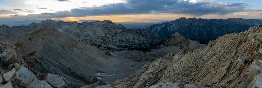
Pfeifferhorn panoramic summit views
Summit views
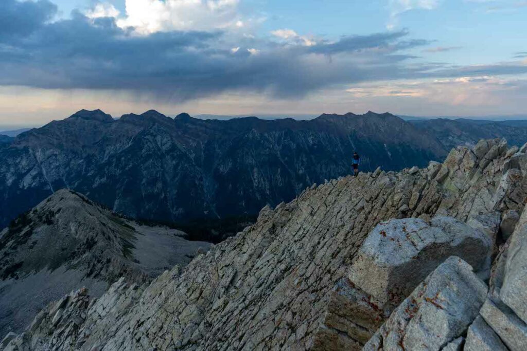
Pfeifferhorn summit at sunset
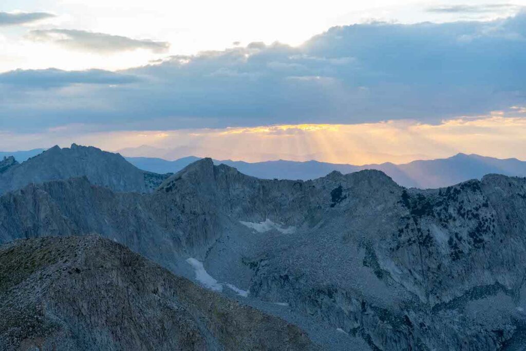
Views of Box Elder Peak and Mount Timpanogos in the far back
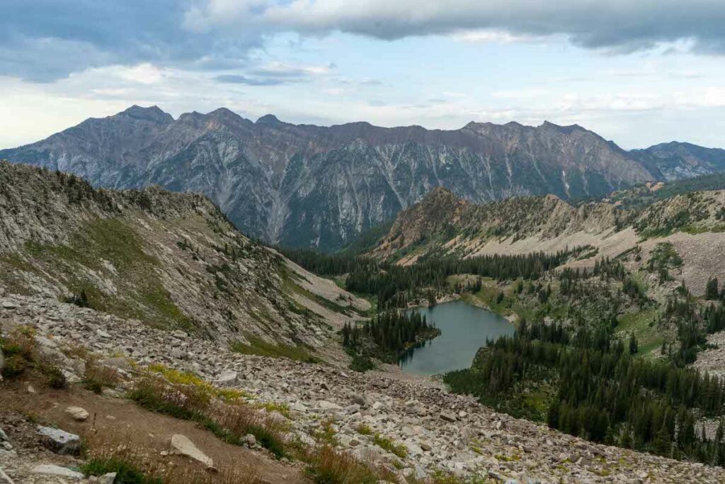
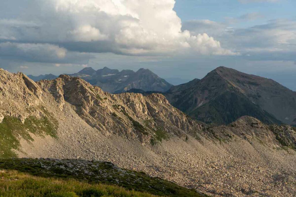
View of Red Pine Lake from the ridge towards Pfeifferhorn

Max DesMarais is the founder of hikingandfishing.com. He has a passion for the outdoors and making outdoor education and adventure more accessible. Max is a published author for various outdoor adventure, travel, and marketing websites. He is an experienced hiker, backpacker, fly fisherman, backcountry skier, trail runner, and spends his free time in the outdoors. These adventures allow him to test gear, learn new skills, and experience new places so that he can educate others. Max grew up hiking all around New Hampshire and New England. He became obsessed with the New Hampshire mountains, and the NH 48, where he guided hikes and trail runs in the White Mountains. Since moving out west, Max has continued climbed all of the Colorado 14ers, is always testing gear, learning skills, gaining experience, and building his endurance for outdoor sports. You can read more about his experience here: hikingandfishing/about
Incredible Views With No One Else Around
Perfect weather, hit the summit about an hour before sunset during our WURL. Had incredible views, not a single other person in sight. On of the best viewpoints in all of Utah.
Some Of The Best Views In The Wasatch
One of the best sunsets of my life. We did an after work hike up and run downhill to stache some food for our WURL attempt next week. Trail is in good condition. Lots of route options up after Red Pine Lake.