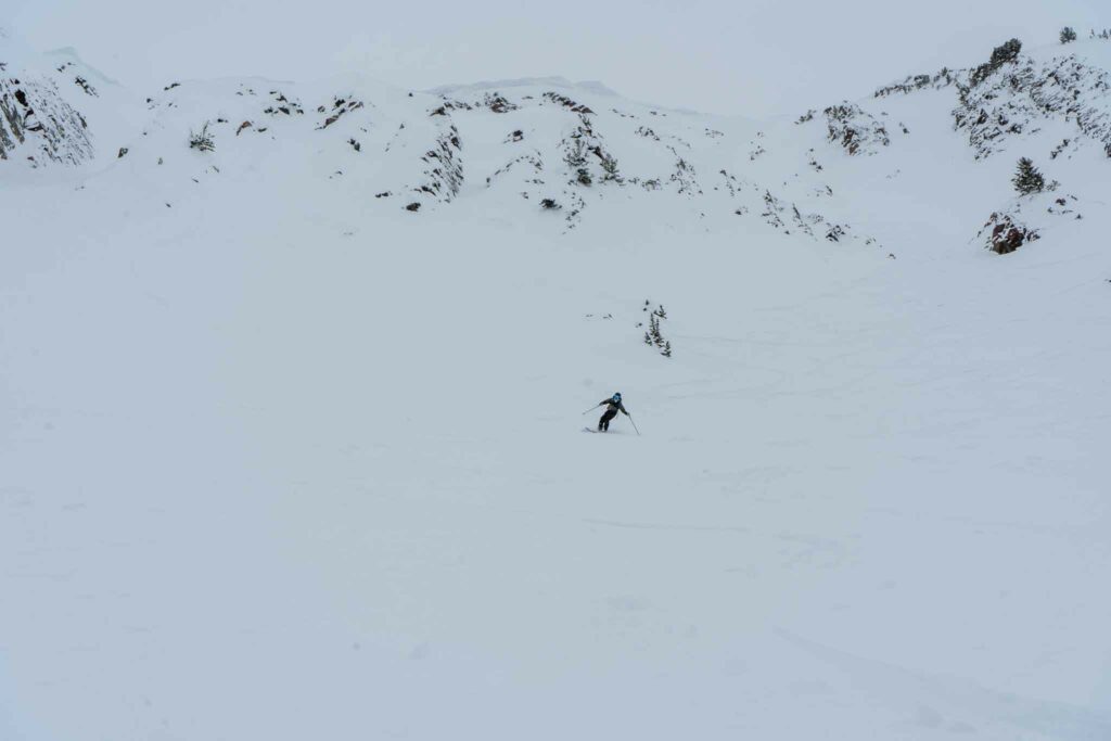
The striking south face of Mount Superior is in clear site of resort skiers, tempting them away from the bustling scene across the street at Snowbird. It is a 3,000 foot, southeast facing line that ranges between 30 and 40 degrees. This makes for incredibly skiing, outrageous views, but an adventure that should never be taken lightly. Avalanche knowledge and quality skiing abilities are essential to maximizing, but not guaranteeing, your safety.
In this article, will give you everything you need and want to know about this line!
Distance – 4.4 miles round trip (7.1 km)
Height – 11,037 feet (3364 m)
Elevation gain – 2,910 feet (887 meters)
Duration – 3.5 – 4 hours
Difficulty – Difficult to Extreme
Trailhead Locations – Cardiff Trail
Dogs: Not Allowed
Logistics
Generally, those looking to ski superior take one of the following approaches:
- They have a hotel or home to stay at in Alta
- They drive their car up the canyon (with an Alta parking reservation when required), and park as close to the trailhead as possible
- They take the bus system up to Alta, and back down (free with Ikon pass, small fee without a ski pass)
With each of these options, most will either hike back to the car, hotel, or bus stop along the rode, or hitch a couple minute ride back up the canyon from the line finish.
The easiest approach is to secure a parking reservation, and parking as close to the trailhead as possible.
Parking reservations are required for Friday, Saturday, Sunday, any holidays, and parking on weekdays before 8 am.Information on securing an Alta Parking Reservation can be found here. Reservations aren’t required any day after 1pm – but often, conditions require an earlier start.
Information on the bus system can be found here.
When Is The Best Time To Ski Mount Superior?
Generally, superior is skied between January and May each year. February – April will have the deepest snowpack, and the spring season sees the snowpack quickly diminish. All of these months can be great months to ski Superior as long as the avalanche and weather conditions align. On nearly any day where conditions align, you’ll find tracks down Superior.
Because this is a south facing line, as the season progresses,
Trail Map
Below is a FatMap route for the classic up track and ski track of Superior. You can download this GPX track for your device or chosen software for free.
Avalanche Information
Slope Angle: 30-40 degrees (the entire run is in avalanche terrain)
Approach Aspect: South and southeast facing
Skiing Aspect: South and southeast (some options can have an east facing aspect)
Elevation Rage: 8400 – 11,024
This entire route is not to be taken lightly. Conditions must align before attempting this line, and avalanches are extremely common on this line. This is a south facing line that extends about 3,000 feet of elevation difference. That means that the sun heats it up very quickly. This zone is prone to wind effect, wind loading, sun effect, and more. Therefore, anyone attempting this line, needs to have a deep understanding of the current conditions, and avalanche training and knowledge.
Directions
Directions to the Alta-Brighton trailhead, a common place for many to park with a reservation.
Route Description
Skiers start by finding Our Lady Of The Snow center and head up Michigan City road. There is almost always a skin track to follow, but if not, the route is relatively simple in that the skin track follows the telephone poles all the ways to the pass.
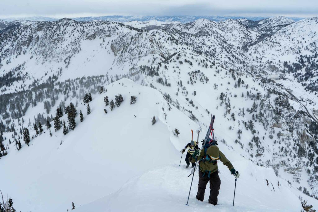
Once arriving at the pass, continue to skin along the ridge over Cardiff Peak, continuing on the ridge to Little Superior, and continuing along the ridge to Superior.

Looking at Superior from Cardiff Peak
An existing skin track and bootpack will likely be there, but if not, the route is generally as simple as following the ridge. It is worth noting that there are parts of this ridge that get very steep and thin, creating a “knife edge” style ridge at various points.

Skiing off the summit is also relatively straightforward. There are various lines that can be taken off of the true summit. Additional lines may appear when snow is higher, and when lower, some of the main route can get quite narrow, particularly in the lower cliff band of the line.

A group just short of the summit.
Once getting below the lower cliff band, the route is very straightforward in an open snowfield back to the road.
Alternative Route
The route above is the most common route. Some will climb Superior directly up the south ridge in spring conditions. The is generally, not the recommended approach. Others may also ski into the north side of Superior, or start in Mill D South Fork, gain the ridge, and then traverse to Superior.
Weather Forecast
Here is a detailed weather forecast for the next 4 days:
Alta, UT
This Afternoon
Scattered snow showers and isolated thunderstorms. Partly sunny, with a high near 42. West southwest wind around 30 mph. Chance of precipitation is 40%. New snow accumulation of less than half an inch possible.
Tonight
A chance of snow showers and scattered thunderstorms before 3am. Mostly cloudy. Low around 20, with temperatures rising to around 23 overnight. West wind 13 to 21 mph, with gusts as high as 31 mph. Chance of precipitation is 70%. New snow accumulation of 1 to 2 inches possible.
Tuesday
Sunny, with a high near 37. Wind chill values as low as 10. West wind 10 to 20 mph.
Tuesday Night
Partly cloudy, with a low around 24. West wind 10 to 20 mph.
Wednesday
A slight chance of snow showers. Mostly sunny, with a high near 29. West northwest wind 13 to 26 mph. Chance of precipitation is 20%.
Wednesday Night
Partly cloudy, with a low around 18.
Thursday
A slight chance of snow showers. Mostly sunny, with a high near 34. Chance of precipitation is 20%.
Other Important Information
Skinning & Booting
You’ll be able to skin to the ridge, and a large portion of the ridge to the summit. The ridge requires some downhill skinning after Cardiff Peak that can be a little scary, so be prepared for that!
Once hiking along the ridge towards Little Superior, conditions may require the transition to booting pretty frequently. During good conditions, you can skin quite far before booting the final push to the summit. You’ll always have a need for strapping the skis or the board to the bag during any conditions however, so be prepared for that.
Will you need an ice axe and/or crampons?
This just depends. During certain conditions, you likely will wish you had them! When conditions align well, you’ll be able to boot the last portion to the summit without any crampons or ice axe needs. That being said, a wind swept ridge, or the ridge during low snow can result in conditions where having those tools are very warranted. The answer here is that it depends. Use recent beta to determine what you need, and if in any doubt, bring crampons and an ice axe.
Naming
The naming of the peaks can be very confusing as the USGS doesn’t have a name for the ski line we are discussing here today. In fact, the USGS labels Superior what everyone else calls Monte Cristo. So here is a quick image for help:

Additional Photos


Max DesMarais is the founder of hikingandfishing.com. He has a passion for the outdoors and making outdoor education and adventure more accessible. Max is a published author for various outdoor adventure, travel, and marketing websites. He is an experienced hiker, backpacker, fly fisherman, backcountry skier, trail runner, and spends his free time in the outdoors. These adventures allow him to test gear, learn new skills, and experience new places so that he can educate others. Max grew up hiking all around New Hampshire and New England. He became obsessed with the New Hampshire mountains, and the NH 48, where he guided hikes and trail runs in the White Mountains. Since moving out west, Max has continued climbed all of the Colorado 14ers, is always testing gear, learning skills, gaining experience, and building his endurance for outdoor sports. You can read more about his experience here: hikingandfishing/about