The Teton Crest Trail is one of the most beautiful backpacking trails in the United States. Located in Teton National Park, Wyoming, this hike features incredible views, fantastic campsites, and tons of wildlife. Backpacking this trail takes a bit of planning, acquiring permits, proper gear, and backpacking experience. Here, we are going to give you everything you need to complete this yourself.
Quick Navigation Links:
Hike Stats | Need To Know | Trail Map | Permits | Itineraries | How To Plan | Directions
Distance: 35-45 miles round trip (56-72 km) – Different routes change distance
Elevation Gain: 10,889 Feet (3318.97 meters) – Option to shorten by 2,500 feet
Elevation Loss: 11,313 Feet (3,448.2 meters)
Duration: 3-5 Days: This can be shortened or lengthened depending upon wants and fitness levels
Difficulty: Strenuous
Highest Elevation: 10,695 Feet
Lowest Elevation: 6,880 Feet
Average Elevation: 8,000 Feet
Permits: Required
Need To Know Information
- In order to backpack this trail, you need to obtain backcountry permits. You can read about the permit system below.
- There are multiple trailhead options – we will discuss these options below to help you choose.
- Bears & Food Storage – If camping below 10,000 feet, hikers are required to carry an approved bear canister to store all food, garbage, toiletries, or anything with odor. It is also required for a member of your party to be carrying bear spray. There is a large population of grizzly and black bear on the trail, so be sure to follow best practices for camping in bear country.
- Bugs during a wet season can be quite bad. They start to die off in the September time frame. Be prepared with bug protection.
- July – September are the most common times to hike this trail as these are the best conditions. Outside of this timeframe, ice and snow are often present, and snowshoes, microspikes, and an ice axe may be necessary.
- You need to bring water filtration for this backpacking trip. There is a fair amount of lakes and water access, but there are sections where water can be far apart, especially in a dry season. Bring a gravity or pump filter.
- You need to bring all of the right gear. Check out our backpacking checklist.
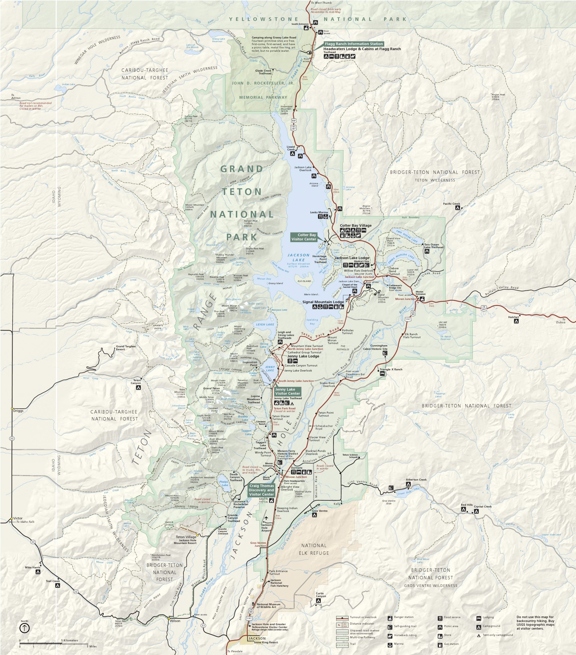
Teton Crest Trail Maps
Below, we have attached a GPX map we made on Gaia. We also have a trail map, and have linked to our recommend map to buy on Amazon for this trip.
Trail Map for Teton Crest Trail – Click to See Full Screen
Here is a great map to carry with you on the trail: See On Amazon
Click Here For The Teton Crest Trail Camping Zones & Backpacking
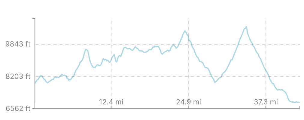
Teton Crest Trail Elevation Profile Map
Permits
A permit is required for all backcountry camping within Teton National Park. The most robust resource for information on permits, what permits are available currently, and where you book your permits is here: https://www.recreation.gov/permits/249986
Need To Know Information About Teton Crest Trail Permits:
- You can only purchase tickets in advance between early January and May 15th each year. You can only reserve sites between: May 1, 2021 – October 31, 2021
- When getting a permit, you choose camping zones and dates for each of those camping zones. Here is a map of the camping zones.
- One permit is good for between 1-6 people, you simply have to identify the number in your party. Groups of 7-12 will have to pay an additional $45 processing fee.
- If getting a permit in person, you can only acquire a permit no more than 1 day before your permit begins.
- Between May 16, 2021 – December 31, 2021, permits can only be acquired in person.
- 2/3 of all available sites can be purchased in advance. Therefore they fill up fast, and 1/3 are available on a first come first serve basis by showing up on site up to 1 day before the trip.
- A $45 non-refundable fee is required for each permit reserved.
- A $35 non-refundable fee is required for each walk-up permit obtained.
- Once a reservation has been made no changes can be made by the customer. You’ll have to call in if you booked in advance.
- Contact the Grand Teton National Park Permits Office at (307) 739-3309 for assistance. (We highly recommend calling the office to go over your plans if you have any questions)
- You must pick up your permit at 10:00 a.m. MT the day of your permit or you will be considered a “no show” and your permit will be given away.
- Before you book your permits, you’ll want to know where you plan on camping each night, and backup areas in case those are booked.
Getting a backcountry permit the day before your trip is likely, but you better show up very early to ensure this is the case. If you plan on this route because you couldn’t get permits online, be sure you have a backup hiking/camping plan in case your itinerary isn’t available.
Campsites
Below are the campsites along the trail with links to the government page for each that maps out the campsite and what is included. We recommend checking each out:
Cascade Canyon, North Fork
Cascade Canyon, South Fork
Death Canyon
Garnet Canyon
Granite & Open Canyon
Holly Lake
Lower Paintbrush
Marion Lake
Phelps Lake
Upper Paintbrush
Surprise Lake
How To Plan Your Trip (Hiking Plan, Permits, Gear)
Knowing the above information about the permit process is crucial before you start planning. Now that you understand the difficult and confusing permit processing, you can begin your trip.
Step 1: Determine how long you want to hike this trail. 3 days, 4 days, 5 days? These are the most common approaches. If your group is inexperienced, we recommend at minimum 4 days. 4 days equates to about 10 miles per day. This may seem simple, but don’t forget about the elevation gain of this hike, and the average elevation. This will slow you down. Experienced backpackers often choose a 3-4 day approach.
Step 2: Once you have identified your itinerary for length of hike, you need to determine your route, and recommended camping zones. the Teton Crest Trail has various “camping zones” in which you acquire permits for. You need to pick these zones based on your days, and the permits available. For a 4 day trip, each day should be about 10 miles, for 3 days, it is more like 13 miles per day. You can plan this by taking a look at the maps provided, and the tools provided in this article. We have some planned itinerary examples for you below. View the camping zone map here.
Step 3: Reserve your permits ahead of time. We recommend doing this where possible. If not, you’ll have to show up the day before your hike.
Step 4: Acquire all the necessary backpacking gear and safety equipment for this backpacking trip. Here is a full checklist of of backpacking gear so you can be sure you have everything you need.
Step 5: Make it to the trail and get hiking!
Other Planning Options
You may not want to complete the whole trail, this is very common. If you don’t want to, simply plan our the routes you want to enter on or exit out of. For example, many will hike in the death canyon area, the paintbrush canyon area, or the cascade canyon area. Maybe you want to add other trails onto your trip, this is okay too. Simply plan your routes, and make your choice. Because this area is so beautiful, there really are tons of options.
Recommended Itineraries
We have created some basic 3 day, 4 day, and 5 day itineraries that should work well for most groups. Check these out, and feel free to adapt to fit your specific needs. Do not just assume any of these work for you. Do your research, understand the mileage of each plan here and don’t underestimate the difficulty. Especially if you are new to backpacking. If you want to complete the whole trail, we recommend starting at Phillips Pass Trailhead and ending at the Leigh Lake / String lake Trailhead.
3 Day Plan (2 Nights)
Starting Trailhead: Phillips Pass Trailhead, Granite Canyon Trailhead, Or Tram Trail (Taking the tram requires a fee, cuts off 5 miles and a lot elevation gain) – See tram info here.
Night 1 Camping Zone: Marion Lake or Death Canyon Shelf
Night 2 Camping Zone: South Fork Cascade
4 Day Plan (3 Nights)
Starting Trailhead: Granite Canyon Trailhead, or Phillips Pass Trailhead
Night 1 Camping Zone: Granite Canyon or Marion Lake
Night 2 Camping Zone: Death Canyon Shelf
Night 3 Camping Zone: South Fork Cascade or North Fork Cascade
5 Day Plan (4 Nights)
Starting Trailhead: Granite Canyon Trailhead, or Phillips Pass Trailhead
Night 1 Camping Zone: Granite Canyon or Marion Lake
Night 2 Camping Zone: Death Canyon Shelf
Night 3 Camping Zone: South Fork Cascade or North Fork Cascade
Night 4 Camping Zone: Upper Paintbrush or Lower Paintbrush
Directions
Below, we have GPS pins for the most common starting locations and ending points. You’ll want to park a car at each end. The north end is inside the park, and therefore you’ll likely need a national parks pass to get inside. These places take you directly to the parking lots for your locations. All are free parking in summer months. Parking inside the park requires a national parks pass.
Phillips Pass Trailhead
Granite Canyon Trailhead
Tram Trailhead / Teton Village Trailhead
In the summer, parking is free here. You can read about Teton Village parking here: https://www.jacksonhole.com/summer-by-car.html
Jenny Lake Trailhead
String Lake Trailhead
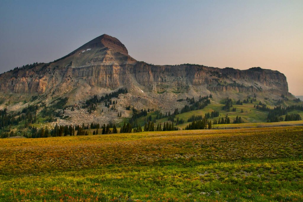
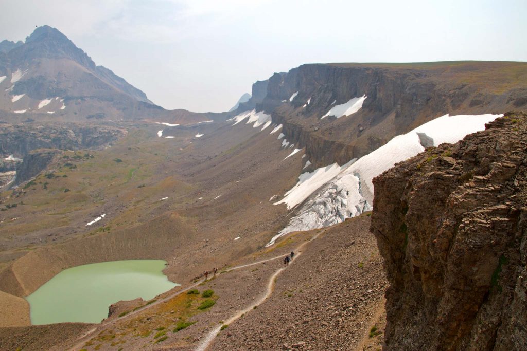
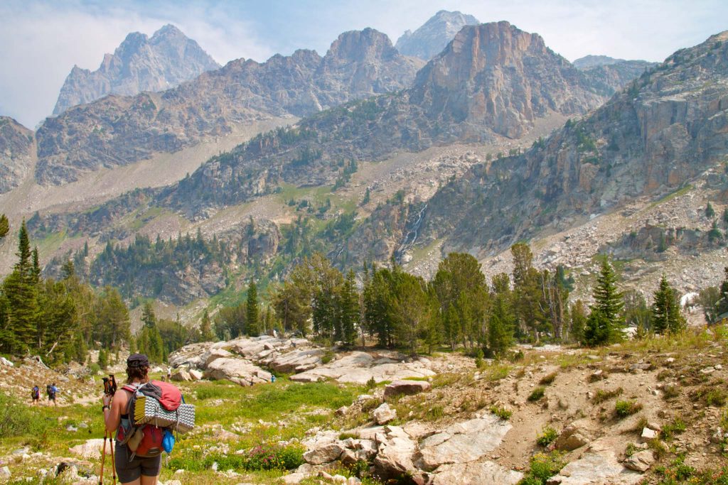
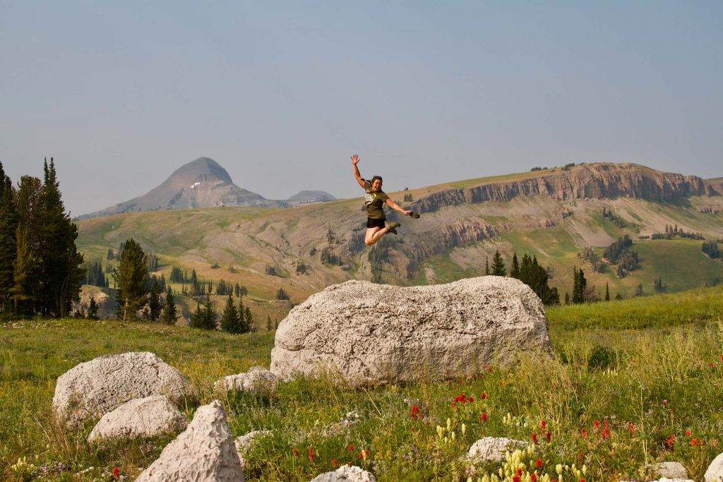
Teton Crest Trail Photographs
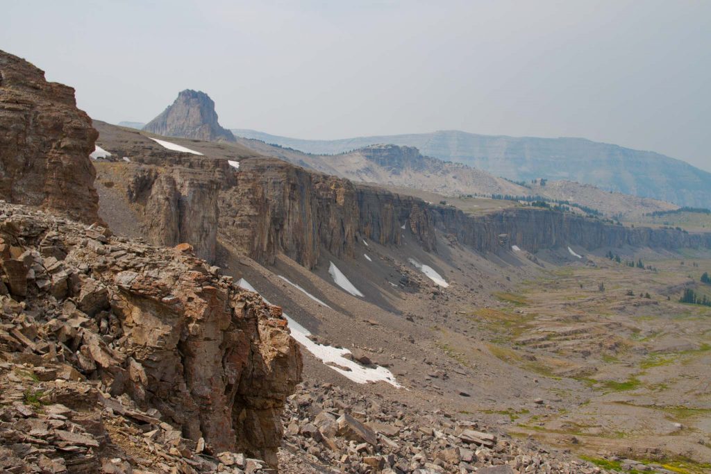
Cliffs along the Teton Crest Trail
Death Canyon, Teton Crest Trail
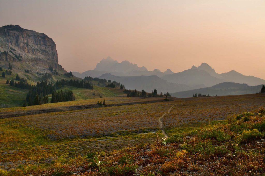
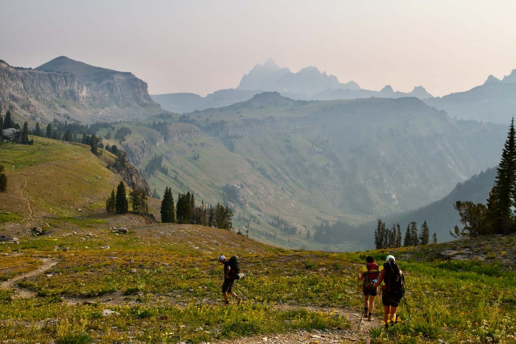
Teton Crest Trail Views
Views along the Teton Crest Trail near death canyon
Views heading towards Cascade Canyon
Views in Cascade Canyon
Views near lake Marion on Teton Crest Trail
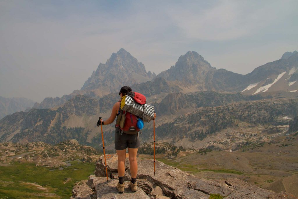
Views of Grand Tetons on Teton Crest Trail

Max DesMarais is the founder of hikingandfishing.com. He has a passion for the outdoors and making outdoor education and adventure more accessible. Max is a published author for various outdoor adventure, travel, and marketing websites. He is an experienced hiker, backpacker, fly fisherman, backcountry skier, trail runner, and spends his free time in the outdoors. These adventures allow him to test gear, learn new skills, and experience new places so that he can educate others. Max grew up hiking all around New Hampshire and New England. He became obsessed with the New Hampshire mountains, and the NH 48, where he guided hikes and trail runs in the White Mountains. Since moving out west, Max has continued climbed all of the Colorado 14ers, is always testing gear, learning skills, gaining experience, and building his endurance for outdoor sports. You can read more about his experience here: hikingandfishing/about