Humboldt Peak in the Sangre De Cristo Mountains of Colorado is considered one of the easier Colorado 14ers, and makes for a fantastic backpacking trip or day hike. This peak is often combined in an overnight trip with Crestone Peak and Crestone Needle (significantly more technically difficult peaks). Here, we will give you everything you need to know to hike Humboldt Peak.
Distance – 11.2 miles round trip (18.02 km)
Height – 14,064 feet (4286.40 m)
Elevation gain – 4,212 feet (1283.82 meters)
Duration – 10 – 12 hours (book time dependant upon trailhead start)
Difficulty – Strenuous
Class: Class 2 Hike
Trailhead Location – South Colony Trailhead (both 2WD and 4WD vehicle options)
Quick Navigation:
Routes | Trail Map | Camping Info | Weather | Directions | Pictures
Need To Know Information
-
- The road to the 4wd trailhead is rough, and requires a good clearance vehicle. Recent improvements to the road mean that Subaru Forester like vehicles can also make it to the trailhead with careful driving.
- Dispersed camping is allowed in Sangre De Cristo Wilderness. There are many campsites utilized near at South Colony Lakes, but be sure to read on the rules and regulations here: https://www.fs.usda.gov/recarea/psicc/recarea/?recid=80754
Hiking Route Options
There is really only one common route to the summit that we will cover in this article.
South Colony Trailhead (4WD) | 11.2 Miles Round Trip (18.02 km) – 4,212 Feet Elevation Gain (1283.82 meters) | Class 2
Hikers begin at the South Colony Trailhead and follow the very well marked path that leads them directly to a forest service access road. Hikers hike on this road for 2.5 miles before reaching the next junction. Here hikers will then bear right towards South Colony Lake. Once reaching the lake, hikers will come across various campsite areas that may make a great overnight spot.
Hikers continue past the first lake and ascend up the very clear and well traveled path to the upper lake. At the upper lake the trail begins to switchback up the steep slope towards the west ridge and saddle of Humboldt. The trail has fantastic switchbacks and gains elevation via a gradual but steep grade due to these switchbacks. Hikers gain the ridge at 12,850 feet. Here, hikers climb along the ridge which remains gradual and simple.
The last .2 miles of the hike the terrain gets a little more difficult in the class 2 range, but still relatively straightforward. Follow cairns and the pretty well traveled path to the summit.
We also created a GPX file of the route that you can download here so that you can make sure the route is in your GPS device or phone.
South Colony Trailhead (2WD) | 16.2 Miles Round Trip (26.07 km) – 5,490 Feet Elevation Gain (1673.35 meters) | Class 2
This is the same route as above, but add 2.7 miles each way and 880 feet of elevation gain.
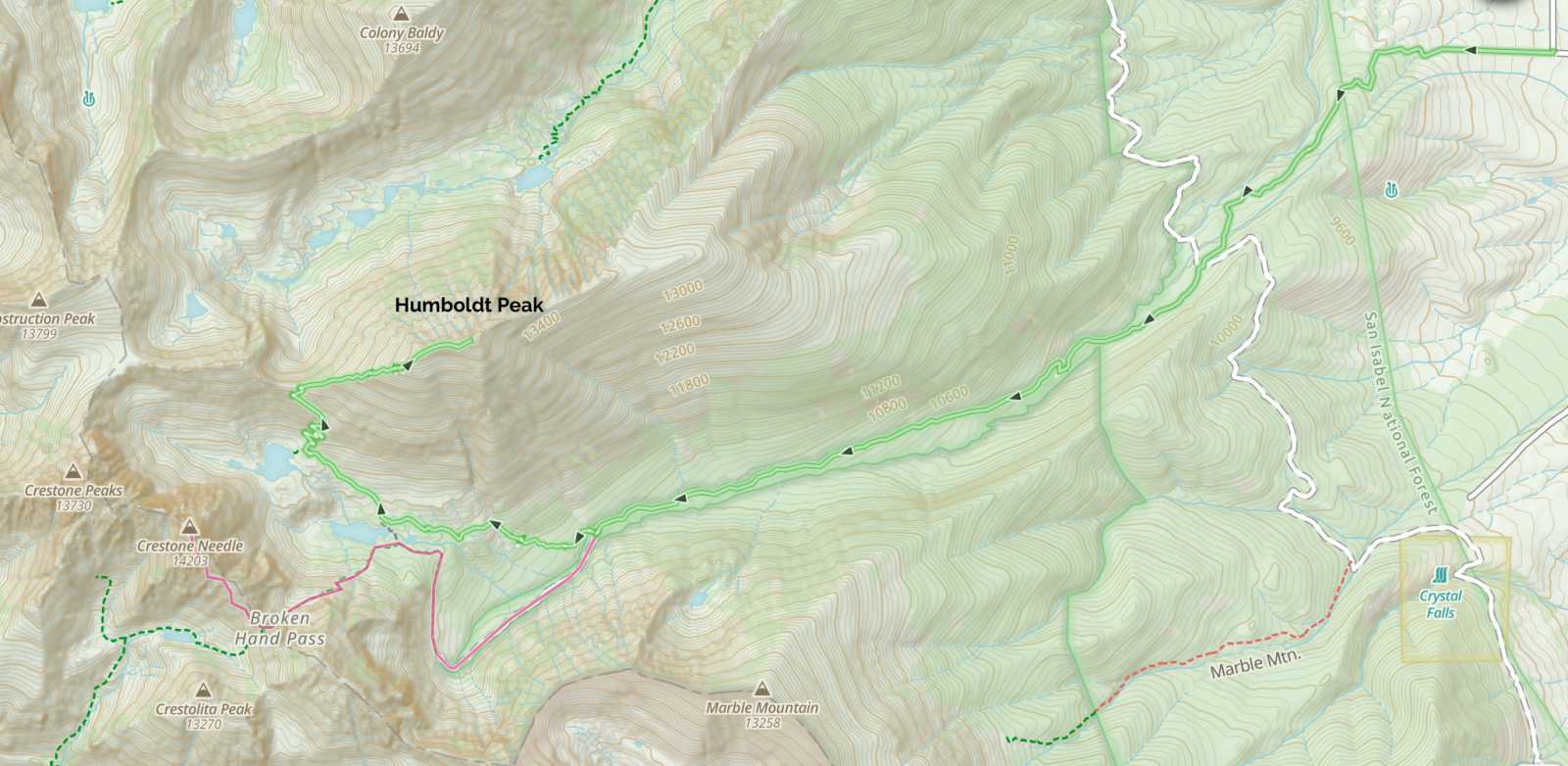
Trail Map
Camping For Humboldt Peak
There are various camping options available. It is worth noting that camping options for this hike are in the Sangre De Cristo Wilderness, so those regulations need to be followed.
The most common camping areas are by South Colony Lake. This is a busy area with dozens of tent sites with incredible views. Hikers must stay at least 300 feet away from the lake when camping. There are also campsites on South Colony Lakes road.
Fishing South Colony Lakes
There are lots of fish both of the South Colony Lakes. The river flowing out of the lakes also is very productive.
Current Weather Conditions:
Here is the detailed weather forecast for the next few days. We highly recommend you check out the mountain forecast for this peak the morning of your hike.
Crestone, CO
Tonight
Mostly clear, with a low around 25. West southwest wind 20 to 30 mph, with gusts as high as 45 mph.
Tuesday
Sunny, with a high near 50. West southwest wind 20 to 40 mph. Little or no snow accumulation expected.
Tuesday Night
Mostly clear, with a low around 26. West southwest wind 20 to 30 mph.
Wednesday
Sunny, with a high near 50. West southwest wind 20 to 45 mph, with gusts as high as 60 mph.
Wednesday Night
A slight chance of snow showers after midnight. Mostly clear, with a low around 23. West southwest wind 20 to 45 mph, with gusts as high as 55 mph. Chance of precipitation is 20%. New rainfall amounts less than a tenth of an inch possible.
Thursday
A chance of snow showers and a slight chance of thunderstorms after noon. Sunny, with a high near 41. West southwest wind 20 to 35 mph, with gusts as high as 55 mph. Chance of precipitation is 30%. New rainfall amounts less than a tenth of an inch possible.
Thursday Night
A chance of snow showers. Mostly clear, with a low around 18. West southwest wind around 20 mph, with gusts as high as 35 mph. Chance of precipitation is 30%.
Directions & Parking
Directions To South Colony Lakes 4WD Trailhead:
Directions to 2wd Trailhead:
Additional Pictures
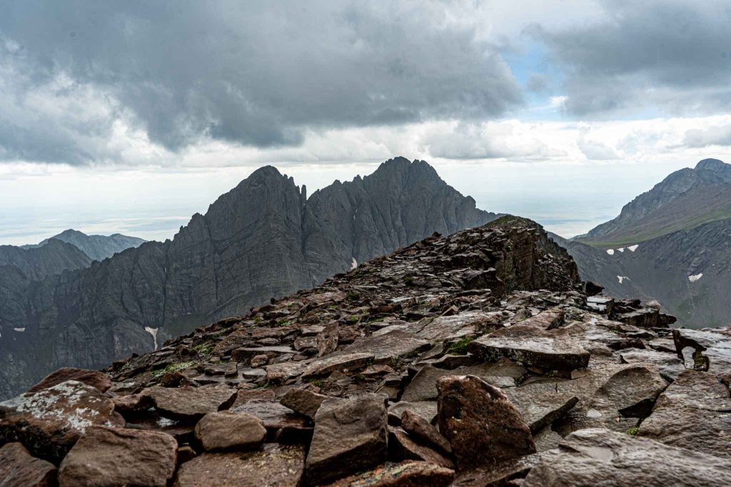
Views of Crestone Peak and Needle from Humboldt Peak
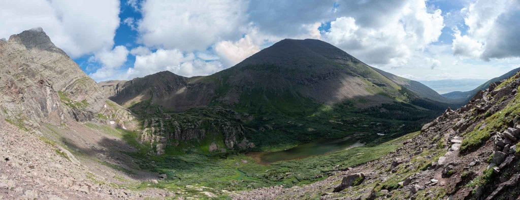
Humboldt Peak from just below Broken Hand Pass
Humboldt Peak as seen from Crestone Needle
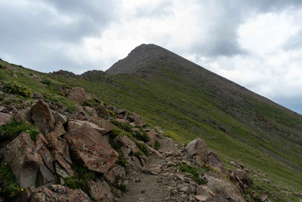
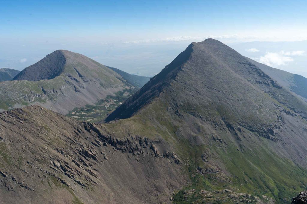
Humboldt Peak ridge to summit
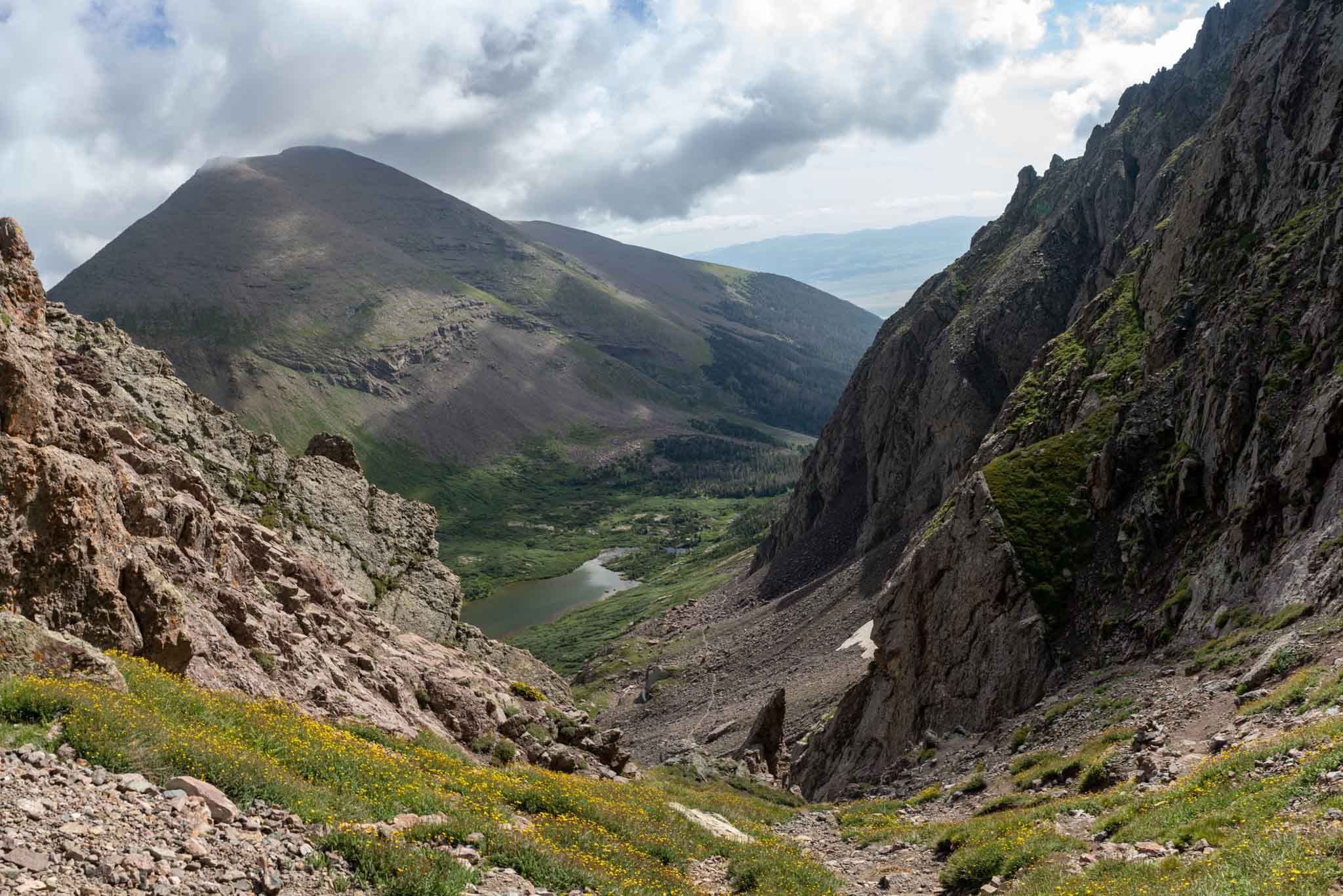
Looking down at the trail from Broken Hand Pass with Humboldt Peak across the valley

Max DesMarais is the founder of hikingandfishing.com. He has a passion for the outdoors and making outdoor education and adventure more accessible. Max is a published author for various outdoor adventure, travel, and marketing websites. He is an experienced hiker, backpacker, fly fisherman, backcountry skier, trail runner, and spends his free time in the outdoors. These adventures allow him to test gear, learn new skills, and experience new places so that he can educate others. Max grew up hiking all around New Hampshire and New England. He became obsessed with the New Hampshire mountains, and the NH 48, where he guided hikes and trail runs in the White Mountains. Since moving out west, Max has continued climbed all of the Colorado 14ers, is always testing gear, learning skills, gaining experience, and building his endurance for outdoor sports. You can read more about his experience here: hikingandfishing/about