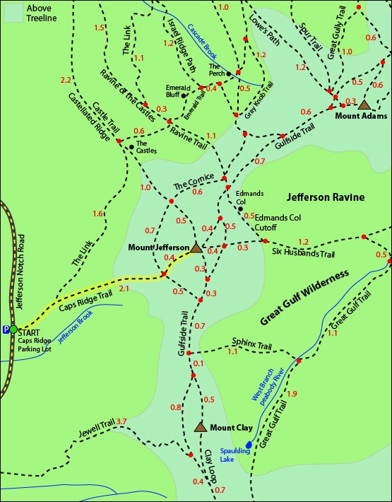
Mount Jefferson is a 5,712 foot mountain located in the Presidential Range of the White Mountains of New Hampshire. It is the third tallest mountain on the official 48 4,000 footers list. Mount Jefferson lies between Mount Clay to the South and Mount Adams to its North. The summit offers expansive views of the rest of the Presidential Range including its Southern neighbor, Mount Washington.
Elevation: 5,372 feet (1,637 meters)
Elevation gain: 2,720 feet
Length: 5 miles roundtrip
Difficulty: Strenuous
Duration (book time): 4.5 hours
Trails
Caps Ridge Trail – 2.5 Miles One Way – (2,720 feet of elevation gain)
Start your hike by following the Caps Ridge Trail for 2.1 miles until you reach a trail intersection with The Cornice. Here, you will stay straight and continue on the Caps Ridge Trail for another 0.4 miles until you reach the summit of Mount Jefferson. The first section of the trail is relatively flat and easy, while the second portion of the trail includes challenging rock scrambles and ladders.
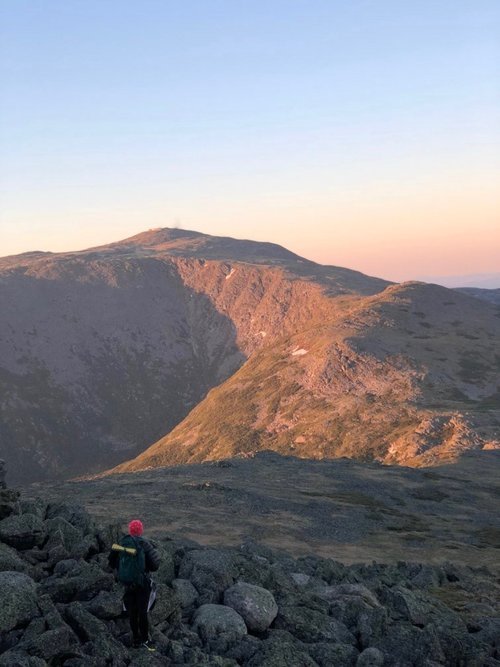
Trail Map
Alternative routes
Great Gulf trail – 7 Miles One Way – (4,300 feet of elevation gain)
Another more difficult approach to summit Mount Jefferson is from the Great Gulf by the Six Husbands Trail. Both trails ascend Jefferson’s Knee, a series of rock scrambles and ladders (7 miles and 4,300 feet one way). This route is not recommended for descent. This route is recommended for experienced hikers only and should not be attempted in wet or icy conditions.
Castle trail – 4.8 Miles One Way – (4,200 feet of elevation gain)
Another option for summiting Mount Jefferson is by taking the Castle Trail. There is roughly 4,200 feet of elevation gain over 4.8 miles, making it a rather challenging climb.

Jewell Trail – 5.5 Miles One Way – (3,750 feet of elevation gain)
Another approach to summit Mount Jefferson is to hike up the Jewell Trail, starting at the Base Station, and connect with the Gulfside Trail (5.5 miles one way, with 3,750 feet of elevation gain). This route is somewhat less rugged and demanding than other routes, but a good portion of the trail is entirely exposed for an extended period of time.
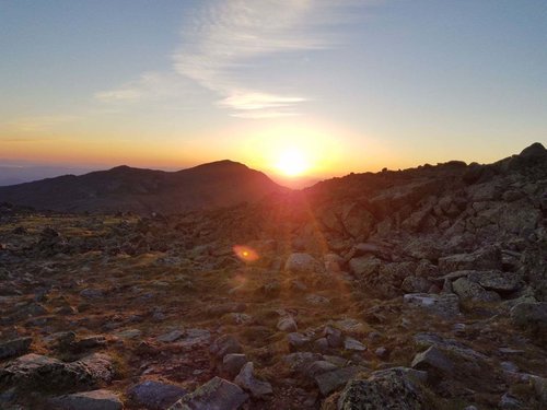
Looking over at Mt. Jeffersons Southern neighbor, Mt. Washington.
Hiking in Winter
Winter conditions in the presidentials are brutal and unforgiving. Jefferson Notch Road is unplowed and gated during the winter season, making access to the Caps Ridge trail nearly impossible. A winter ascent on Mount Jefferson is most commonly approached by taking the Lowe’s Path and Randolph Path to Edmunds Col and the Castle Trail. These routes are exposed and require special equipment and skills. Winter above tree line poses a major risk and can be extremely challenging to navigate in low visibility.
Camping and Overnight Hiking Options
The Randolph Mountain Club (RMC) has four shelters in the immediate area including Log Cabin, Gray Knob Cabin, The Perch and Crag Camp. Each shelter requires a fee to stay overnight and do not accept prior reservations.
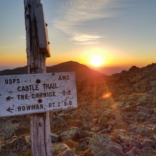
Trail junction
Parking
Caps Ridge Trail
The trailhead parking for Caps Ridge trail is located on Jefferson Notch Road in Thompson and Meserves Purchase, New Hampshire. A parking permit is required to park at White Mountain National Forest trailheads and parking areas. Rates go for $3 per day. Jefferson Notch Road is closed from late fall until late spring.
Castle Trail
The trailhead parking for the Castle trail is located in Randolph, New Hampshire. It will be the second trailhead sign on the left after Lowe’s Store. Directions Here
Jewell trail
The trailhead parking for Jewell trail is located on the Cog Railway Base Station Road, roughly 1 mile from the four way crossing with Mt. Clinton road and Jefferson Notch road. A parking permit is required to park at White Mountain National Forest trailheads and parking areas. Rates go for $3 per day. Directions Here. If this is full, there is a second trailhead further down the road.
Directions
To get to the Caps Ridge Trailhead parking area
Traveling West on Route 302: Turn right on Mount Clinton Road, directly past the AMC Highland center, and continue straight for 3.6 miles. At the crossroads, continue onto Jefferson Notch Road and follow the dirt road for 3.4 miles. The parking area will be on the right hand side of the road.Traveling East on Route 302: Turn left onto Base Station Road. The turn is about 4.4 miles East of the junction of Route 3 and 302. Drive straight for about 4.5 miles. At the crossroads, make a left turn onto Jefferson Notch Road. Continue on the dirt road for 3.4 miles until you reach the trailhead parking lot, which will be on the right hand side. *NOTE* Jefferson Notch Road is open only in the summer and early fall. Be sure to check the latest gate status updates and road closures.
Weather
Much of the trail is entirely exposed above tree line, so be prepared and check the weather forecast religiously. Sustained winds of over 100 miles per hour are not uncommon and freezing temperatures, sleet and snow can occur during any month of the year. If the weather is bad, turn back immediately.
Gorham, NH
Tonight
A slight chance of snow showers between 2am and 4am, then a chance of rain and snow showers. Partly cloudy, with a low around 38. West wind 5 to 15 mph. Chance of precipitation is 30%. New rainfall amounts less than a tenth of an inch possible.
Tuesday
A chance of rain and snow showers. Mostly cloudy, with a high near 45. West wind around 15 mph, with gusts as high as 25 mph. Chance of precipitation is 50%. New rainfall amounts between a tenth and quarter of an inch possible.
Tuesday Night
Rain showers likely before midnight, then rain showers likely and patchy fog. Cloudy, with a low around 35. West wind around 15 mph, with gusts as high as 25 mph. Chance of precipitation is 70%. New rainfall amounts between a quarter and half of an inch possible.
Wednesday
A chance of rain showers. Cloudy, with a high near 39. Southeast wind 15 to 20 mph. Chance of precipitation is 40%.
Wednesday Night
A slight chance of rain showers before 2am. Mostly cloudy, with a low around 36. Southeast wind 10 to 20 mph, with gusts as high as 30 mph.
Thursday
A chance of rain showers after 8am. Mostly cloudy, with a high near 44. Chance of precipitation is 40%.
Thursday Night
A chance of rain showers before 2am. Mostly cloudy, with a low around 36. Chance of precipitation is 40%.
Additional photos
Trail junction for Gulfside trail and Six Husbands

Andrea is a writer, hiker, and adventurer from New England. She enjoys snowboarding, sunrise hikes, winter, night hiking, traveling, and photography.