Mount Bross sits at 14,172 feet tall, and is one of the fourteeners part of what is known as the Decalibron. A hike featuring four (three official) 14,000 foot peaks, Mount Democrat, Mount Cameron, Mount Lincoln, and Mount Bross. This is one of the easier 14ers in terms of distance and elevation gain.
***IMPORTANT NOTE***
– The summit of Mount Bross is closed to the public. Read about this here: https://www.14ers.org/peaks/mosquito-range/mount-bross/. Starting Friday July 27th, 2023 the summit of Mount Democrat and Mount Lincoln were both reopened to the public.
Difficulty – Intermediate
Distance –3.2 miles round trip (5 km)
Height – 14,172 feet (4,319.6 m)
Elevation gain – 2,462 feet (750.4 m)
Duration – 4 to 6 hours (book time)
Seasons – Year-round (caution and experience needed in winter – see below)
Trailhead Location – End of Stevens Gulch Road – 12,030 feet (directions below)
Trail Map
Trails
West Slopes | 3.2 Miles Round Trip | 2,462 Feet Elevation Gain
The most direct path up to Mount Bross begins at the right side of the Kite Lake Trailhead. The first .4 miles are relatively flat, and feature stunning views of all of the surrounding mountains. Hikers will ascend to a scree field at the side of the steep slopes of Mount Bross. This point of the hike is a bit more dangerous, as falling and sliding rocks are a possibility, especially with hikers in front. It is steep, and the footing isn’t great. Winter or icy conditions need extreme caution. There is also quite a bit of avalanche risk here.
Other options to Bross would be the entire Decalibron, hiking or hiking with Mount Cameron and Mount Lincoln. You can read about these options by clicking these links.
The summit of Mount Bross is currently closed to public due to private property concerns.
KITE LAKE TO MOUNT BROSS & MOUNT LINCOLN: 7 MILES ROUND TRIP | 2,550 FEET ELEVATION GAIN
This route begins at the same starting location as the above route, and hikers will head up towards Mount Bross first. This trail begins relatively flat before hitting the rock/scree fields below Mount Bross. Quickly, this route gets very steep with lots of loose rock and gravel. Extra caution should be taken on this path due to the trail conditions and loose rock. Once hikers ascend to above the steep grade, the hike over to Mount Lincoln is relatively simple and considered class 1. Hikers are urged to stay on trail due to the dangers of old mines, as well as private property concerns. The summit of Mount Bross is currently considered closed due to private property reasons.
S Gully | 5 Miles Round Trip | 2,462 Feet Elevation Gain
Hikers beginning at Kite Lake Trailhead will ascend the gully on the northwest side of the mountain. This is an Ice Ace and Crampon route for spring season. Only highly experienced individuals for this.
East Slopes Road | 5 Miles Round Trip | 2,900 Feet Elevation Gain
Hikers begin taking the old mining roads on the east side of Mount Bross. Parking at Mineral Park Mine.
Hiking in Winter
Mount Bross is often hiked in winter. Extreme caution should be taken when doing any winter route. The entire Decalibron is done in winter, but accidents do happen. Avalanche risk is here. We recommend looking at full winter routes for these mountains before proceeding.
Camping Information
There are 5 tent sites available at the Kite Lake Campground. It also features toilets, parking at trailhead, and picnic tables. No water is available. The camping fee is $12. Information on camping can be found here. Kite lake is frequently fished.
Directions & Parking
The parking area has a $3 self service pay station. It fills up very quickly due to popularity. You will see cars lined up down the road to hike here.
Current Weather Conditions
Here is a detailed forecast for the next 4 days:
Alma, CO
Tonight
Snow showers and a slight chance of thunderstorms before midnight, then snow and a slight chance of thunderstorms. Cloudy, with a low around 16. South southeast wind around 10 mph. Chance of precipitation is 90%. New snow accumulation of 3 to 7 inches possible.
Saturday
Snow and a slight chance of thunderstorms before noon, then snow showers and a chance of thunderstorms. Cloudy, with a high near 20. East wind around 10 mph. Chance of precipitation is 100%. New snow accumulation of 9 to 13 inches possible.
Saturday Night
Snow showers likely and a slight chance of thunderstorms. Cloudy, with a low around 16. North wind 10 to 15 mph. Chance of precipitation is 70%. New snow accumulation of 2 to 4 inches possible.
Sunday
Snow showers before noon, then snow showers and a slight chance of thunderstorms. Cloudy, with a high near 26. West northwest wind 15 to 20 mph. Chance of precipitation is 90%. New snow accumulation of 1 to 3 inches possible.
Sunday Night
A chance of snow showers and a slight chance of thunderstorms before midnight. Mostly cloudy, with a low around 15. West northwest wind 10 to 15 mph. Chance of precipitation is 50%. New snow accumulation of less than half an inch possible.
Monday
A slight chance of snow showers and a slight chance of thunderstorms after noon. Partly sunny, with a high near 29. West wind 15 to 25 mph, with gusts as high as 40 mph.
Monday Night
Partly cloudy, with a low around 18. West southwest wind 20 to 25 mph.
Additional Pictures
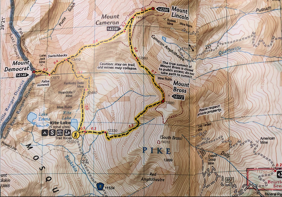
Mount Lincoln from Mount Bross
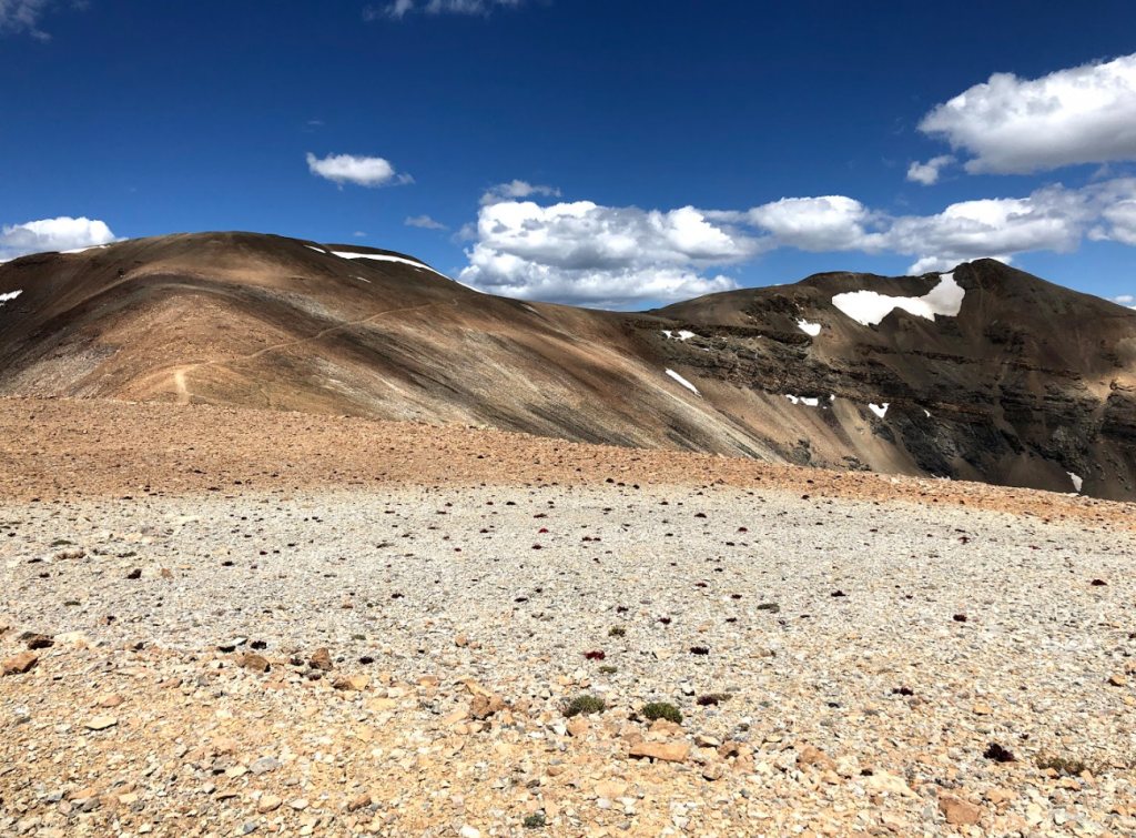
Pano Views Heading Down Mount Bross
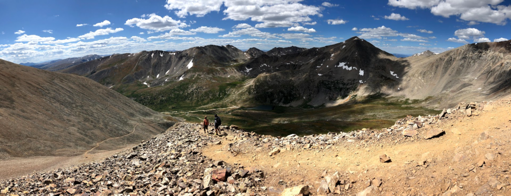
Summit Views on Mount Bross
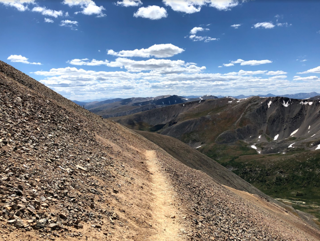
Trail on Scree Field Heading Down Mount Bross
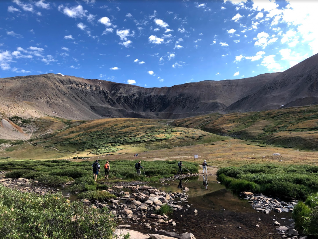
Views from Kite Lake
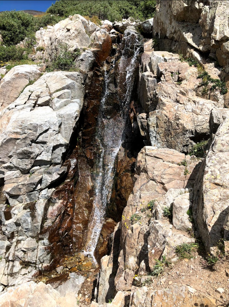
Waterfall at Base of Mount Bross
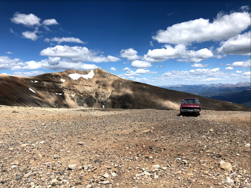
Abandoned Truck on Mount Bross

Max DesMarais is the founder of hikingandfishing.com. He has a passion for the outdoors and making outdoor education and adventure more accessible. Max is a published author for various outdoor adventure, travel, and marketing websites. He is an experienced hiker, backpacker, fly fisherman, backcountry skier, trail runner, and spends his free time in the outdoors. These adventures allow him to test gear, learn new skills, and experience new places so that he can educate others. Max grew up hiking all around New Hampshire and New England. He became obsessed with the New Hampshire mountains, and the NH 48, where he guided hikes and trail runs in the White Mountains. Since moving out west, Max has continued climbed all of the Colorado 14ers, is always testing gear, learning skills, gaining experience, and building his endurance for outdoor sports. You can read more about his experience here: hikingandfishing/about