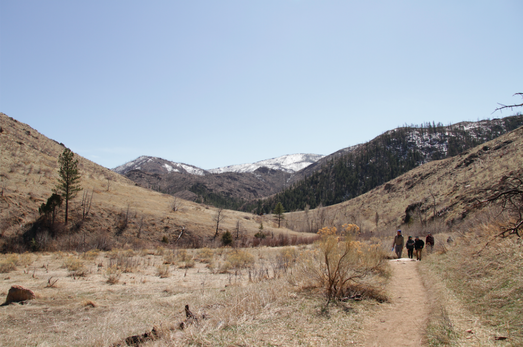
The Hewlett Gulch trail (#954) is located only 25 minutes outside Fort Collins, and takes hikers along Gordon Creek. Hikers are taken through some gorgeous scenery with mountains on either side, unique rock formations, nearby bighorn sheep and deer populations. This hike can be done in a full, intermediate level loop, or hikers can choose to shorten the hike by simply turning around whenever ready. Either option is fantastic as the trail is uniquely beautiful all the way through. (We would recommend the full loop given the outstanding views once ascending above the gulch, and the extremely cool rock formations located 2-3 miles into the hike.
Distance –8.2 miles round trip (13.20 km)
Highest Point – 6,797 feet (2,071.7 m)
Elevation gain – 1,125 feet (342.9m)
Duration – 3 to 4 hours (book time)
Difficulty – Intermediate
Seasons – Year-round (caution needed in winter – see below)
Trailhead Location – Hewlett Gulch Trail – 5,680 feet (directions below)
Trail Map
The below trail map highlights the 3 main sections of the Hewlett Gulch Trail and mileage for each. We also included a GPX map below this.
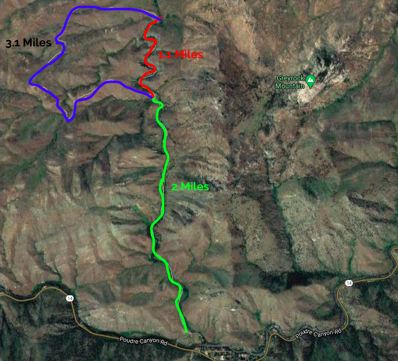
Hewlett Gulch Trail Map
Trails
Hewlett Gulch Full Loop: 8.2 Miles Round Trip | 1,125 Feet Elevation Gain
The full loop trail begins at the Hewlett Gulch Trailhead. It begins with 2 miles of level or gradual gain terrain on a well traveled, easy to follow and pretty smooth path. Even the views early on are great. Within the first two miles, hikers will have to cross the river several times. During lower water times, strategically placed rocks and some downed trees/branches enable hikers to pass pretty easily. After rainfall, during snowmelt, or other high water times, these river crossings can be a bit more difficult, and you may have to get your feet wet.
2 miles in, hikers will hit a fork, to the left, hikers head steeply uphill and to the right, hikers remain relatively flat for the next mile of hiking, but head towards some really gorgeous rock formations and river crossings. If doing the loop, we recommend going left, and tackling the most of the elevation gain early, and leaving the hardest river crossings for the way back.
Bearing left at the fork, hikers will quickly ascend via switchbacks. The views simply keep getting better as you can see more of the valley below, and the surrounding mountains (pictures below). The trail remains easy to follow and is well traveled the entire way.
Hikers will reach a great viewpoint (and common turnaround point) around 3.2 miles into the hike. Here, hikers will descend slightly before beginning the ascent to the highest point on the trail (around 3.8 miles in to the hike). The trail then maintains a gradual decline for the next couple of miles before reaching the river drainage and cool rock formations. 6.2 miles in, hikers will reach the trail junction, and then retrace their steps back to the trailhead.
Hewlett Gulch Trail – Out And Back To River Drainage: 6 Miles Round Trip
If hikers don’t want to do a lot of elevation gain, they may choose to bear right at the fork, and just hike through the river drainage portion, which is quite a unique area with numerous river crossings.
Hikers of course have the options of turning around at any point to make this hike as long or short as they please.
Hiking Hewlett Gulch in Winter
This is a great winter hiking area. Extra caution needs to be taken during wet and icy times. We highly recommend bringing traction devices such as microspikes to remain safe on the trails and to avoid falls.
Camping And Other Information
There are no campsites near the trail, however all along Poudre Canyon there are many campgrounds to choose from that are very close. You can read more about amenities and camping nearby here: https://www.fs.usda.gov/recarea/arp/recarea/?recid=36779
This trailhead has space for 22 cars, and has a bathroom at it. There is no water, though water can be taken from the creek as long as you have a filter system with you.
Dogs are allowed here, and it is one of the closer places to Fort Collins where dogs are allowed off leash on trail. You will encounter mountain bikers here as well. This is a well used trail.
Current weather conditions:
Here is the detailed weather forecast for the next few days. We highly recommend you check out the mountain forecast for this region the morning of your hike.
Laporte, CO
Overnight
A chance of showers and thunderstorms before 2am, then a chance of showers and thunderstorms. Cloudy, with a low around 44. West northwest wind 16 to 20 mph, with gusts as high as 31 mph. Chance of precipitation is 30%.
Friday
A chance of rain showers before noon, then showers and thunderstorms. Mostly cloudy. High near 62, with temperatures falling to around 58 in the afternoon. Northwest wind 16 to 24 mph, with gusts as high as 37 mph. Chance of precipitation is 80%. New rainfall amounts less than a tenth of an inch possible.
Friday Night
Showers and thunderstorms. Cloudy, with a low around 40. Northwest wind 3 to 15 mph, with gusts as high as 22 mph. Chance of precipitation is 80%.
Saturday
Showers and thunderstorms. Cloudy, with a high near 45. North northeast wind 6 to 12 mph, with gusts as high as 17 mph. Chance of precipitation is 100%.
Saturday Night
Showers and thunderstorms. Cloudy, with a low around 36. North northwest wind 3 to 12 mph, with gusts as high as 18 mph. Chance of precipitation is 90%.
Sunday
A chance of rain showers before noon, then showers and thunderstorms. Mostly cloudy, with a high near 55. Chance of precipitation is 80%.
Sunday Night
A chance of rain showers before midnight. Partly cloudy, with a low around 37. Chance of precipitation is 30%.
Directions & Parking
The parking lot here has 22 spots with no trailer park spots. This is a free parking area with bathrooms at the trailhead. This trailhead is only a short distance from the Greyrock Mountain trailhead.
Directions to Hewlett Gulch Trailhead
Additional Pictures
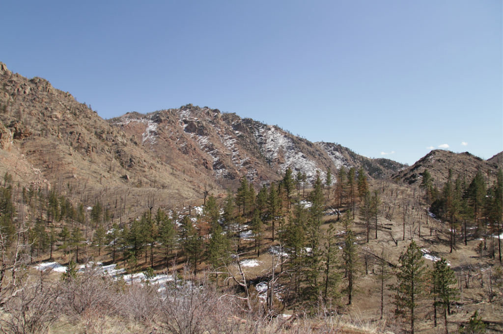
Views From Hewlett Gulch Trail While Ascending
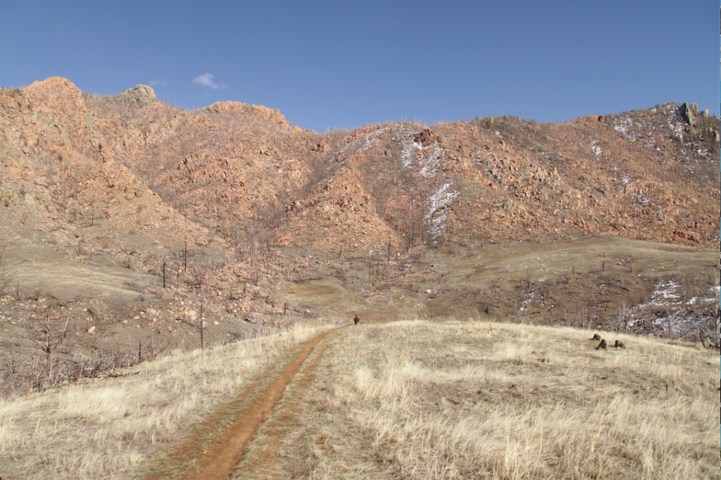
Views From Hewlett Gulch Trail
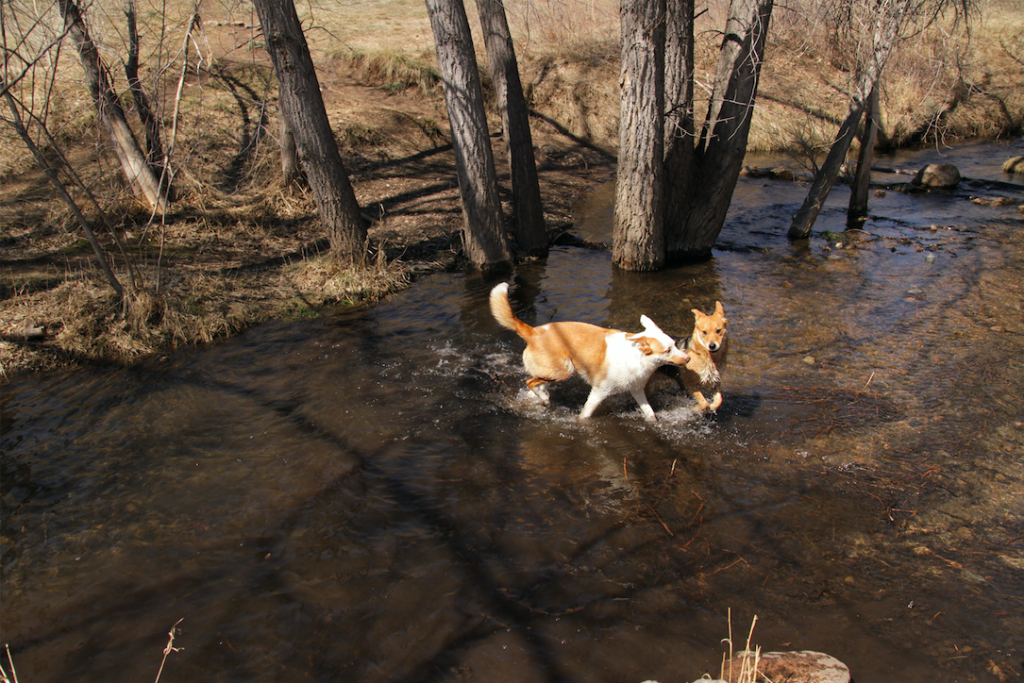
River Crossing at Hewlett Gulch Trail
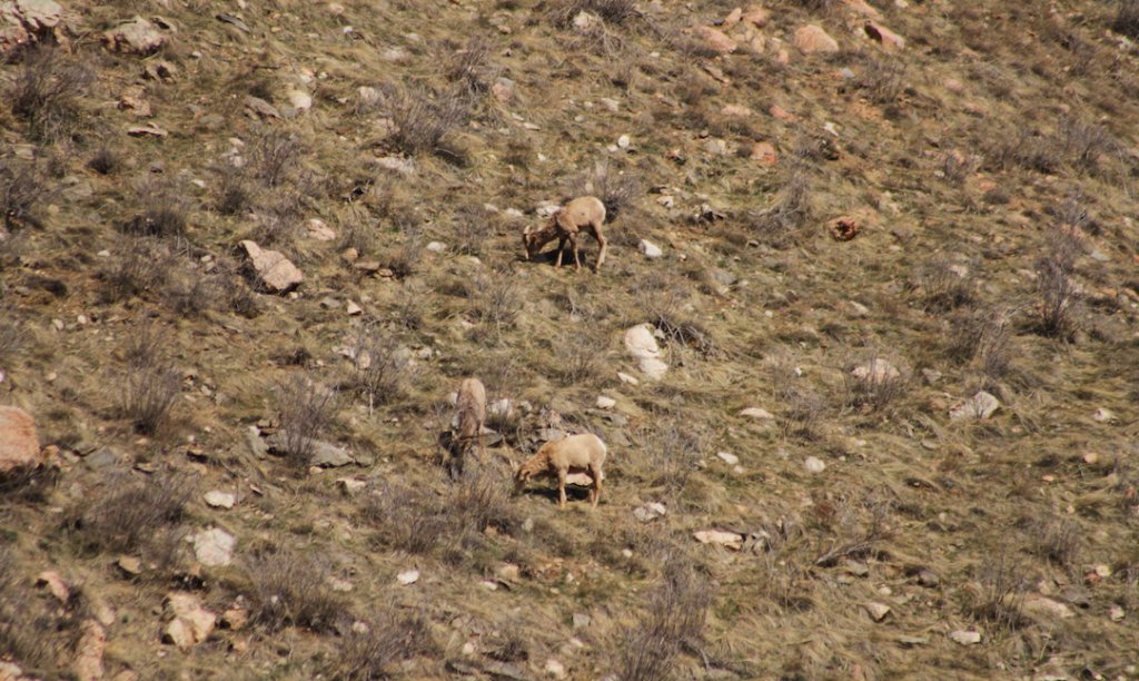
Rams on the Hewlett Gulch Trail
Looking Back At The Hewlett Gulch Trailhead

Max DesMarais is the founder of hikingandfishing.com. He has a passion for the outdoors and making outdoor education and adventure more accessible. Max is a published author for various outdoor adventure, travel, and marketing websites. He is an experienced hiker, backpacker, fly fisherman, backcountry skier, trail runner, and spends his free time in the outdoors. These adventures allow him to test gear, learn new skills, and experience new places so that he can educate others. Max grew up hiking all around New Hampshire and New England. He became obsessed with the New Hampshire mountains, and the NH 48, where he guided hikes and trail runs in the White Mountains. Since moving out west, Max has continued climbed all of the Colorado 14ers, is always testing gear, learning skills, gaining experience, and building his endurance for outdoor sports. You can read more about his experience here: hikingandfishing/about