Mount Eisenhower is NH’s twelfth highest peak and sits at the southern end of the Presidential Traverse. It lies between Mount Pierce and Mount Franklin, and features one of the most unique dome summits in NH. 360 degree views across the very large 6 acre summit leave hikers with a large amount of space to roam around the summit.
Elevation: 4,760 feet (1,451 m)
Mileage: 6.6 miles
Range: Southern Presidential Range
Elevation Gain: 2,750 feet
Duration: 3-6 Hours
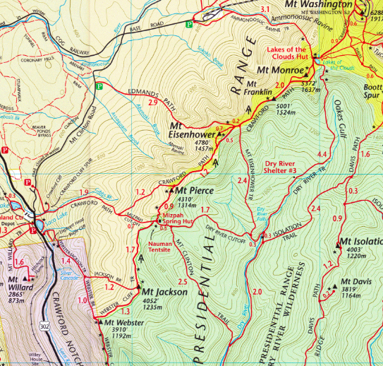
Trail Map
Trails
Edmands Path – 6.6 miles round trip – 2,750 feet elevation gain
Edmands path begins on Mount Clinton road (directions below) and features the quickest and least elevation gain up to the summit. This is the best path if you are looking to quickly summit just Eisenhower, and avoid the other nearby peaks.
Crawford Path – 9.4 miles round trip – 3,200 feet elevation gain
This trail begins right across from the AMC Highland Center in Crawford Notch. This is a longer path, and you can add in another .4 miles to summit Mount Pierce, as well as pass the very cool Mizpa Spring AMC Hut. You can access the trailhead from Route 302, or from the Crawford Connector Trailhead on Mount Clinton Road.
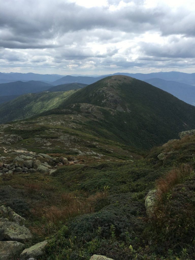
Photo by @laxfreak548
Parking
There are many parking lots in Crawford Notch that will work for the Crawford Path Route. The closes would be at Saco Lake. The Edmands Path route has a parking lot at the trailhead.
Directions
To Edmands Path Trailhead:
To Crawford Path Trailhead:
Nearby Hikes
Crawford Notch has access to a plethora of nearby hikes with all sorts of attributes. The short distance cliffs of Mount Willard, nearby presidential peaks like Mount Jackson and Mount Webster, and even waterfall hikes with Arethusa & Ripley Falls. If you are looking for a hike that prepares you for a lot of the 4,000 footers, but is slightly easier, try the nearby Mount Crawford.
Weather Forecast
Bartlett, NH
This Afternoon
Sunny, with a high near 40. Northwest wind 0 to 5 mph.
Tonight
Clear, with a low around 23. North wind 0 to 5 mph.
Saturday
Sunny, with a high near 48. North wind 0 to 10 mph.
Saturday Night
A chance of rain showers between 8pm and 1am, then a chance of rain and snow showers. Mostly cloudy, with a low around 35. West wind 5 to 15 mph, with gusts as high as 25 mph. Chance of precipitation is 50%.
Sunday
A chance of rain showers. Mostly cloudy, with a high near 52. Southwest wind 10 to 15 mph, with gusts as high as 30 mph. Chance of precipitation is 50%.
Sunday Night
A chance of rain showers before 2am. Mostly cloudy, with a low around 44. Chance of precipitation is 40%.
Monday
A slight chance of rain showers after 2pm. Mostly cloudy, with a high near 53.
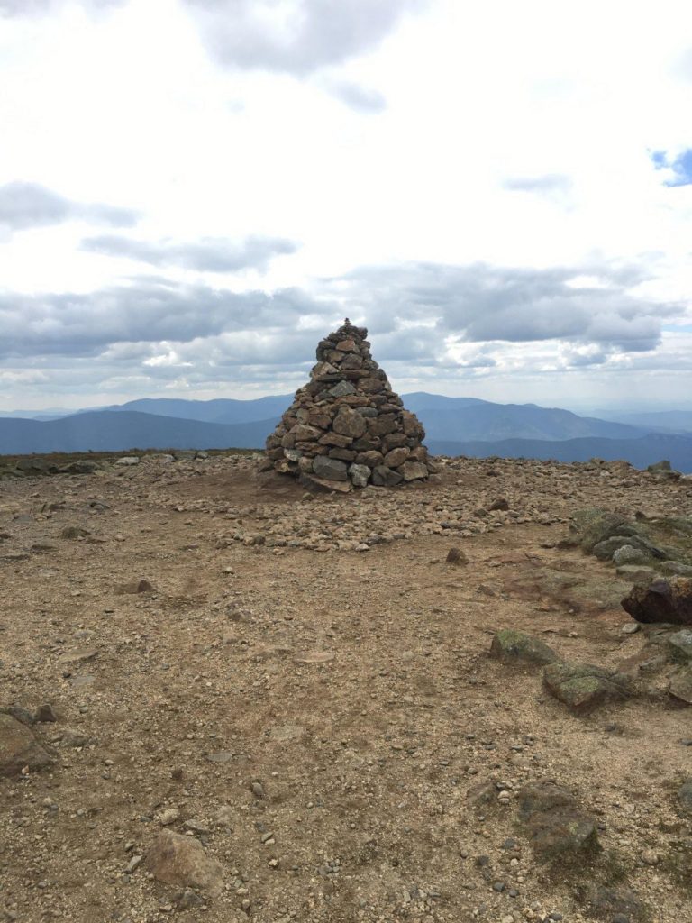
Photo by @laxfreak548

Max DesMarais is the founder of hikingandfishing.com. He has a passion for the outdoors and making outdoor education and adventure more accessible. Max is a published author for various outdoor adventure, travel, and marketing websites. He is an experienced hiker, backpacker, fly fisherman, backcountry skier, trail runner, and spends his free time in the outdoors. These adventures allow him to test gear, learn new skills, and experience new places so that he can educate others. Max grew up hiking all around New Hampshire and New England. He became obsessed with the New Hampshire mountains, and the NH 48, where he guided hikes and trail runs in the White Mountains. Since moving out west, Max has continued climbed all of the Colorado 14ers, is always testing gear, learning skills, gaining experience, and building his endurance for outdoor sports. You can read more about his experience here: hikingandfishing/about