
In this article, we aim to give you as much information as possible, to help you prepare for an attempt at or simply just to learn about, the WURL (Wasatch Ultimate Ridge Linkup).
What Is The WURL?
The Wasatch Ultimate Ridge Linkup, abbreviated as “WURL,” presents an extraordinary ridge route encircling Little Cottonwood Canyon in Utah’s Wasatch Mountains. This challenging route primarily involves difficult scrambling, boulder hopping, and navigating a few rugged trails, spanning approximately 36 miles with an elevation gain of around 18,000 feet. This route continues to grow in popularity, but it is extremely difficult and dangerous. In this article, we try to provide as much information as we can, but DO NOT take this route lightly.
The WURL and Jared Campbell
Jared Campbell is the individual who dreamed up with the route, first completed it, and is an all around incredible incredible athlete and environmentalist. He has completed the Barkley Marathons, three times, a feat no one has repeated yet, a 10-time Hardrock 100 finisher, an engineer, a family man, conservationist, and a whole lot more. He has a website, with information on the WURL here.
Need To Know Information
- The WURL is NOT a maintained trail. Only a very small percentage of the WURL is on actual trails.
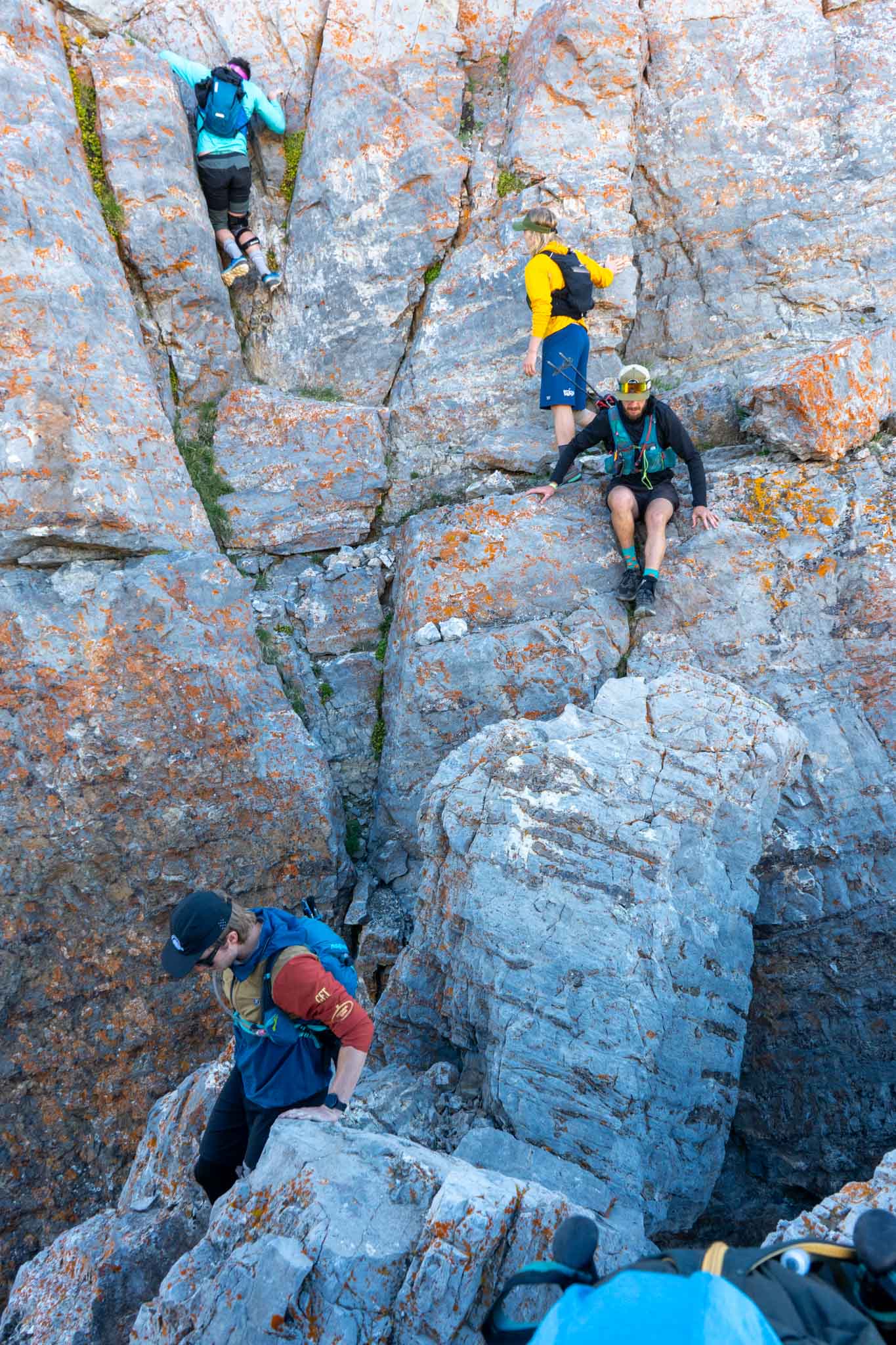
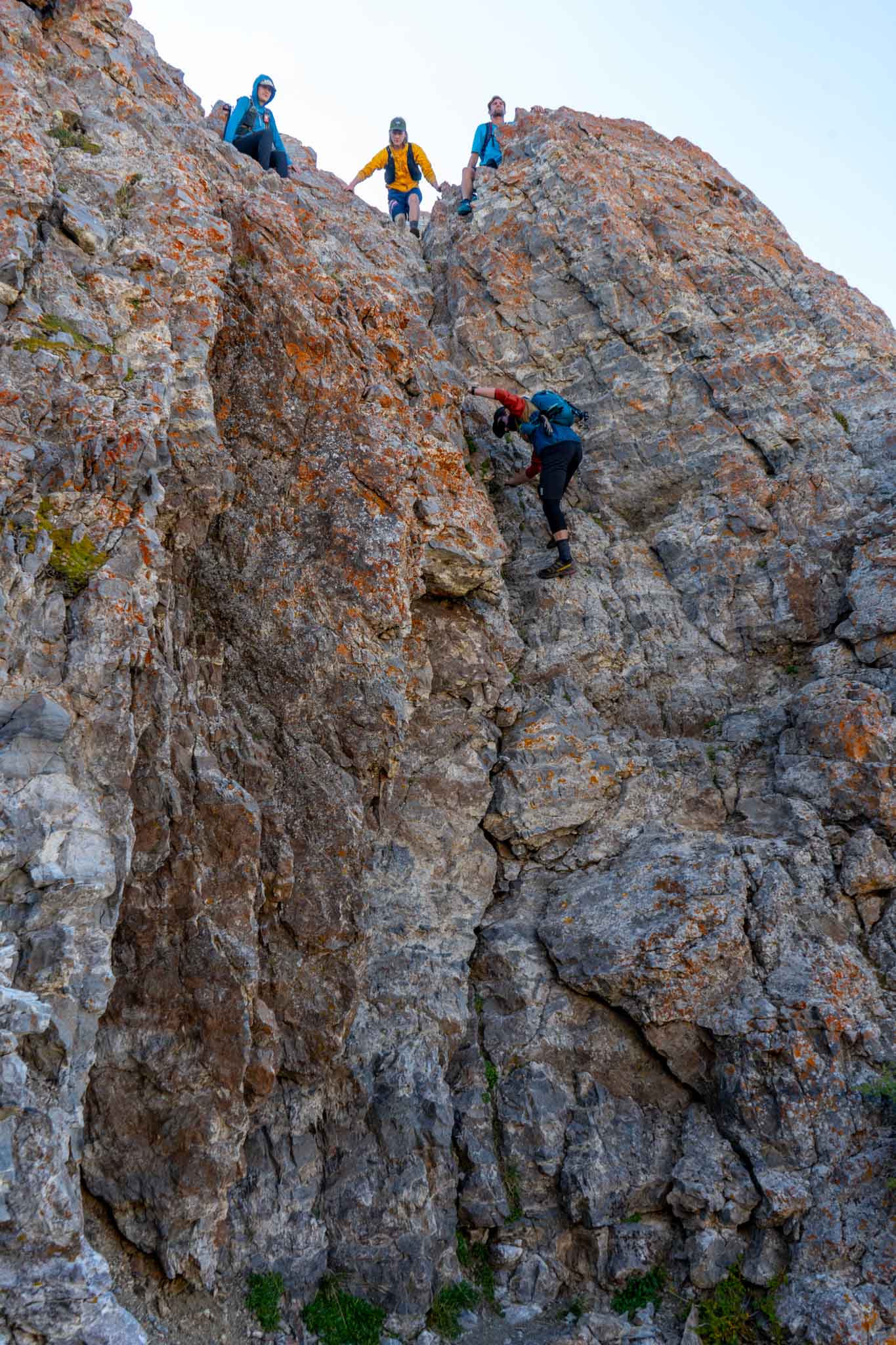
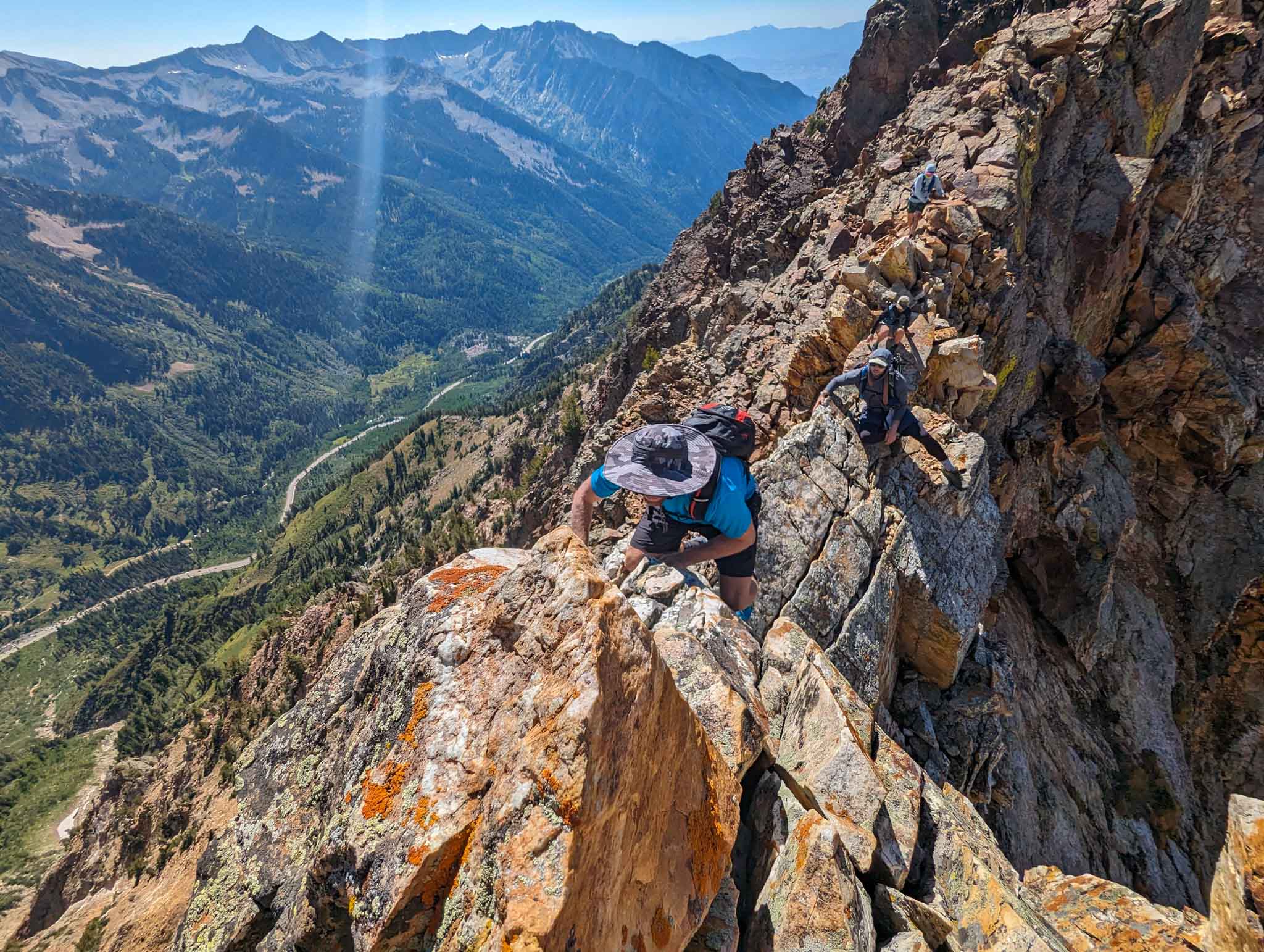
- Successfully navigating this route demands a robust background in rock climbing and substantial experience in traversing highly unstable, rocky terrain. The peaks and ridges encompassed by the WURL have seen serious accidents and fatalities, emphasizing the importance of understanding associated risks, enhancing proficiency, and ensuring thorough preparedness before embarking on this challenge.
- Anyone attempting this route should scout sections of the WURL (below, we will highlight some of the most difficult sections worth scouting beforehand).
- It is essential to stash water and food at parts along the trail, or have friends join you at various points to supply food, water, and potentially gear along the way. An “unsupported” WURL has only been attempted a few times ever.
- Various parts of the WURL are class 5 – meaning they require climbing with risk of death or serious injury.
- Staying “true to the WURL” means staying as close to the ridge as possible the entire way. There are points where staying on the ridge is impossible without climbing gear, and therefore, you go as close as possible. That being said, this is a self regulated route, and modifying the WURL for your needs is totally up to you.
WURL Stats
Distance: ~36 miles (58 km)
Vertical Gain & Loss: ~18,000 feet (5486 meters) – Most people’s watches or GPS devices appear to get between 20,000 and 21,000 feet of vertical gain and loss. My watch recorded just over 20,000 feet of gain.
Fastest Known Times: Read Page
Summits: Below, we list out the “named summits” along the WURL, in order, for informational purposes. Note that some of these peaks may go by different names as well. Twin Peaks, O’Sullivan Peak, Dromedary Peak, Monte Cristo, Mount Superior, Flagstaff Mountain, Davenport HIll, Honeycomb North, Honeycomb South, Patsy Marley, Mount Wolverine, Mount Tuscarora, Point Supreme, Peak 10,864, Devil’s Castle, Sugarloaf, Mount Baldy, Hidden Peak, American Fork Twin Peak East, American Fork Twin Peak West, Red Stack, Red Baldy, White Baldy, The Pfeifferhorn, Upwop Peak, South Thunder, Bighorn, Lone Peak
WURL GPX Files
We have compiled some of the best GPX files of the entire route. These you can download, and are essential to have on your phone, GPS device, and watch.
This is a Caltopo map and GPX file created by Jared Campbell himself.
This is the GPX file on the FKT website.
OnX Backcountry GPX file with routes for supporting team members to join as well.
WURL Map
On the below map, Blue pins represent notable points and summits. Green represents where our group cached food and water. The teal lines represent the WURL route. 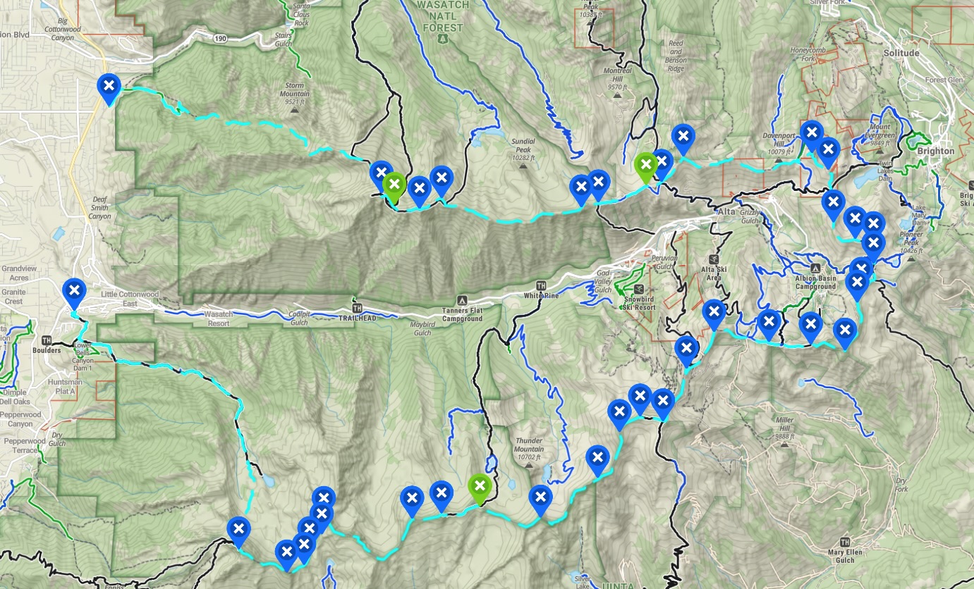
Noteworthy Sections
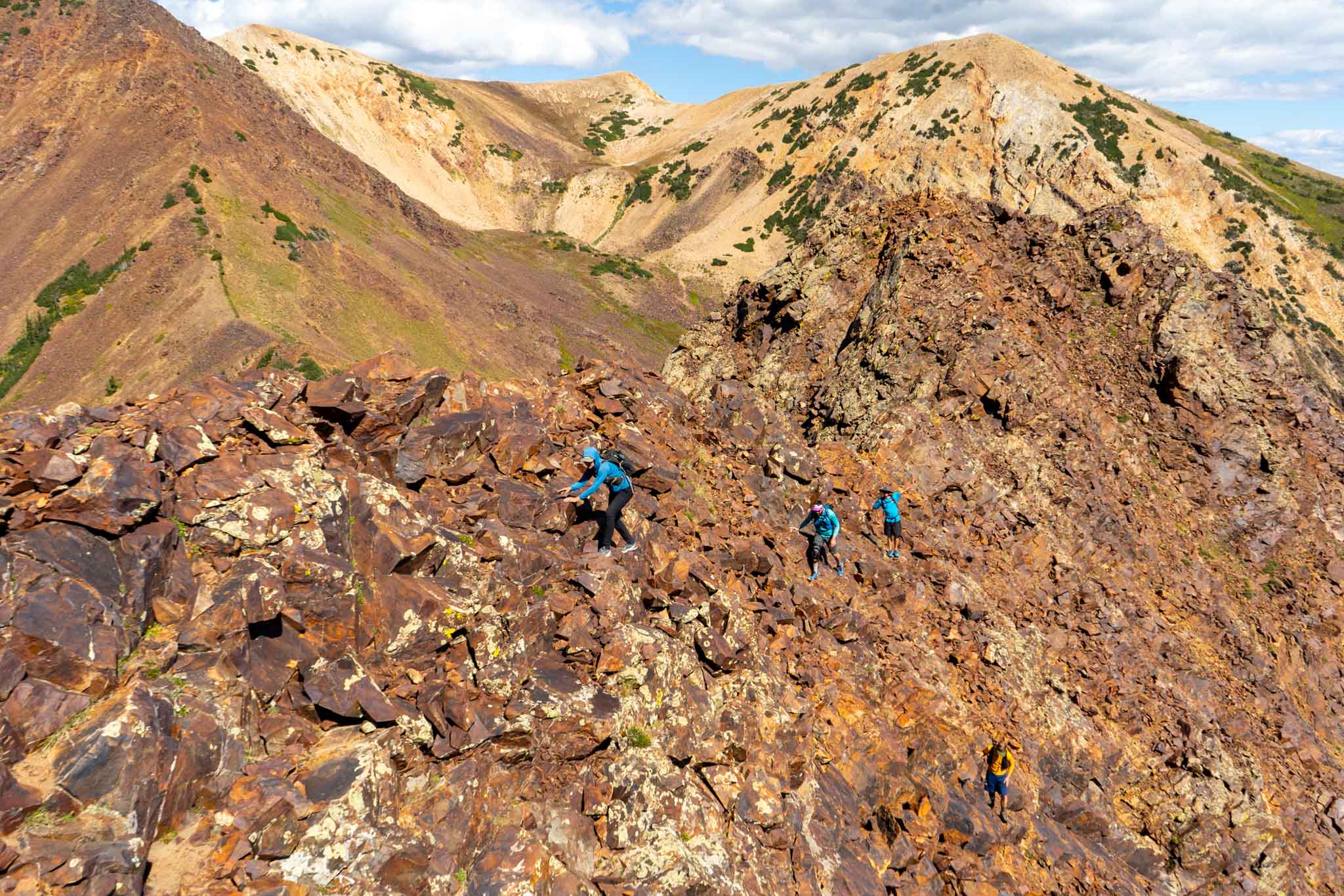
The sections listed below are sections that are noteworthy because of route finding or difficulty. We highly recommend that you, or at least one member of your group scouts / completes these locations before attempting the WURL. Before attempting the WURL, we would say at a minimum that you or a member of your group needs to have completed the following sections:
Twin Peaks To Dromedary
Dromedary to Superior
Devils Castle
Big Horn Peak To Lone Peak and Notch descent
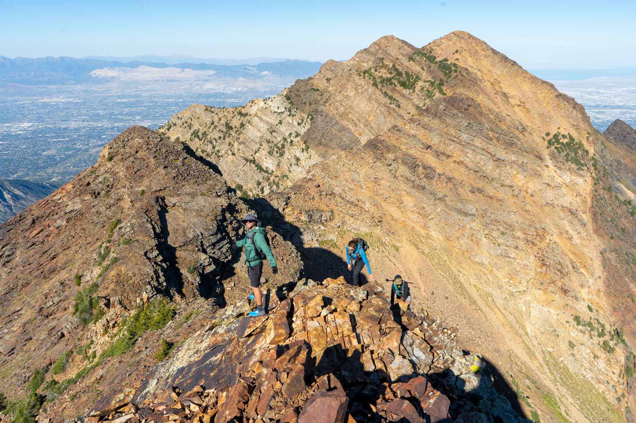
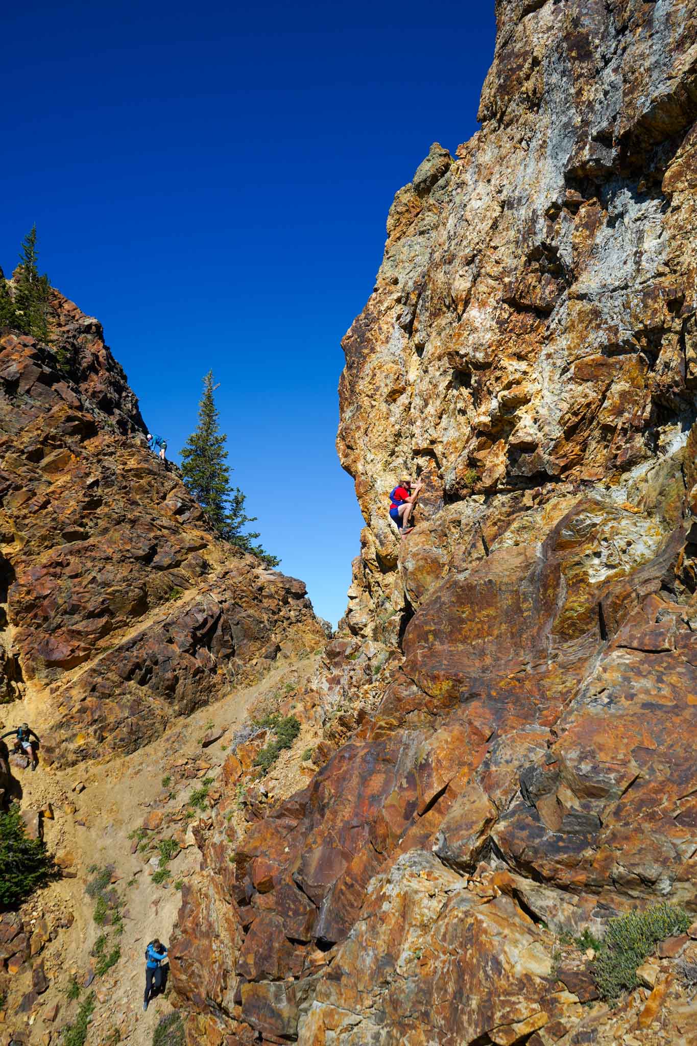
These sections require lots of route finding and exposed climbing / scrambling where extreme care is needed. Having a past experience on these sections will greatly help with route finding. These sections are time consuming, slow moving, and have high consequences.
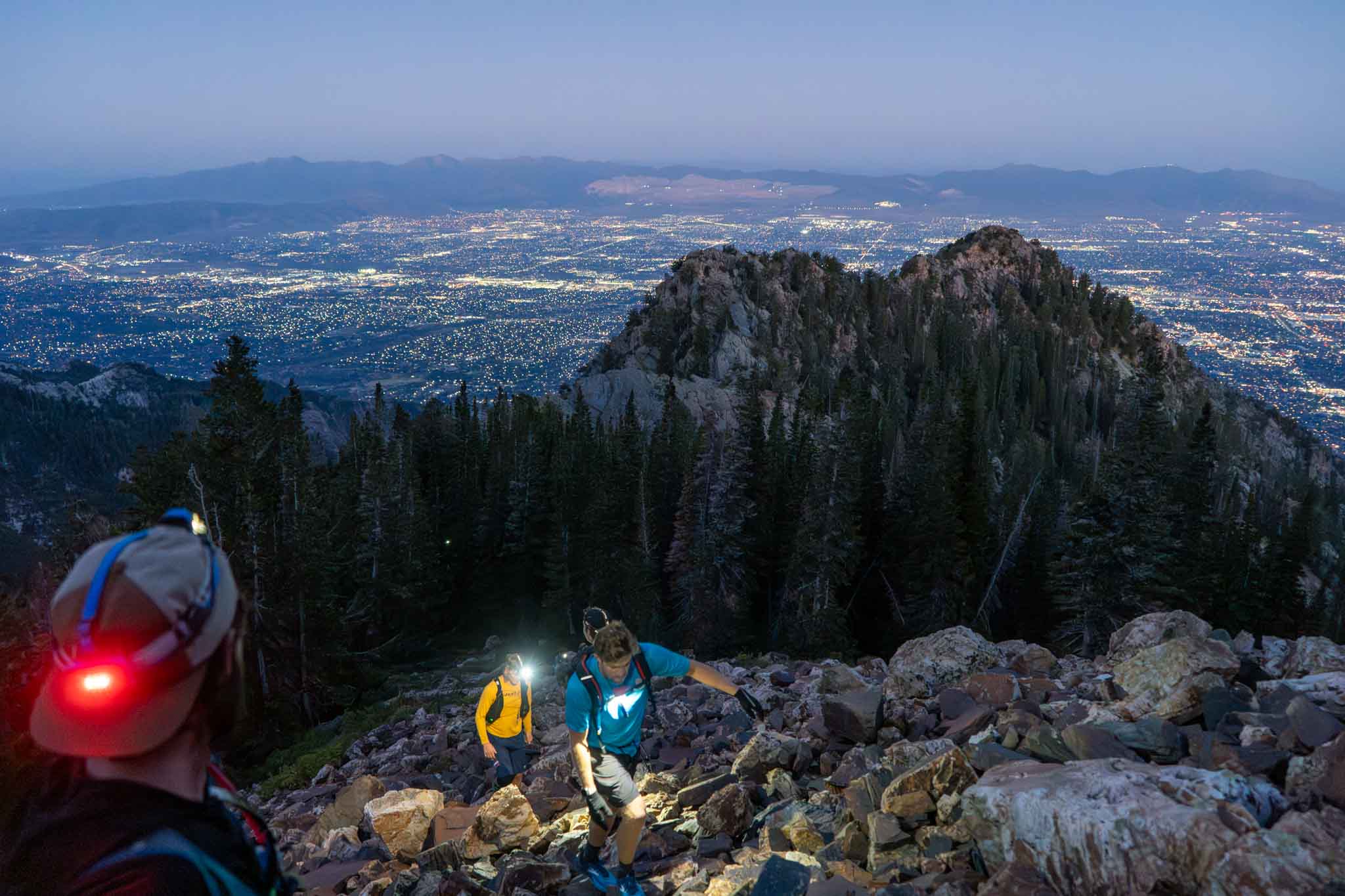
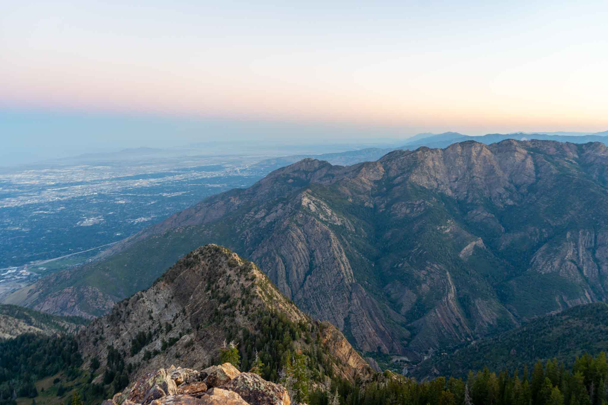
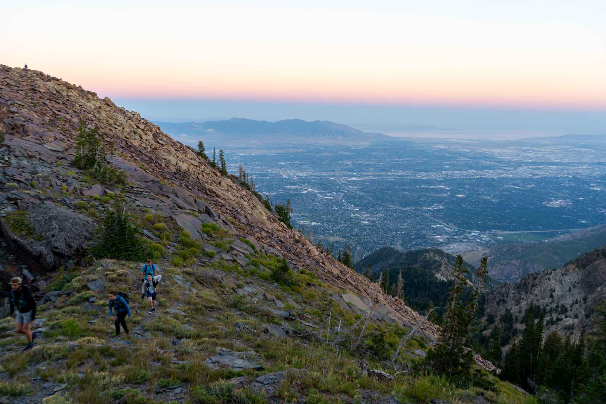
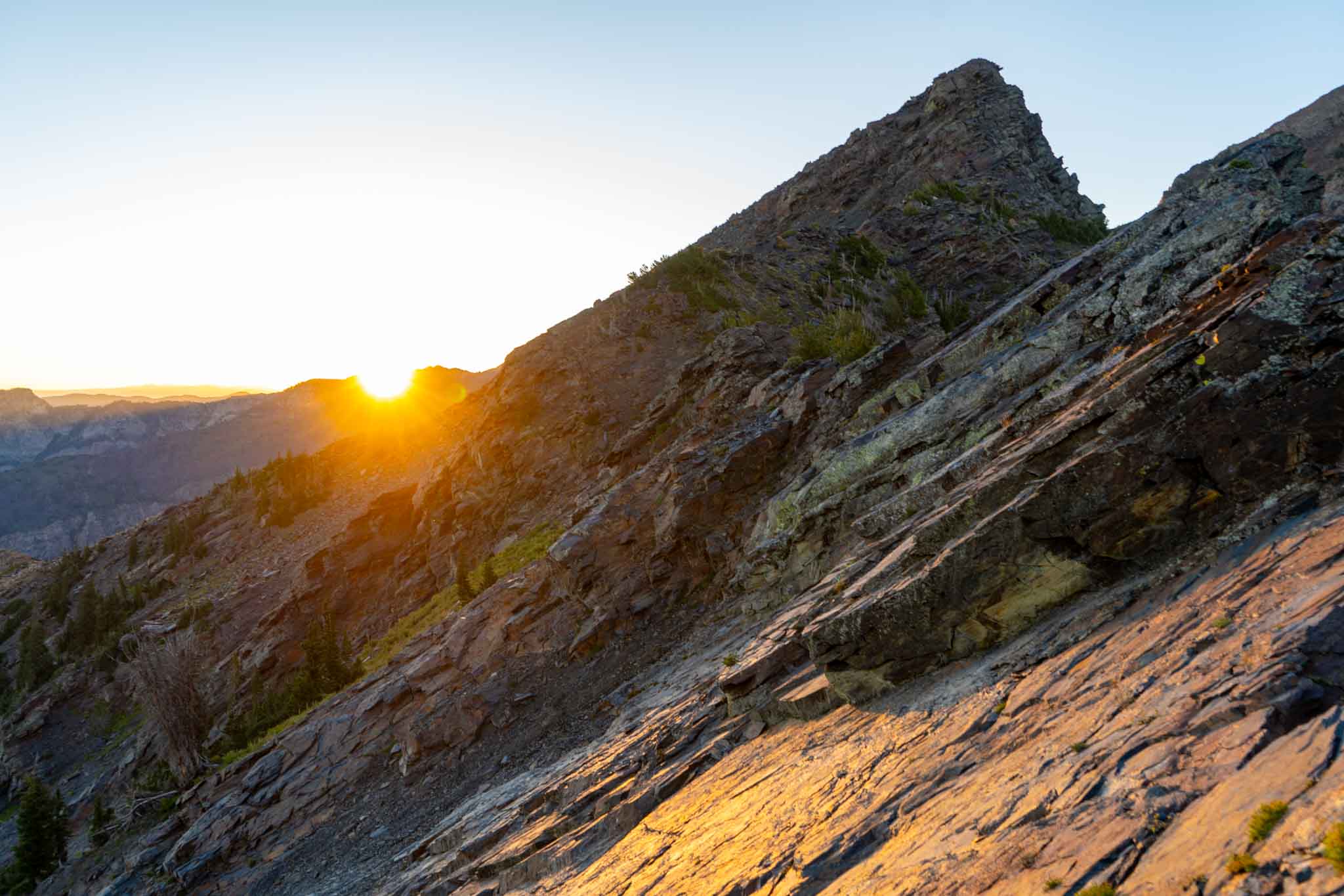
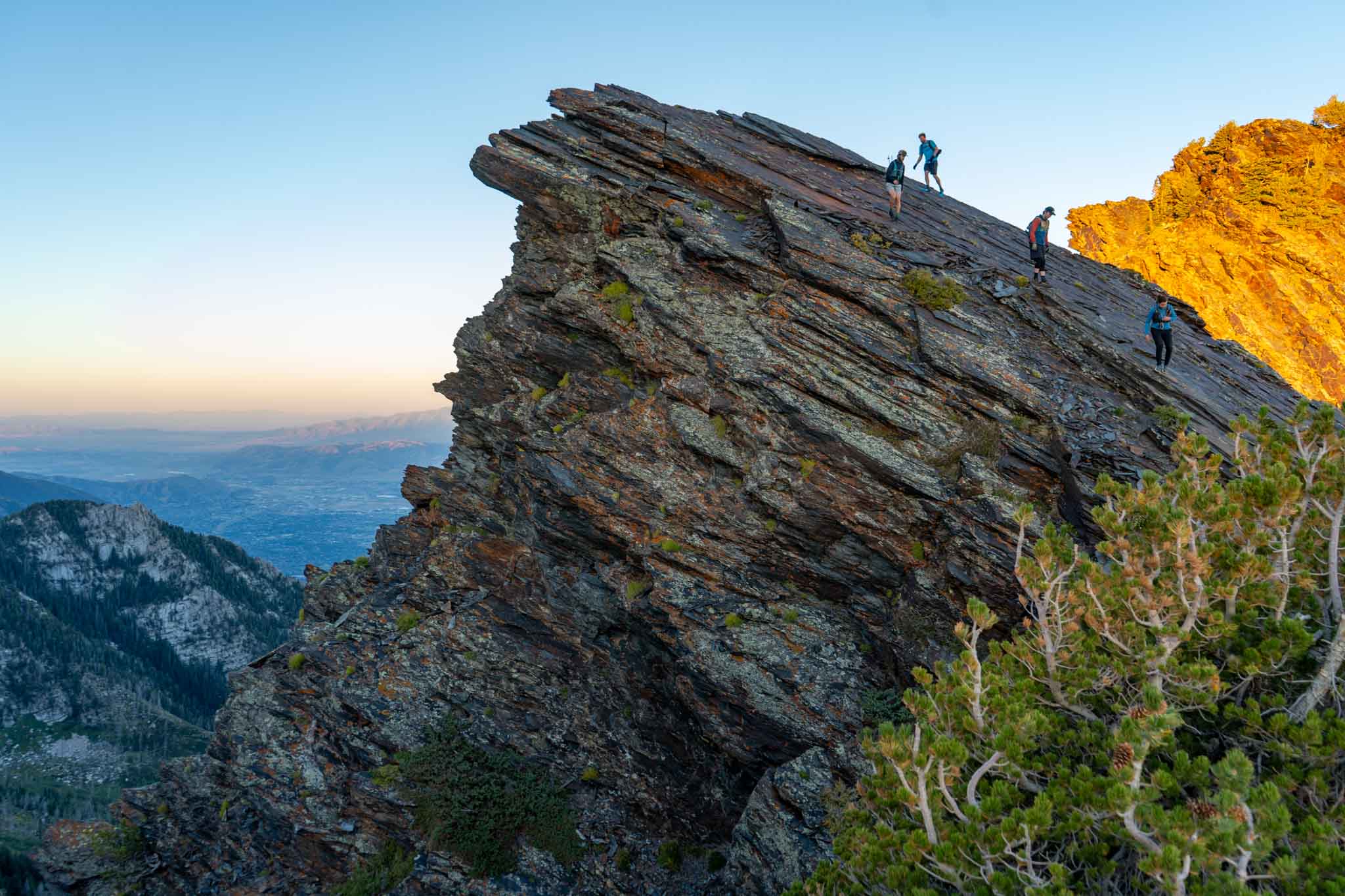
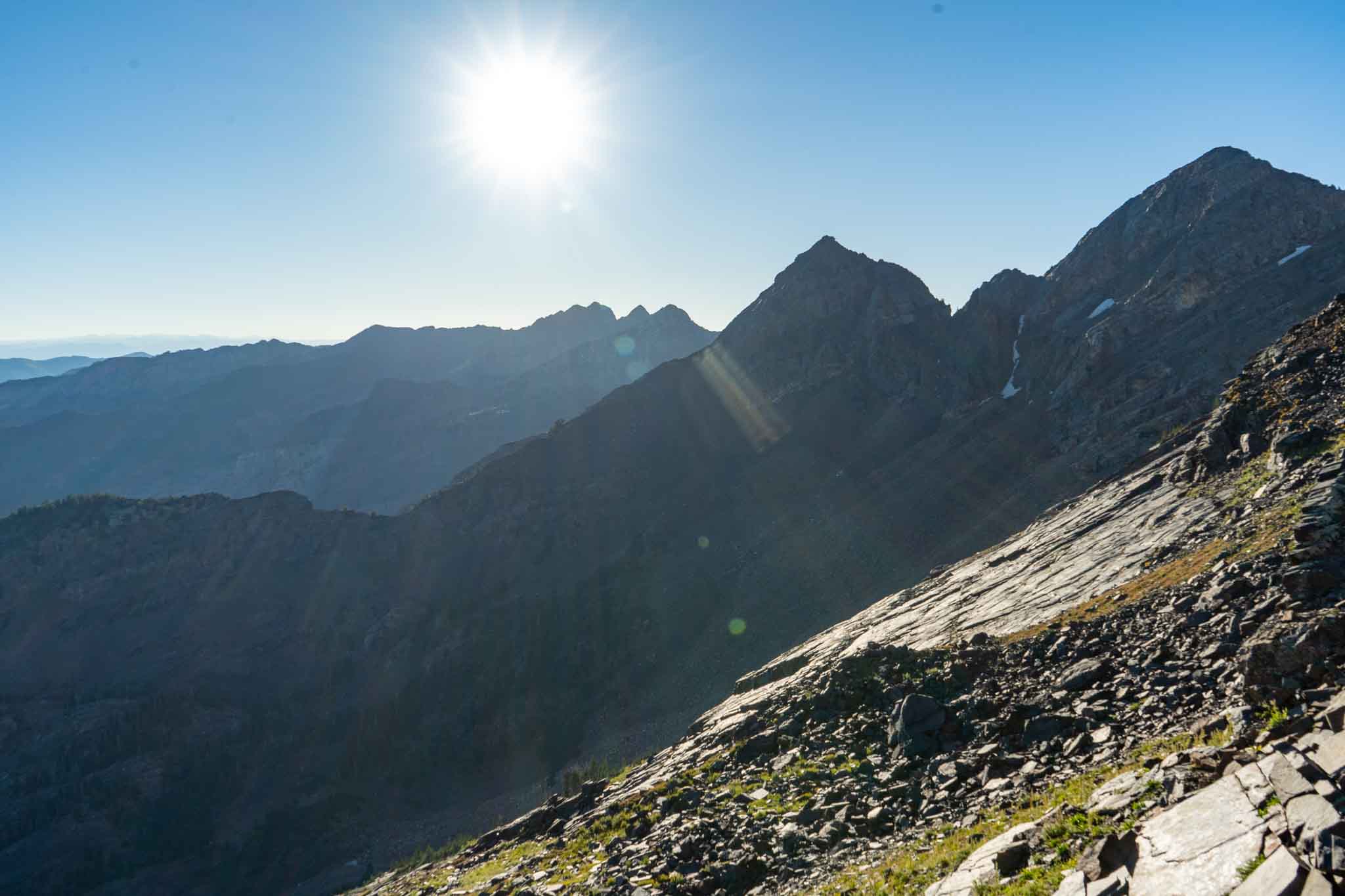
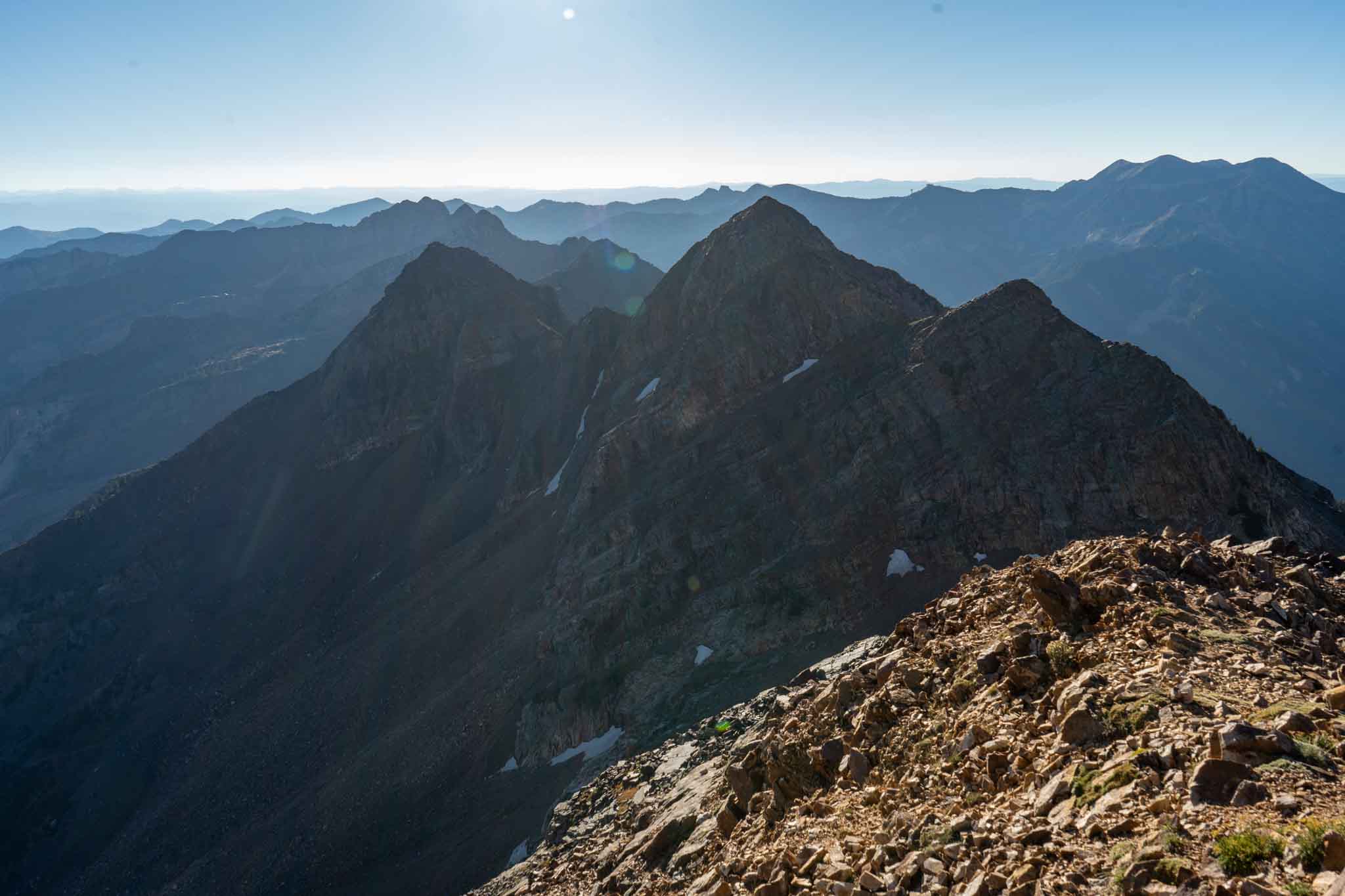
Route Description
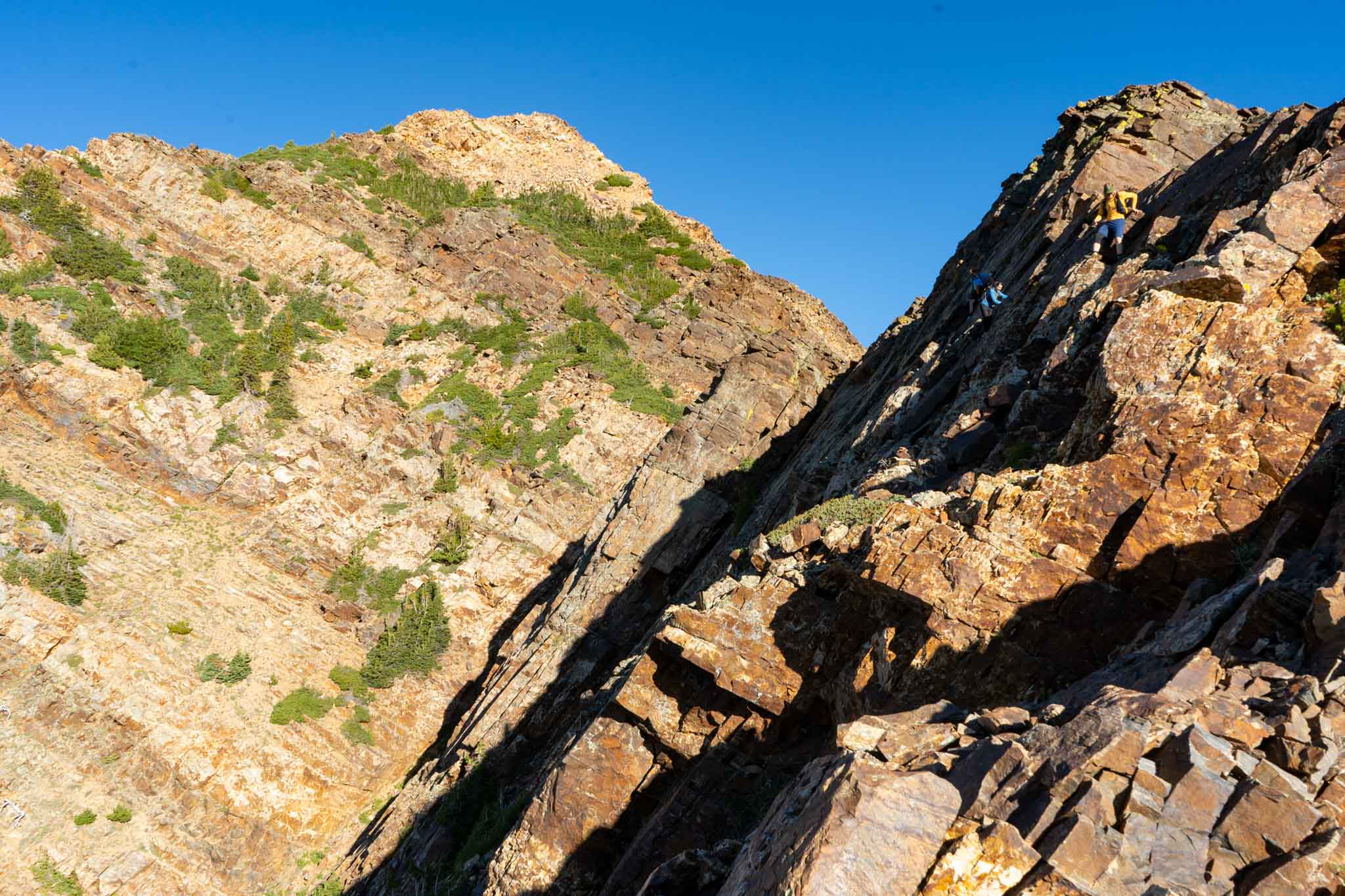
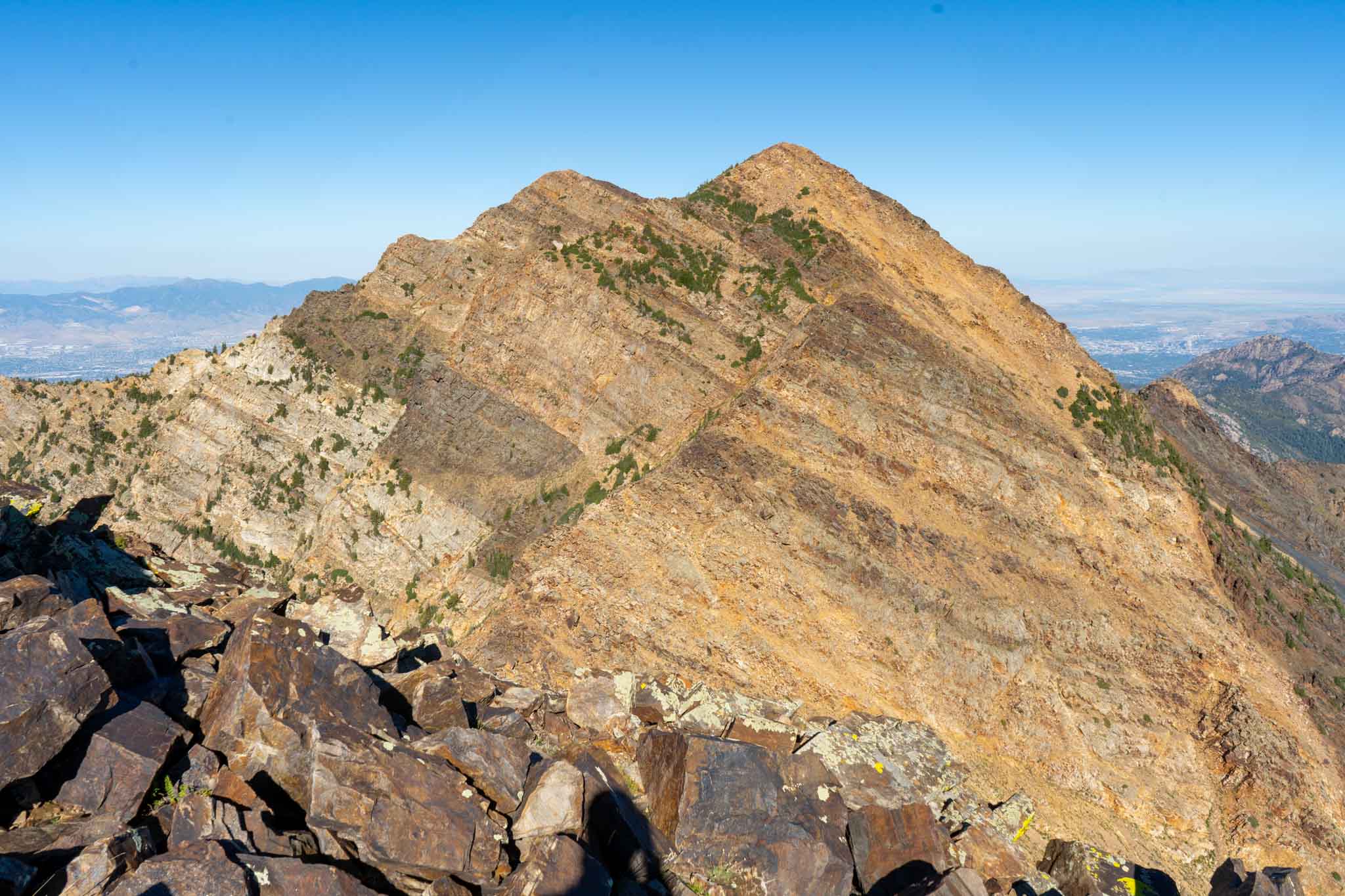
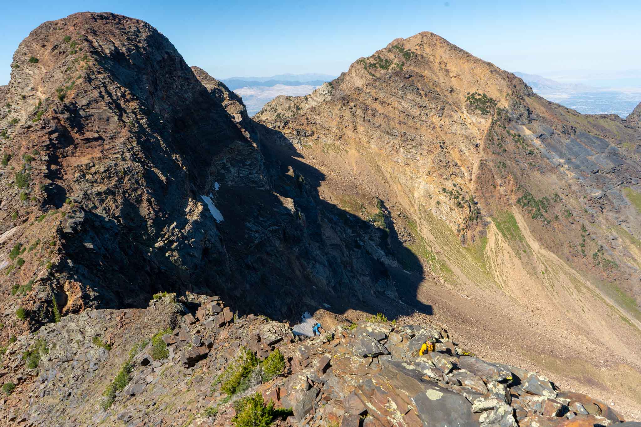
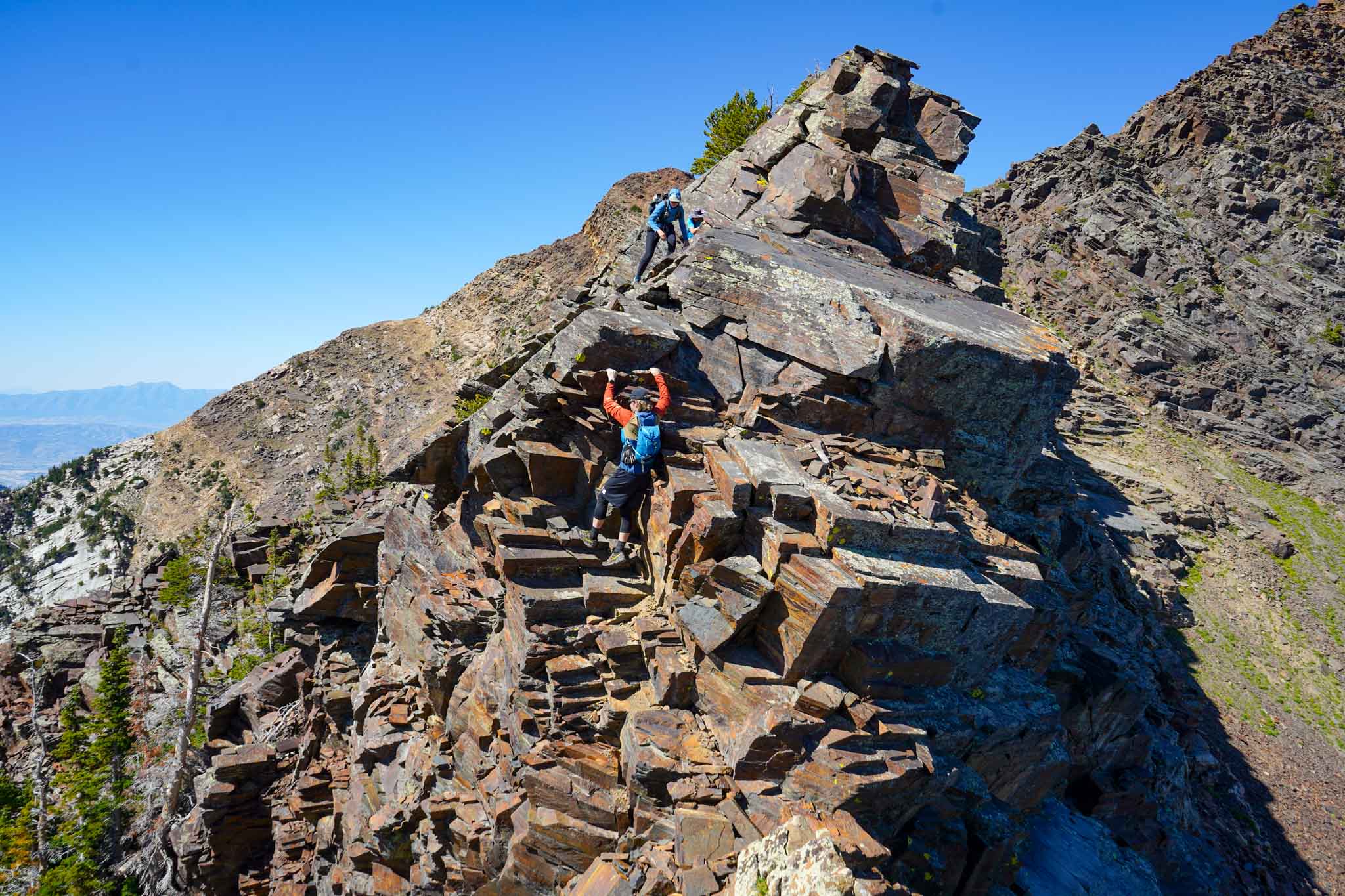
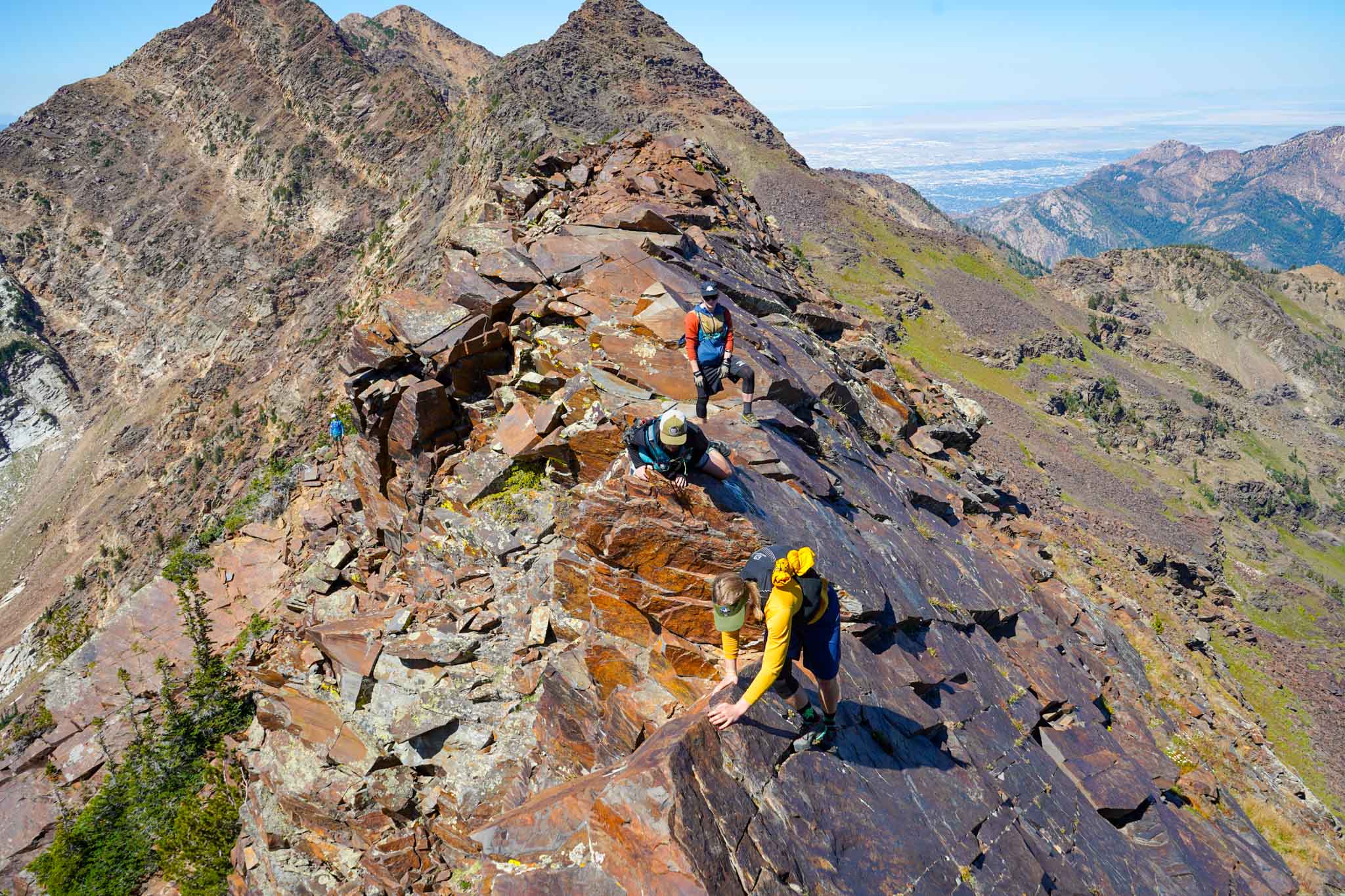
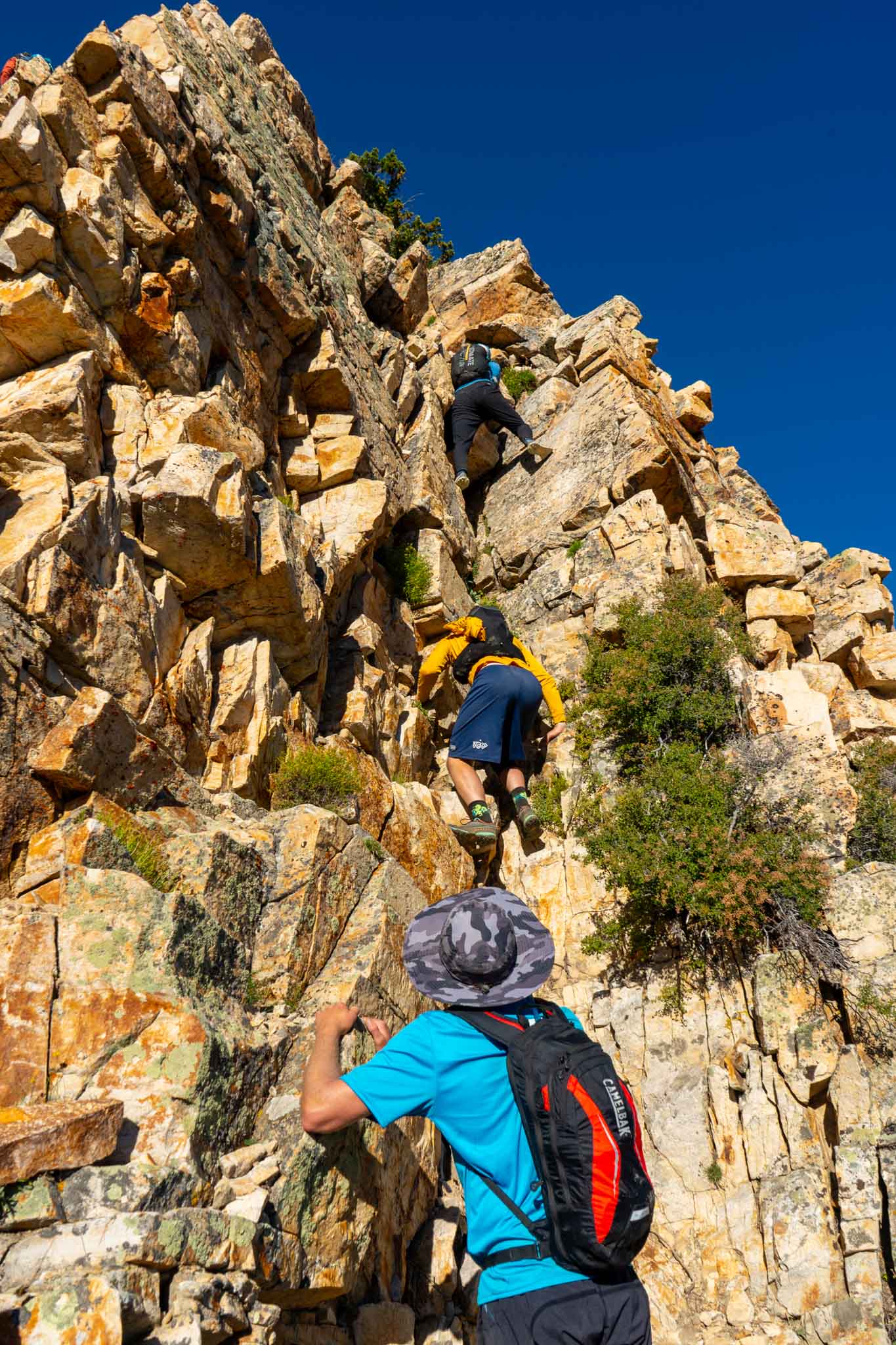
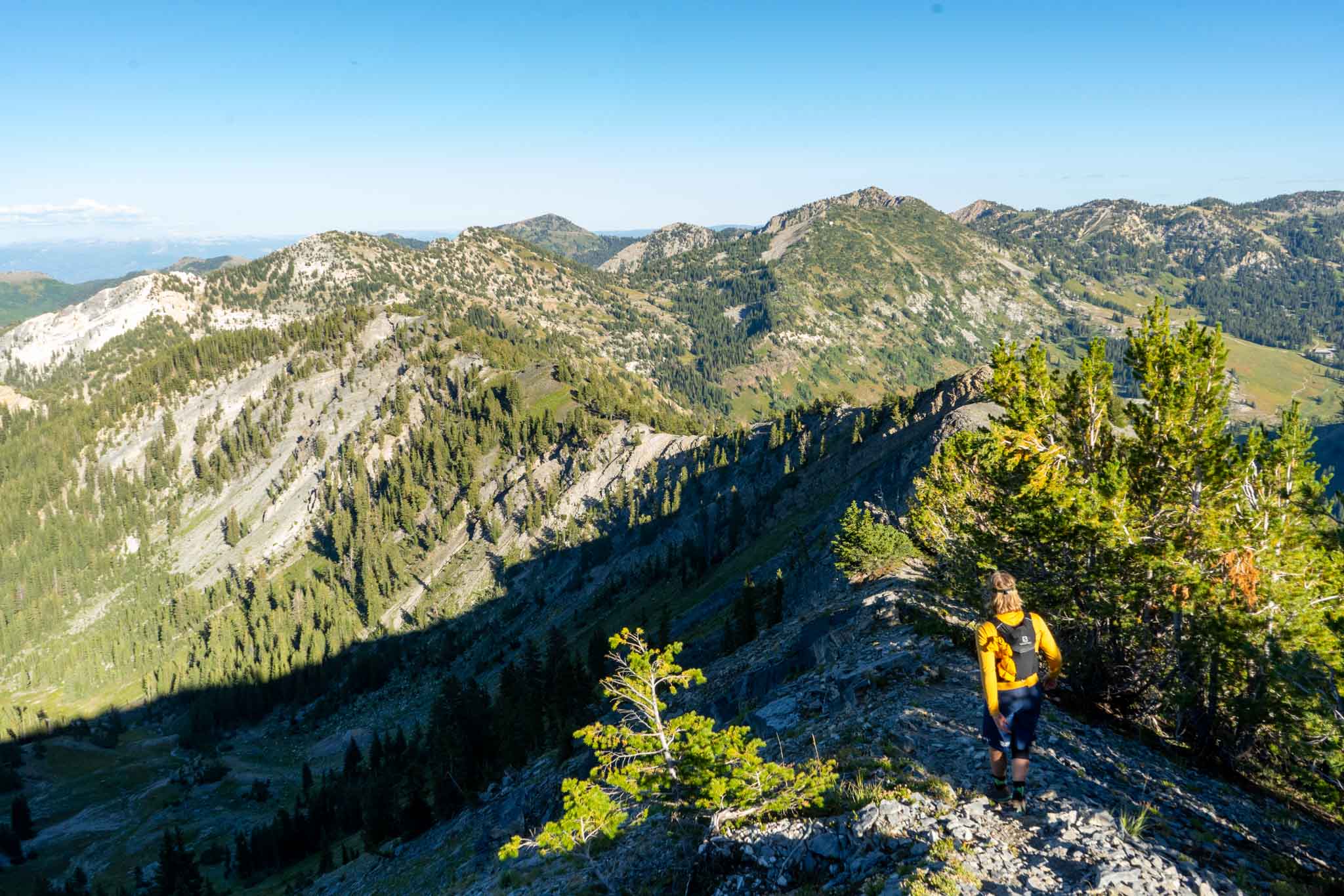
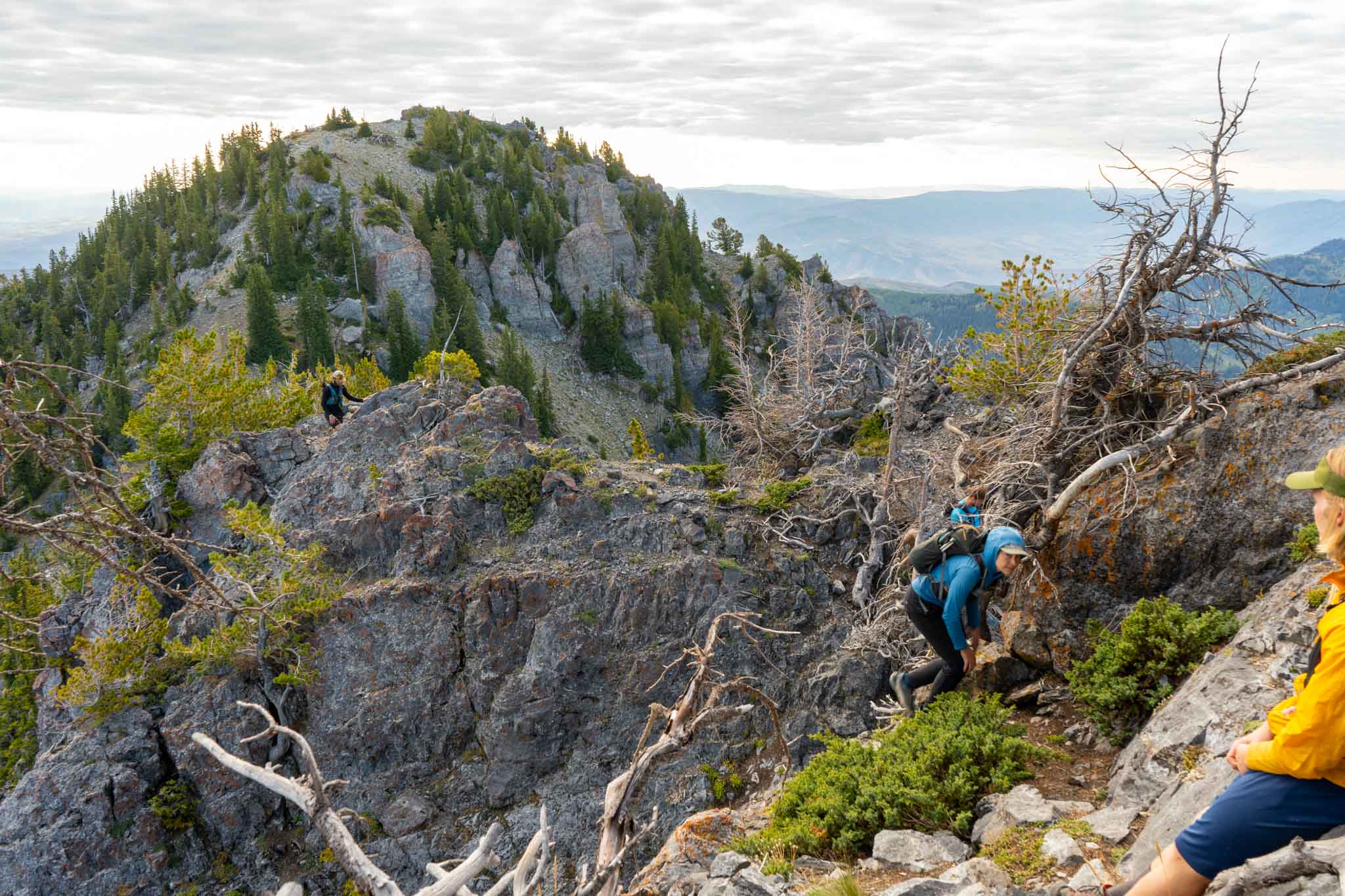
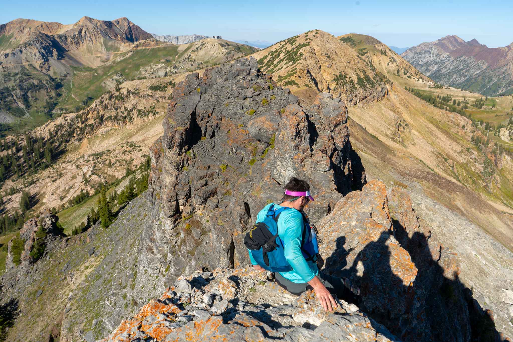
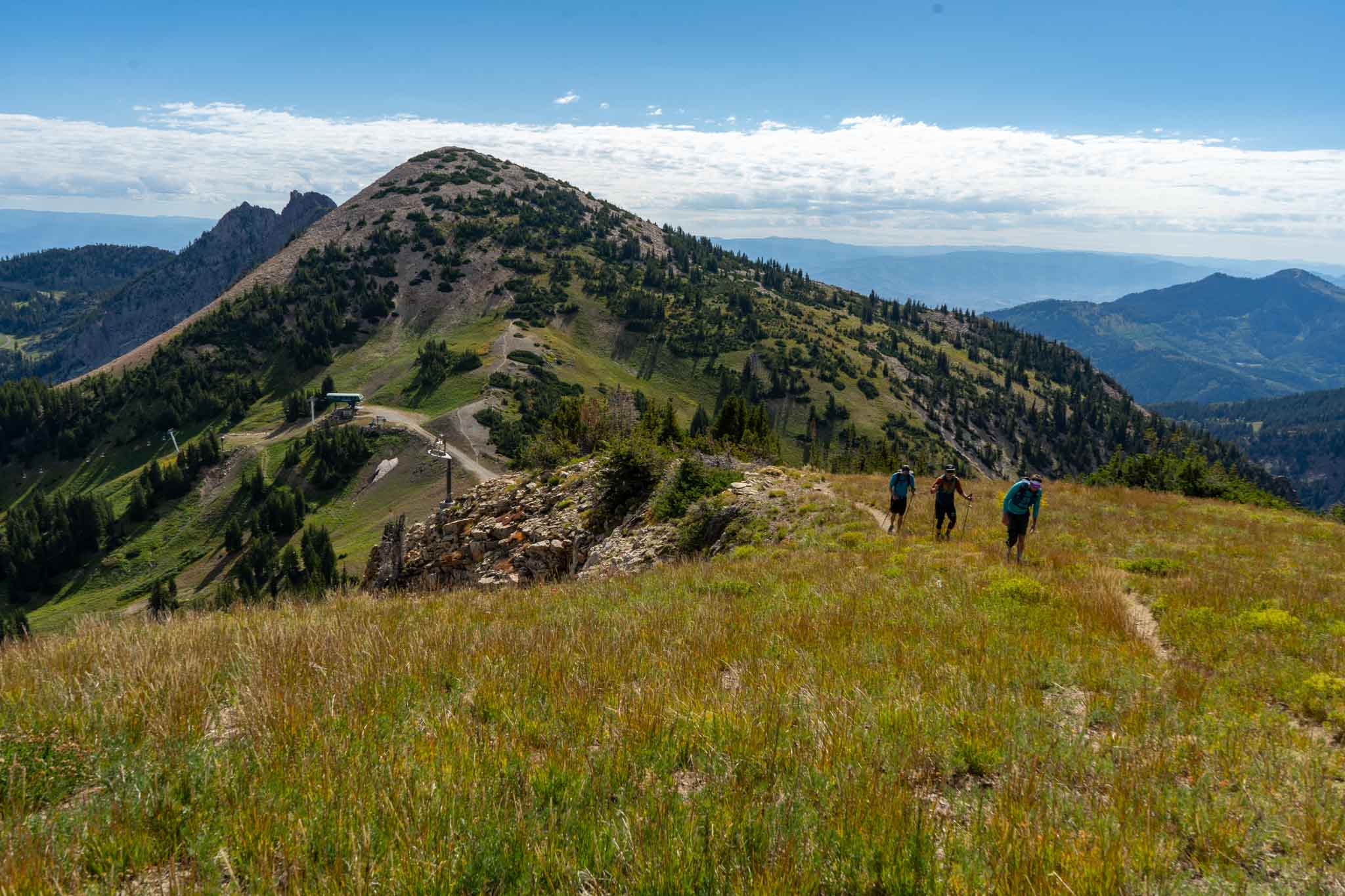
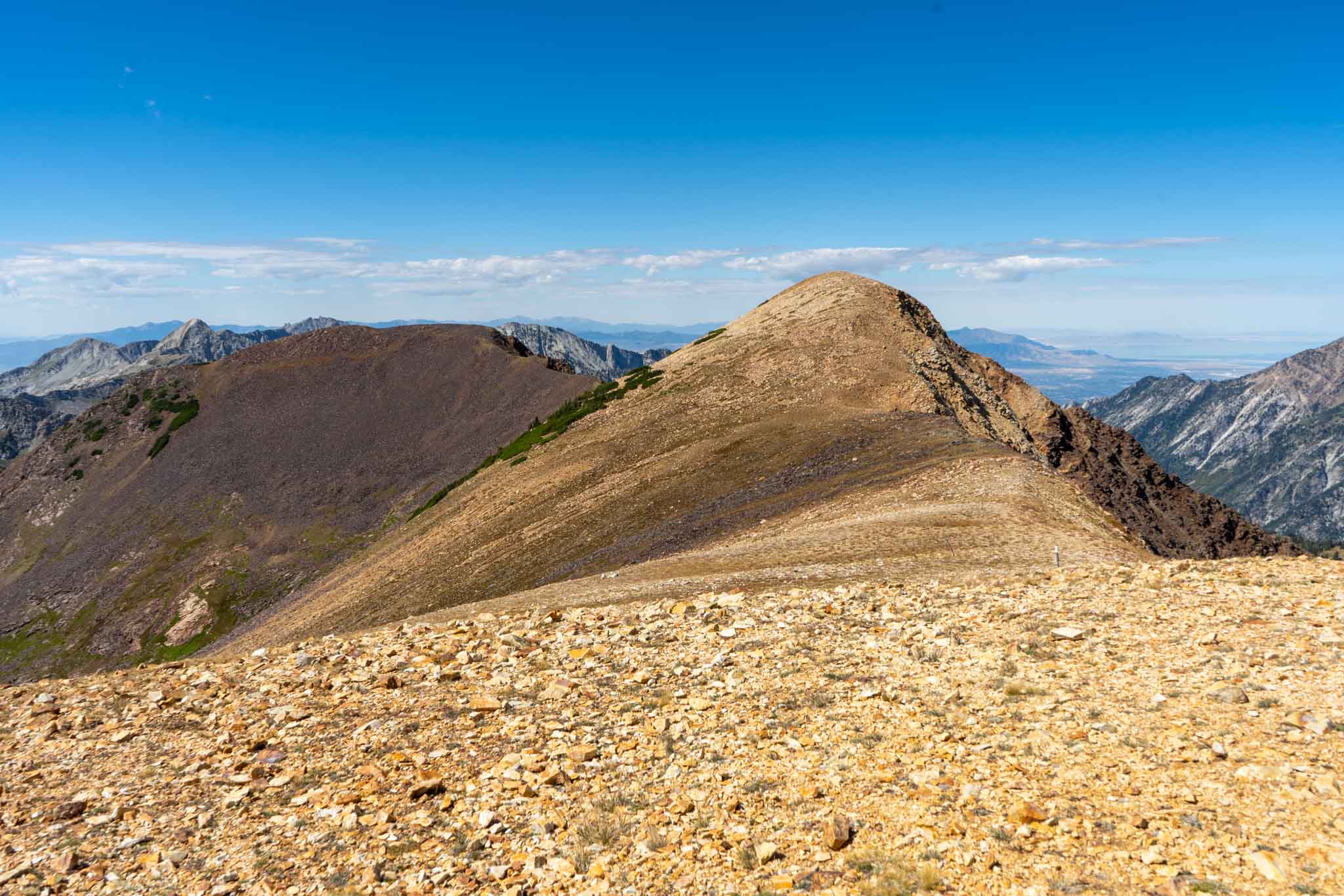
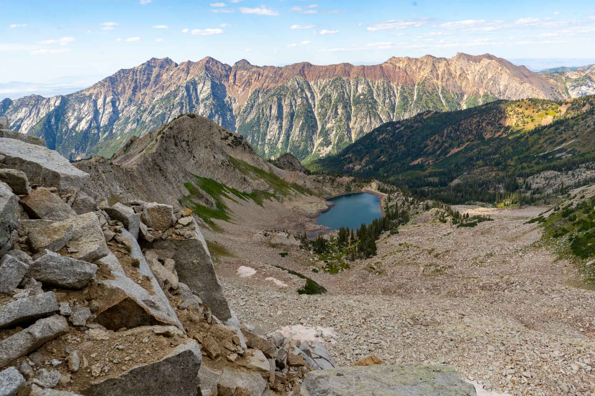
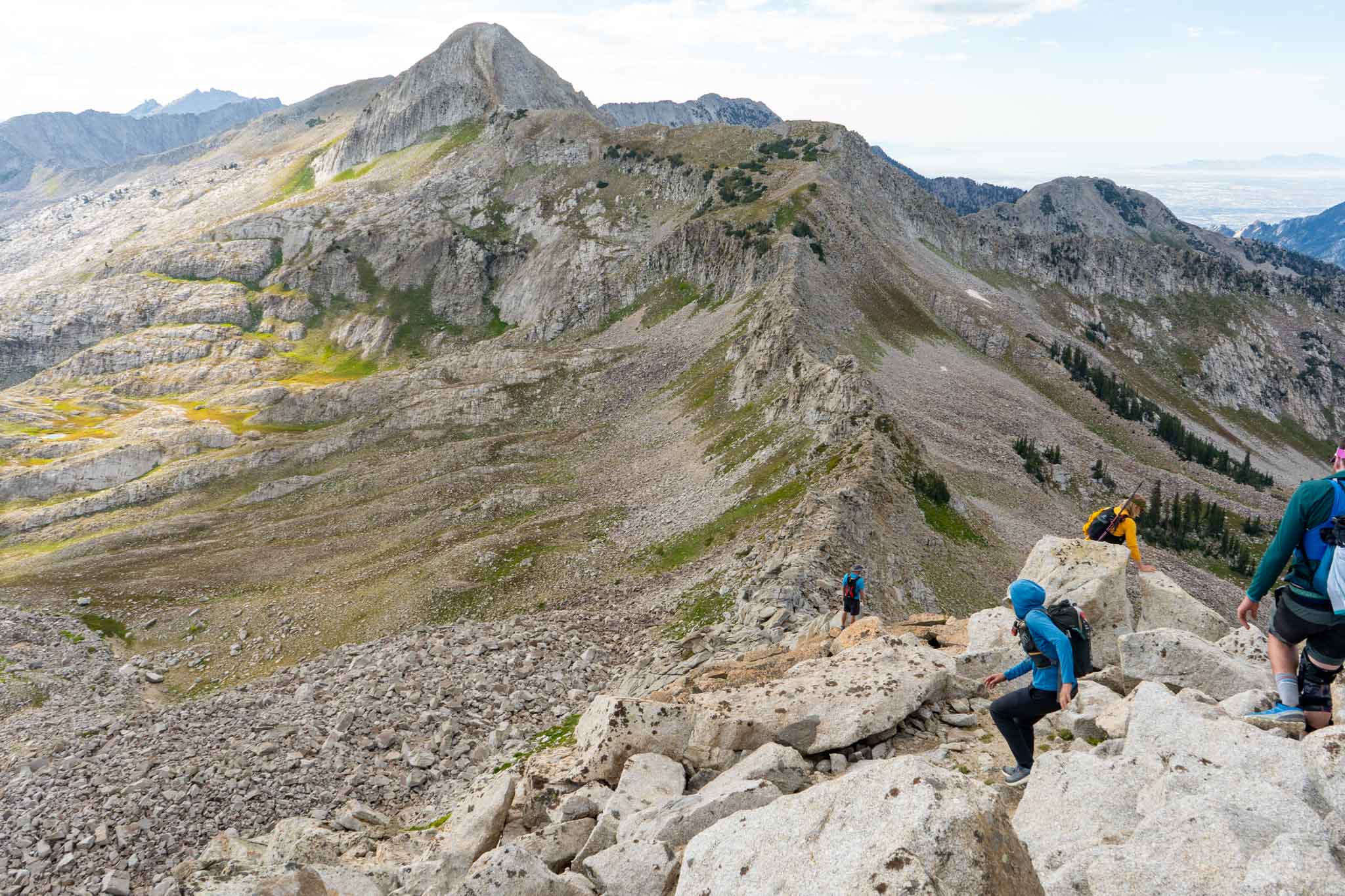
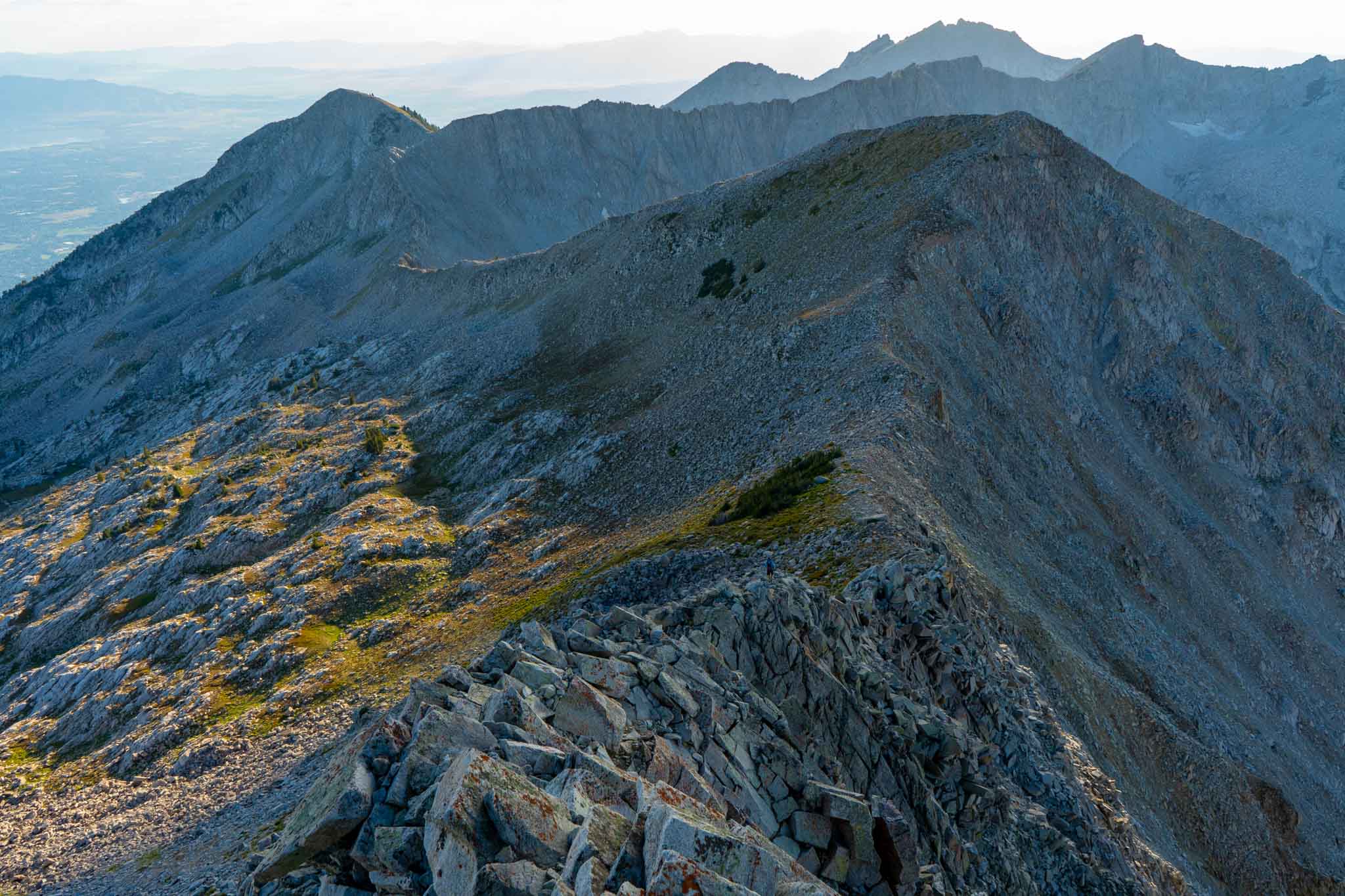
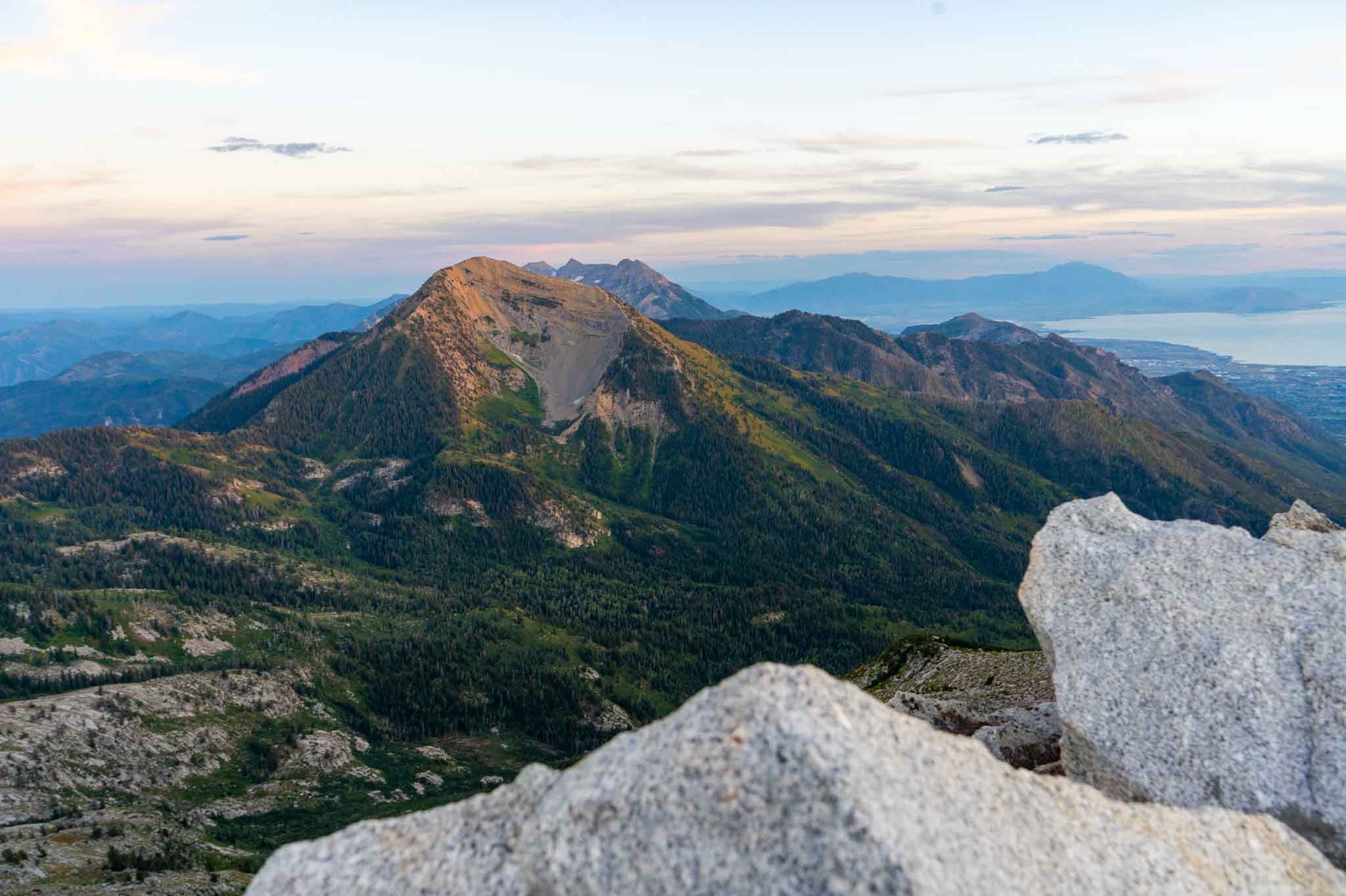
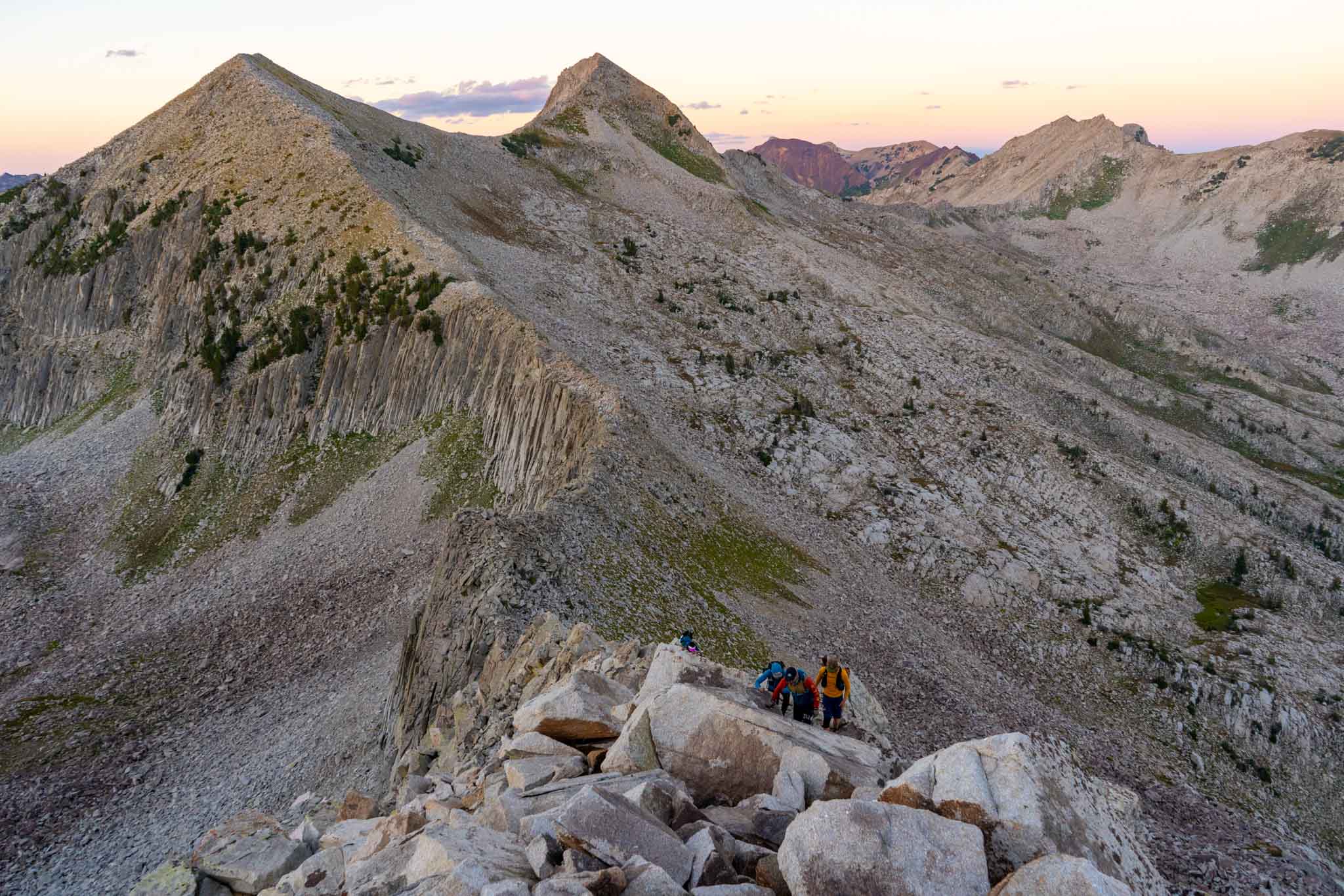
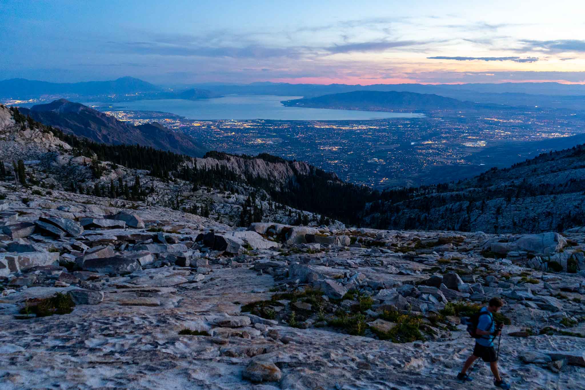
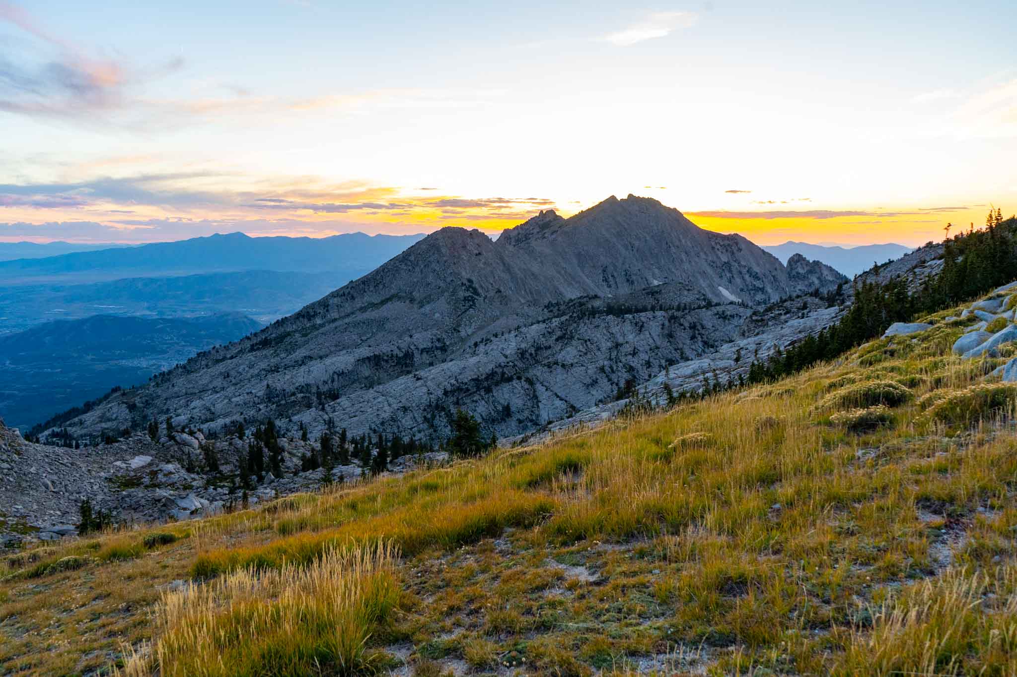
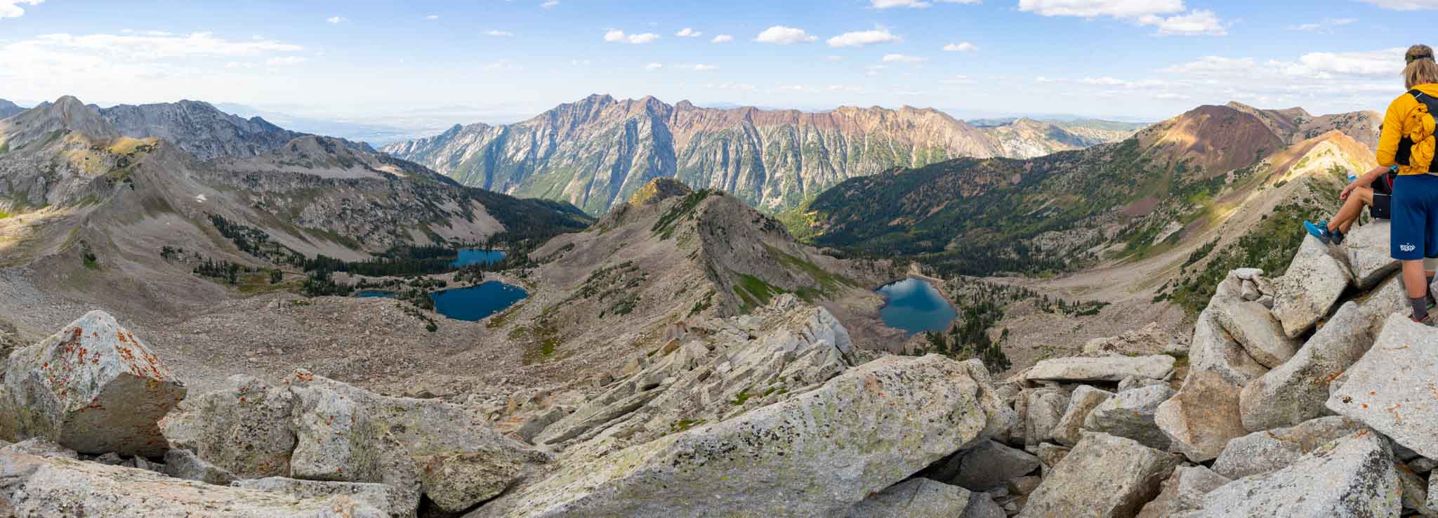
Below we have created a photograph gallery in order of the WURL for you to see sections, the views, and the route in some places.


")


WURL Videos
In preparation for the WURL, I watched a lot of videos as well. Here were my favorites:

Max DesMarais is the founder of hikingandfishing.com. He has a passion for the outdoors and making outdoor education and adventure more accessible. Max is a published author for various outdoor adventure, travel, and marketing websites. He is an experienced hiker, backpacker, fly fisherman, backcountry skier, trail runner, and spends his free time in the outdoors. These adventures allow him to test gear, learn new skills, and experience new places so that he can educate others. Max grew up hiking all around New Hampshire and New England. He became obsessed with the New Hampshire mountains, and the NH 48, where he guided hikes and trail runs in the White Mountains. Since moving out west, Max has continued climbed all of the Colorado 14ers, is always testing gear, learning skills, gaining experience, and building his endurance for outdoor sports. You can read more about his experience here: hikingandfishing/about
One Of The Hardest Things I've Ever Done
This route is just insanely epic. It was one of the hardest things i’ve ever done, featured some crazy difficult and dangerous terrain, was definitely a suffer fest, but something I will never forget.
Did you find this review helpful? Yes No