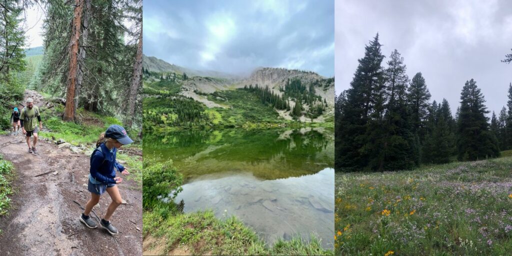
As the snow melts and spring turns to summer, Colorado paints the landscape with green aspens, winding rivers, and fields of wildflowers. Fourtneers lose their winter coat. Mountain passes open. Trails welcome runners, bikers, and dogs. Alpine lakes melt under the sun.
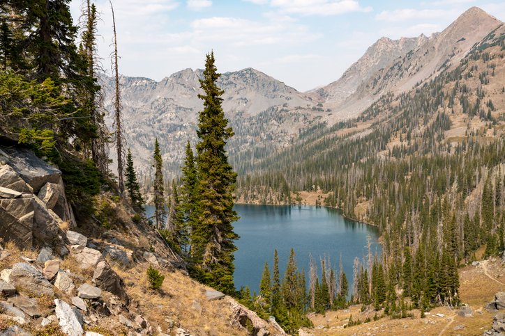
There are over 2,000 alpine lakes across the Centennial State. Some decorate roadsides with parking, while others are home in high country basins. Hiking to alpine lakes is the perfect way to experience a Colorado summer.
What is an alpine lake?
Alpine lakes sit at high altitudes in the mountainous zone. They are formed from glacial, volcanic, or landslide activity. Some Colorado lakes, like Green Lake in Crested Butte, have unique hues of jade and turquoise. This is a product of lakes formed from glacial activity that produces glacial silt. Glacial silt is sediment from ground-up rock created during glacial erosion. Scattered sunlight also helps the lakes erupt with color.
Front Range Colorado
Emerald Lake
Elevation Gain: 702 feet (214 meters)
Distance: 3.2 miles (5.1 kilometers)
Duration: 1 hour 40 minutes
Difficulty: Moderate
Type: Out & back
Trailhead: Bear Lake Trail
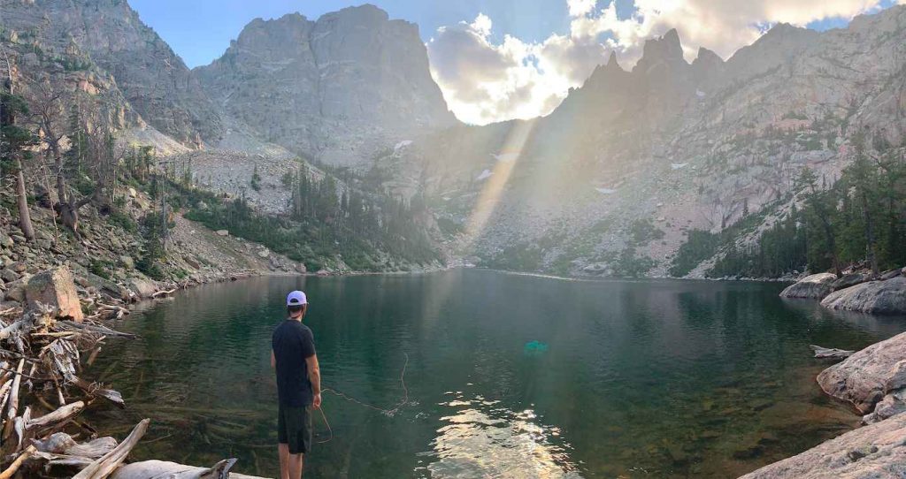
Emerald Lake is a rich green and blue high alpine lake in Rocky Mountain National Park. The trail leads you along or near four other lakes, Bear Lake, Nymph Lake, Dream Lake, and Lake Haiyaha (if you start at Glacier Gorge trailhead). Hallett Peak and Flattop Mountain reflect in the lake’s pristine waters. We love this hike as you can extend it to see some of the most beautiful lake hikes in one manageable day hike.
If you’re in the Front Range during the winter, snowshoe to Emerald Lake and experience what it’s like covered in ice and snow.
Before hiking Emerald Lake, be aware that you will pay a daily $30 entrance fee ($15 if you’re arriving on foot) to Rocky Mountain National Park. Like most hikes in the park, be prepared to arrive early for the best parking and to avoid the summer crowds.
Read More About This Hike Here
Chasm Lake
Elevation Gain: 2,552 feet (778 meters)
Distance: 8.0 miles (13 kilometers)
Duration: 7 hours
Difficulty: Hard
Type: Out & back
Trailhead: Longs Peak Ranger Station
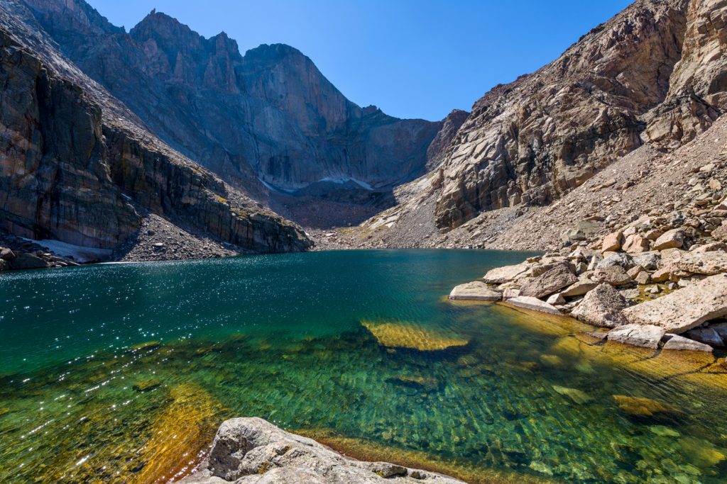
Longs Peak stands to the west, and Mount Lady Washington lies to the north with Chasm Lake at the base. The journey to Chasm Lake begins on East Longs Peak Trail at 9,405 feet. Trekking to Chasm Lake is a steady uphill climb for about four miles through Lodgepole pine, fir, spruce, and boulder fields. Along the way, hikers are gifted views of Peacock Pool and Columbine Falls.
Do you want to conquer Chasm Lake, Longs Peak, and the surrounding Rocky Mountain wilderness? Camp at Longs Peak Campground, Goblins Forest Backcountry Campground, or Boulder Fields.
Pro-tip: Try to catch the Chasm Lake hike at sunrise.
Read More About This Hike Here
Lake Isabelle
Elevation Gain: 751 feet (229 meters
Distance: 4.46 miles (7.18 kilometers)
Duration: 3 hours 30 minutes
Difficulty: Moderate
Type: Out & back
Trailhead: Long Lake Trailhead
Lake Isabelle is south of Rocky Mountain National Park in the Indian Peaks Wilderness. It’s an expansive high alpine lake nestled below Niwot Ridge. Niwot Ridge includes Navajo Peak, Navajo Glacier, Apache Peak, and Shoshoni Peak.
The hike to Lake Isabelle travels through pine forest, a moose haven. Along the way, you can take side hikes to Long Lake. Beyond Lake Isabelle, you can hike to waterfalls and Navajo Glacier.
The road to Long Lake Trailhead is only open in the summer (though a longer approach can be done in winter), and it’s popular. Arrive early and you need to reserve a parking spot (see details in link below).
Read More About This Hike Here
Crater and Mirror Lake
Lone Eagle Peak seen from a small pond before Crater Lake
Elevation Gain: 3,027 feet (923 meters)
Distance: 14.6 miles (23.5 kilometers)
Duration: 8 hours 30 minutes
Difficulty: Hard
Type: Out & back
Trailhead: Monarch Lake Trailhead
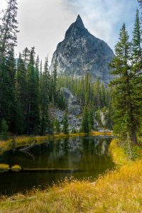
Crater Lake is one of the best hikes in Colorado for alpine lakes. It features three lakes, including Crater Lake, Mirror Lake, and Monarch Lake. This Indian Peaks Wilderness trail travels through aspen groves, moose territory, and waterfalls. It leads you all the way to Crater Lake, where Lone Eagle Peak pierces the landscape with its jagged edge.
While you can hike Crater and Mirror Lake in a day, you should go through the permit system and stay overnight at Crater Lake. Follow the northern shoreline of Crater Lake for the best campsite in the entire Indian Peaks Wilderness.
Read More About This Hike Here
Northern Colorado
Gilpin Lake
Elevation Gain: 2,390 feet (728 meters)
Distance: 11 miles (17.7 kilometers)
Duration: 7 hours
Difficulty: Moderate
Type: Loop
Trailhead: Slavonia Trailhead
Gilpin Lake is in the Mount Zirkel Wilderness Area near Steamboat Springs, Colorado. The sizeable clear alpine lake is etched into the Rockies with views of Big Agnes Mountain and Mt. Zirkel. Other highlights on this trek are the abundance of wildflowers, aspen groves, snapshots of the Continental Divide, a 35-foot waterfall, and Gold Creek Lake.
The best time to do this hike is mid-July, when the wildflowers are exploding, and the creek crossings are less daunting.
Read More About This Hike Here
Central Colorado
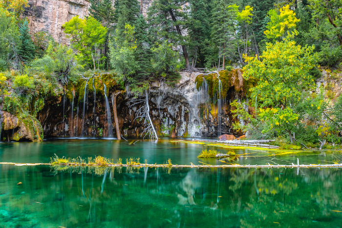
Hanging Lake
Elevation Gain: 1,187 feet (362 meters)
Distance: 2.4 miles (3.9 kilometers)
Duration: 1 hour 45 minutes
Difficulty: Moderate
Type: Out & back
Trailhead: Hanging Lake Trailhead
You will find Hanging Lake in White River National Forest in Glenwood Canyon. It’s known for its mossy-green hue and rushing waterfalls. In 2011, the National Park Service deemed it a National Natural Landmark for its unique geology and formation. It’s also known as one of the largest hanging plant communities.
Although this hike is short, it’s steep and rocky as it pushes further into Glenwood Canyon and Deadhorse Creek Canyon. Before you plan this hike, be prepared to purchase a hiking permit.
Read More About This Hike Here
Cathedral Lake
Elevation Gain: 1,986 feet (605 meters)
Distance: 5.6 miles (9 kilometers)
Duration: 4 hours 30 minutes
Difficulty: Intermediate
Type: Out & back
Trailhead: Cathedral Lake Trailhead
Hiking to Cathedral Lake is a religious experience. The picturesque lake is in the high alpine near Aspen. The well-maintained trail features aspen groves, waterfalls, rushing water, and beautiful landscape snapshots. If time and weather allow, take the right detour for Electric Pass. Here you will be rewarded with panoramic views of the Maroon Bells Wilderness.
The trek to Cathedral Lake begins on aspen-lined Castle Creek Road. Exploring the Ashcroft ghost town is worth the post-hike adventure.
Read More About This Hike Here
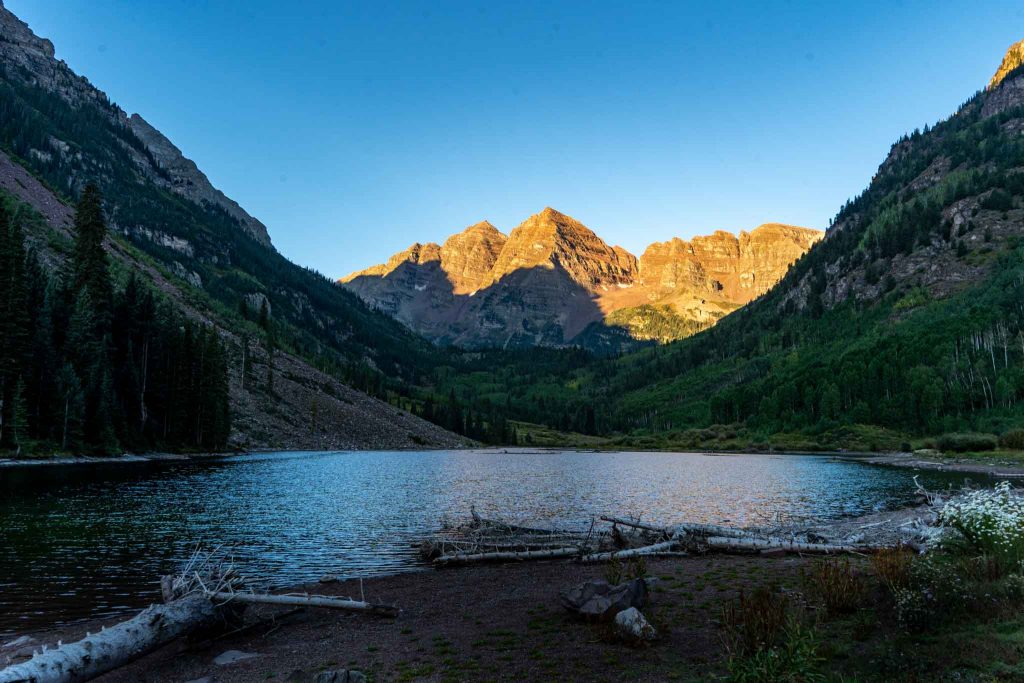
Maroon Lake
Elevation Gain: 160 feet (49 meters)
Distance: 1.9 miles (3.1 kilometers)
Duration: 45 minutes
Difficulty: Easy
Type: Loop
Trailhead: Maroon Lake Trailhead
Towering mountains overlook the White River National Forest landscape blending into Maroon Lake. The surrounding scenery makes the Maroon Bells the most photographed mountains in Colorado.
The two-mile jaunt to Maroon Lake near Aspen is the best bang for your buck hike in the entire state. It is an accessible way to experience the 300 million-year-old lake sculpted by Ice Age glaciers. The best time to visit Maroon Lake is in September and October when the Aspens explode with autumnal color.
About 1.5 miles further on Maroon Lake Trail is Crater Lake. Crater Lake is just as beautiful and less popular.
Read More About This Hike Here
Snowmass Lake
Elevation Gain: 3,873 feet (1180 meters)
Distance: 16.6 miles (3346.7 kilometers)
Duration: 12 hours
Difficulty: Hard
Type: Out & back
Trailhead: Maroon Snowmass Trailhead
Have you ever seen a more beautiful high-alpine lake than Snowmass Lake? Looming ridgelines, massive cliffs, piercing Snowmass Mountain, meandering wildlife, and designated camping await you at Snowmass Lake. Although, the hike to this wilderness area in White River National Forest is an undertaking. But, worth it.
The trail is home to wildflowers, views, water crossings, switchbacks, and significant elevation gains. This is a popular spot for backpacking in the summer. You don’t want to miss the opportunity to wake up to Snowmass Mountain meeting the morning sky.
Read More About This Hike Here
New York Lake
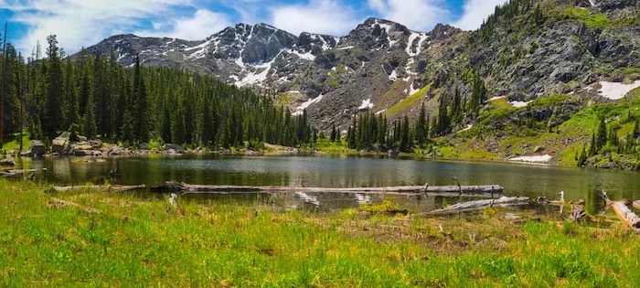
Image courtesy of Hiker.app
Elevation Gain: 2,352 feet (717 meters)
Distance: 9.1 miles (14.6 kilometers)
Duration: 5-6 hours
Difficulty: Hard
Type: Out & back
Trailhead: Forest Road 418
Are you searching for a difficult, route-finding hike with a picturesque alpine lake at the end? Then head to Edwards, Colorado, and tackle the New York Lake hike. This is a hard nine-mile out and back that is not well-trafficked.
The trail takes you over New York Mountain, which sits at 12,550 feet, and through Holy Cross Wilderness. It involves scrambling and navigating off-trail. Take proper precautions with a satellite device, plenty of water, and appropriate gear. If you’re up for the challenge, the remote and relatively untouched wilderness could be all yours for the day.
Read More About This Hike Here
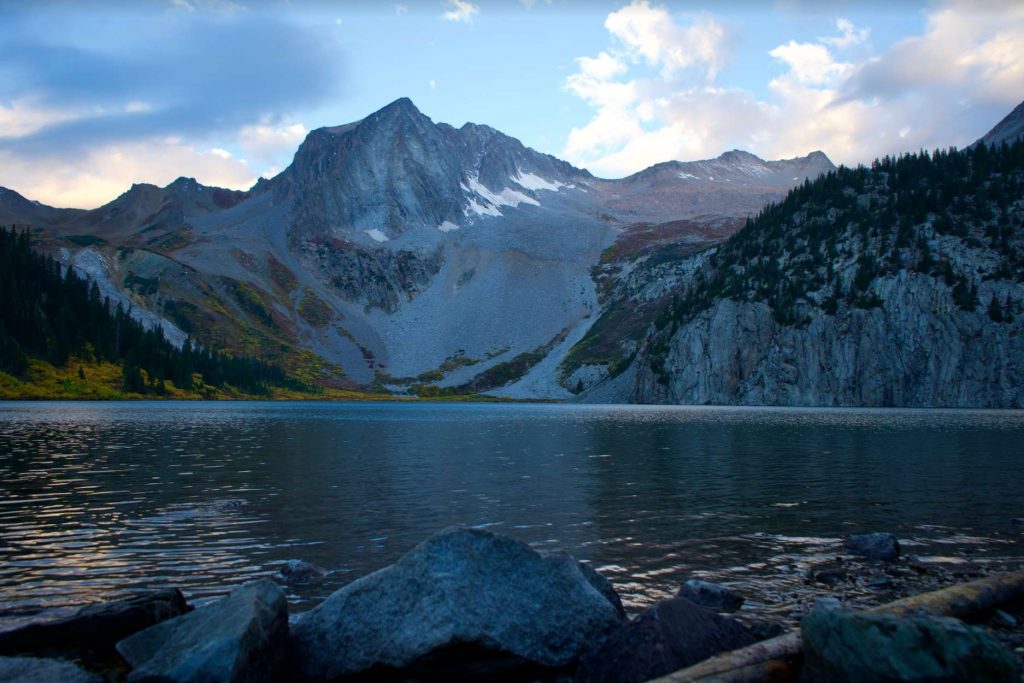
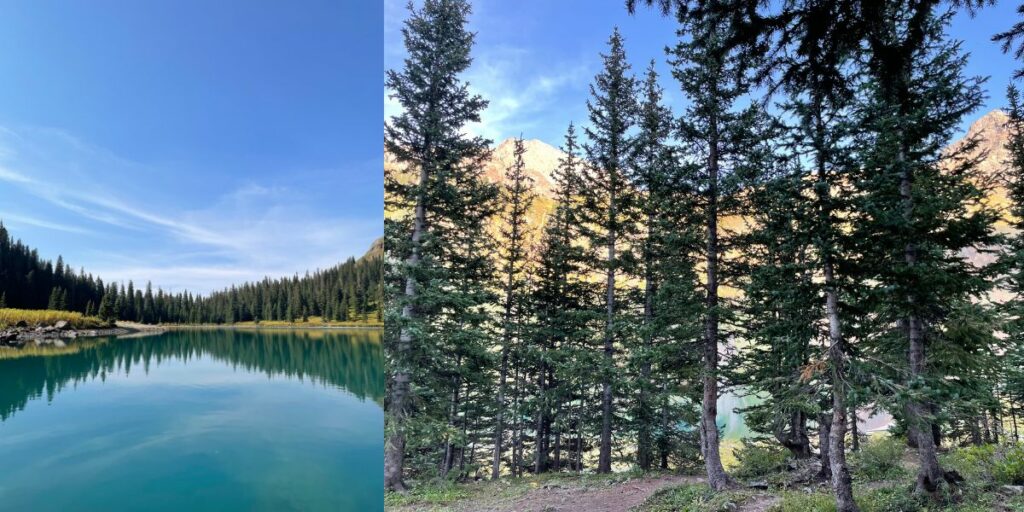
Green Lake
Green Lake, Colorado
Elevation Gain: 1,814 feet (553 meters)
Distance: 8.5 miles (13.7 kilometers)
Duration: 4 hours 20 minutes
Difficulty: Moderate
Type: Out & back
Trailhead: Green Lake Trailhead
If you’re staying in Crested Butte, hiking to Green Lake is an essential experience. You catch the trail right from Crested Butte’s Nordic Center. The 8.5-mile trek leads you through an aspen grove of switchbacks and meadows of wildflowers. The trail ends at Green Lake, which sits at the base of Mt. Axell. Green Lake is as green as the surrounding Gunnison National Forest.
To avoid crowds and thunderstorms, hike Green Lake earlier in the day.
Read More About This Hike Here
Southwest Colorado
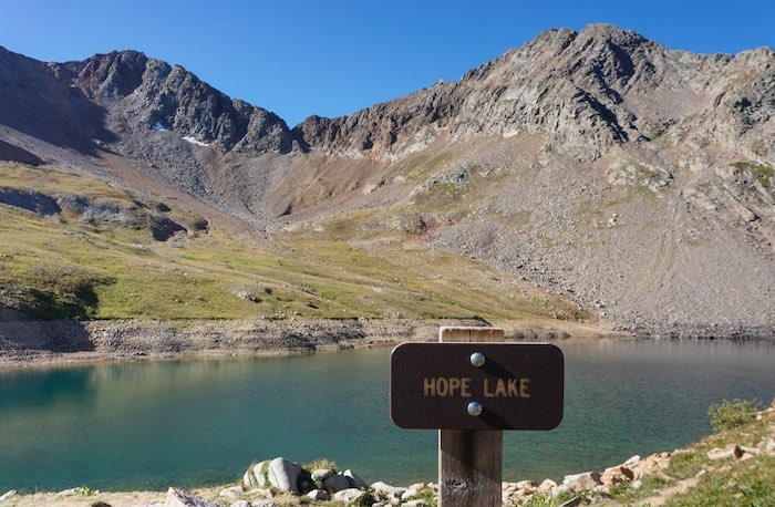
Hope Lake
Elevation Gain: 1,515 feet (157 meters)
Distance: 6.0 miles (9.7 kilometers)
Duration: 3 hours
Difficulty: Moderate
Type: Out & back
Trailhead: Lake Hope Trailhead
Hope Lake is tucked away in the San Juan Mountains. Most alpine lake hikes in this region are beautiful but hard with significant elevation gains. Hope Lake is a moderate hike with views and surrounding wilderness just as beautiful as the lakes in the area. This trek features switchbacks lined with wildflowers, views of the Wilson Range, creek crossings and waterfalls, and a high alpine lake framed by the San Juan Mountains.
Hope Lake is a 15-minute drive from Telluride near Trout Lake. You can drive to Trout Lake and paddleboard, swim, and fish. Established campgrounds and primitive camping sites are near Trout Lake and Hope Lake’s trailhead.
Read More About This Hike Here
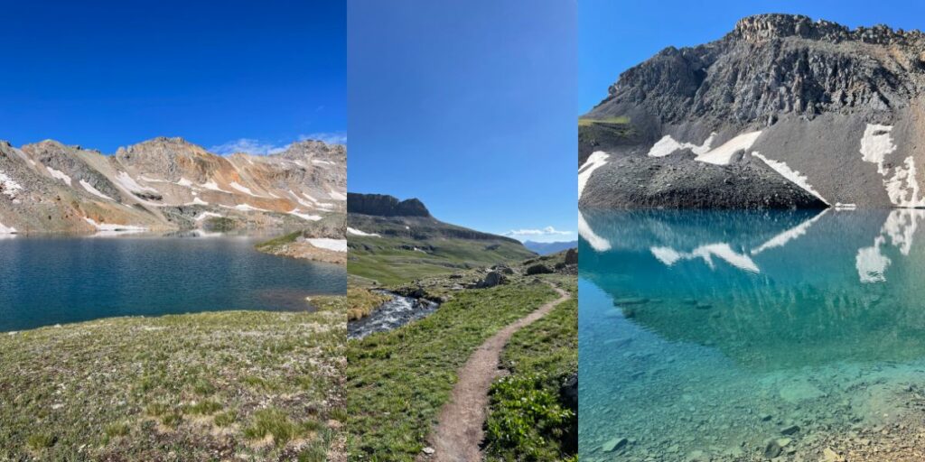
Blue Lakes
Elevation Gain: 2,509 feet (765 meters)
Distance: 8.7 miles (14 kilometers)
Duration: 5 hours 8 minutes
Difficulty: Hard
Type: Out & back
Trailhead: Blue Lakes Trailhead
If you want to go to the turquoise waters of the Caribbean in the middle of Colorado, put a Blue Lakes hike on your bucket list. Blue Lakes hike features three high alpine lakes and an additional expedition to Mt. Sneffels, a Colorado 14er that sits at 14,157 feet, if you’re up for it.
The trail not only features three glacial lakes with brilliant blue water, but also wildflowers, Mt. Sneffels, Dallas Peak, and Gilpin Peak, and panoramic views of the stunning Sneffels region.
Aside from a day hike to experience the three high alpine lakes, you can also backpack and setup a basecamp at Lower Blue Lake to conquer Mt. Sneffels.
Pro-tip: Plan to backpack out of Blue Lakes at sunrise. The entire Mount Sneffels Wilderness comes aglow in the warm morning light of the mountains.
Read More About This Hike Here
Columbine Lake
Elevation Gain: 2,837 feet (865 meters)
Distance: 7.9 miles (12.7 kilometers)
Duration: 5 hours 16 minutes
Difficulty: Hard
Type: Out & back
Trailhead: Forest Road 820
Columbine Lake feels like another world in San Juan National Forest near Silverton, Colorado. The sapphire blue waters compliment the looming grainy ridge that features Lookout Peak. Beyond the picturesque Columbine Lake, the best part of this hike is Upper Mill Creek Basin. In the summer, it’s painted green and gives way to overwhelming views of San Juan National Forest. It’s worth the 16 switchbacks that start the hike through a coniferous forest.
If you want to immerse yourself in Columbine Lake, there are areas to camp near the trailhead or around the lake. Start this hike early because parking is limited.
Read More About This Hike Here

Madeleine is a freelance writer and social media manager in the outdoor, gear, and travel space. She loves being buried in the snow, running single-track, and eating gummies next to high alpine lakes. When she’s not writing or traveling, you can find Madeleine in Telluride, Colorado romping around in the San Juans.